


Get to know Lianzhou
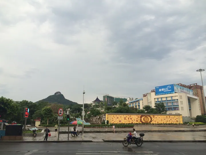
Photo adjustments
Full frame retained; proportionally resized and converted to WebP. No retouching or changes to the photographed subject. Card displays may crop the view.
- Administrative area
- County-level city · 县级市
- Part of
- Qingyuan
- Chinese name
- 连州市
- Local areas
- County-level city guide
Area & population
- Area in the source
- 2,663.33 km²
- Population · 2010 Census
- 367,859
Source: cited geographic source, as of the dates shown.
Setting and landscape
Lianzhou sits on the southern flank of the Mengzhu Range (萌渚岭) in the Nanling Mountains (南岭); mountains make up 72.2% of its area and hills 15.9%. The Boji range (簸箕山脉) in the north peaks at Tiantang Ridge (天堂岭), 1,712 metres, the highest point in the city, on the border with Lanshan County (蓝山县) in Hunan. The Dadongshan range (大东山山脉) in the east rises to Yankeng Mountain (岩坑山) at 1,604 metres. The Xingzi River (星子河) rises in the Dadongshan range, near the large Tanling Reservoir (潭岭水库), and the Sanjiang River (三江河) from Liannan (连南) joins the Lian River (连江) at Shuangxi (双溪), south of the town.
History
The city's culture and tourism bureau traces settlement here to the Neolithic. Local figures include Liu Zhan (刘瞻), twice chief minister under the Tang, and Feng Dafei (冯达飞), a commander of the Red Seventh Army. The Tang poet Liu Yuxi (刘禹锡) and the writer Han Yu (韩愈) both wrote about its landscape. Formerly Lian County (连县), it became Lianzhou City on 22 April 1994.
By 2025 the city had recorded 418 immovable heritage sites, 72 of them protected. The Huiguang Pagoda (慧光塔), more than 1,000 years old, is a national key protected site. Provincial listings include the cliff inscriptions of Jinfeng Mountain (巾峰山), Dayun Cave (大云洞) and Yanxi Mountain (燕喜山), carved from the Song dynasty to the Republic and including texts by Zhou Dunyi (周敦颐), as well as Feng Dafei's former home and the old Hui'ai Hospital (惠爱医院旧址).
What to see
Lianzhou Underground River (连州地下河), in Dadong village (大洞村) of Dongpi town (东陂镇), is a national 5A scenic area: a karst cave with two dry upper levels above an underground river, lined with stalactites, stalagmites and columns, and close to 18°C all year. The Huangchuan Three Gorges (湟川三峡) and Longtan (龙潭) area in Jiupi town (九陂镇) is rated 4A; the tourism bureau calls the Huangchuan the source of the Bei River (北江) and describes it winding between three gorges.
The bureau also lists Fushan (福山) at Bao'an (保安), counted as the 49th Taoist blessed land, the Qitian Ridge old road (骑田岭古道), the flagstone street of Dongpi (东陂古石板街), the Lianzhou Museum (连州市博物馆), the Liu Yuxi Memorial Hall (刘禹锡纪念馆) and old villages such as Fengyang (丰阳古村) and Shilan stockade (石兰寨). Lianzhou also hosts the Lianzhou International Photography Festival.
Highlights
- Lianzhou Underground River 连州地下河: National 5A karst cave in Dongpi town with an underground river on its lowest level.
- Huangchuan Three Gorges 湟川三峡: 4A river-gorge area at Longtan village, Jiupi town.
- Huiguang Pagoda 慧光塔: Pagoda of more than 1,000 years, Lianzhou's national key protected site.
Sources for this guide
地理位置 - 连州市政府门户网站 · Lianzhou Municipal People's Government
地形地貌 - 连州市政府门户网站 · Lianzhou Municipal People's Government
历史沿革 - 连州市政府门户网站 · Lianzhou Municipal People's Government (Culture, Radio, Television, Tourism and Sports Bureau)
连州A级景区简介 · Lianzhou Municipal People's Government (Culture, Radio, Television, Tourism and Sports Bureau)
人文景观 - 连州市政府门户网站 · Lianzhou Municipal People's Government (Culture, Radio, Television, Tourism and Sports Bureau)
Lianzhou - Wikipedia · Wikipedia · CC BY-SA 4.0
Original English written from the listed sources and checked sentence by sentence against quoted extracts by a separate reviewer. Updated 2026-09-23.
Explore Lianzhou
Core places to explore, with English and Chinese names.
Places to explore around Lianzhou
 Lianzhou Underground River · 连州地下河
Lianzhou Underground River连州地下河
Lianzhou Underground River combines a walking cave with a boat passage beneath the hills. The upper two levels contain dry galleries with stalactites and other limestone formations, while the lowest level carries the…
Read the place guide → Huangchuan Three Gorges · 湟川三峡
Huangchuan Three Gorges湟川三峡
Huangchuan Sanxia is a set of three gorges on the Huangchuan river, part of the Bei Jiang (North River) system of the Pearl River basin, in the Lianzhou stretch of the river in Qingyuan, Guangdong. It is a national AAAA scenic area, a national water-conservancy scenic area and a national leisure-agriculture-and-rural-tourism demonstration site.
Read the place guide →Plan your visit
Getting there
Lianzhou is about 140 km in a straight line from central Qingyuan. Search for 连州市 in a map app to find stations and your accommodation.
Where to stay →Build your route
Lianzhou Underground River and Huangchuan Three Gorges are both listed here. The linked place guides have entrance and visit details.
Continue with Qingyuan →More in Qingyuan
Sources & geographic information
Administrative names and parent areas: Official geographic directory · Reference date 2026-09-06.
Some facts checked against Lianzhou — Wikipedia contributors, CC BY-SA 4.0.
Photo: Lianzhou Underground River · Source photographer · License not provided. EXIF orientation normalized; resized without changing aspect ratio; converted to WebP. No subject edits.
Photo: Huangchuan Three Gorges · Source photographer · License not provided. EXIF orientation normalized; resized without changing aspect ratio; converted to WebP. No subject edits.
Map data © OpenStreetMap contributors. Pins mark approximate centres, not entrances or boundaries.