


Get to know Daxin County
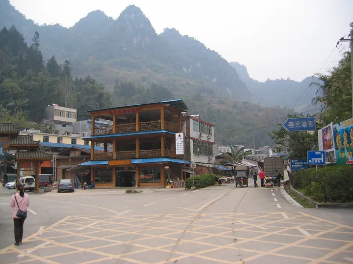
Photo adjustments
Full frame retained; proportionally resized and converted to WebP. No retouching or changes to the photographed subject. Card displays may crop the view.
- Administrative area
- County · 县
- Part of
- Chongzuo
- Chinese name
- 大新县
- Local areas
- County guide
Area & population
- Area in the source
- 2,756.00 km²
- Population · 2020
- 282,563
- Administrative seat
- Taocheng
Source: cited geographic source, as of the dates shown.
Setting and landscape
The county covers 2,742 square kilometres. Its border river, the Guichun (归春河), rises at E'quan (鹅泉) in Jingxi (靖西), runs about 150 kilometres, loops through Vietnam and re-enters China at Detian village (德天村); between Detian and Shuolong (硕龙镇) its 14.5-kilometre course forms the frontier. Villagers read the name as "returning home to meet spring".
What to see
Detian Falls (德天跨国瀑布), 57 kilometres from the county seat, forms where Pudang Island (浦汤岛) splits the Guichun and the water drops over cliffs in three tiers: about 200 metres wide and 70 metres high, spanning both countries. It opened to visitors in 1992 and became a national 5A scenic area in 2018, and it is the core of the Chinese side of the China–Vietnam Detian (Ban Gioc) cross-border tourism cooperation zone, agreed in November 2015 as China's first such zone. The site includes the old boundary marker No. 53 and Paotai ("Fort") Hill (炮台山).
Mingshi Pastoral Area (明仕田园) in Kanxu township (堪圩乡), 37 kilometres from the falls and 10 kilometres from Vietnam, was the filming base of the fantasy drama "The Journey of Flower" (花千骨). The county's other AAAA scenic areas are Laomumian (老木棉), Longgong Xianjing (龙宫仙境), Anping Xianhe (安平仙河) and Dayang Valley (大阳幽谷). Its historic sites include the old town of Yangli (养利古城), the Anping chieftain's yamen (安平土司衙门) and the cliff-carved figures of Huixian Rock (会仙岩) at Anping.
History and culture
Under the Northern Song six native chieftaincies ruled what is now Daxin: Yangli, Wancheng (万承), Taiping (太平), Xialei (下雷), Mingying (茗盈) and Encheng (恩城). Anping (安平) and Quanming (全茗) were added from the late Yuan and early Ming, making eight, and direct rule was not complete until the early Republic.
The county's Zhuang song fairs date back to the Tang, and each township holds its own festivals with song gatherings, such as the Frost's Descent (霜降) fair at Xialei in the ninth lunar month. Local groups still wear distinct dress, among them the Shangjia "short-jacket" Zhuang (上甲短衣壮) of Baoxu (宝圩乡). Food customs listed by the county include five-colour glutinous rice, sticky-rice dumplings, raw fish (鱼生) and pickled sour pork (腌酸肉).
Highlights
- Detian Falls 德天跨国瀑布: Three-tier cross-border waterfall on the Guichun River, about 200 m wide; national 5A scenic area since 2018.
- Mingshi Pastoral Area 明仕田园: AAAA scenic area in Kanxu, 10 km from Vietnam; filming base of "The Journey of Flower".
- Anping chieftain's yamen 安平土司衙门: Seat of one of the eight native chieftaincies of the Daxin area.
- Xialei Frost's Descent fair 下雷霜降歌圩: Zhuang song fair held at Xialei in the ninth lunar month.
Sources for this guide
大新县旅游概况 · Daxin County People's Government
德天跨国瀑布景区 · Daxin County People's Government
明仕田园 · Daxin County People's Government
土司文化 · Daxin County People's Government
民族风情 · Daxin County People's Government
Original English written from the listed sources and checked sentence by sentence against quoted extracts by a separate reviewer. Updated 2026-09-25.
Explore Daxin County
Core places to explore, with English and Chinese names.
Places to explore around Daxin County
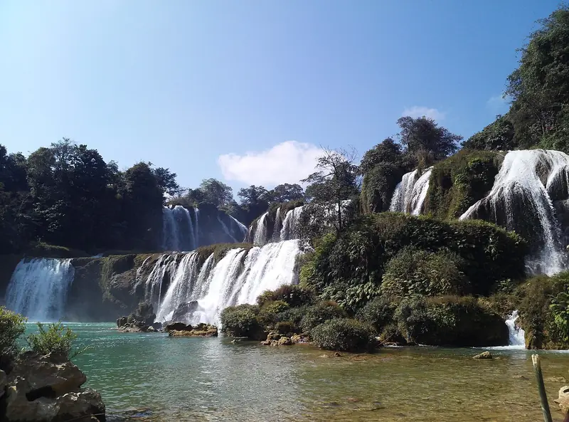 Detian Transnational Waterfall (德天跨国瀑布), Daxin County. Photograph: "從中國境內觀看的德天瀑布".
Detian Transnational Waterfall德天跨国瀑布
Detian Transnational Waterfall is a major waterfall landscape at the China–Vietnam border in Daxin County, within the Chongzuo area of Guangxi.
Read the place guide →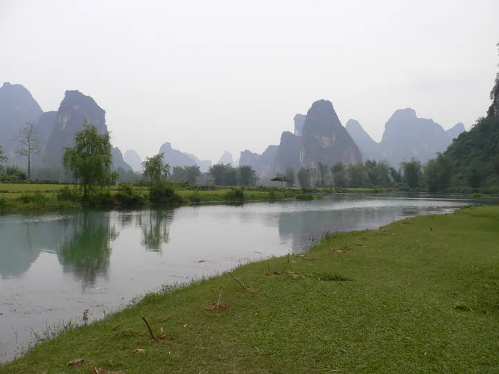 A calm river curving through flat green fields, a small thatched pavilion on the far bank, and a long rank of steep karst peaks receding into haze behind; pale overcast sky and trees along the banks.
Mingshi Countryside明仕田园
Mingshi places a slow river between limestone peaks, rice fields and village buildings. A bamboo-raft excursion shows the landscape from water level, where the fields and the bases of the hills become part of the same view. The…
Read the place guide →Local life & food
Daxin County local specialties
大新县特色美食 · 1 specialties to discover
 Mingshi countryside tofu 明仕山水豆腐AI dish illustration / AI 菜品示意图
A good first tasting focuses on the bean flavour and soft texture. Strong chilli or meat sauce creates a different impression from a lightly seasoned version.
Source ↗Read the dish guide →All dish names · 全部菜名 (1)
More dishes from across Guangxi are in the Guangxi food guide.
Plan your visit
Getting there
Daxin County is about 55 km in a straight line from central Chongzuo. Search for 大新县 in a map app to find stations and your accommodation.
Where to stay →Build your route
Detian Transnational Waterfall and Mingshi Countryside are about 20 km apart in a straight line. The linked place guides have entrance and visit details.
Continue with Chongzuo →More in Chongzuo
Sources & geographic information
Administrative names and parent areas: Official geographic directory · Reference date 2026-09-06.
Photo: Detian Transnational Waterfall · 黃雲紫水 · CC BY-SA 4.0. Full frame retained; EXIF orientation normalized, proportionally resized to at most 800 pixels and converted to WebP. No generated pixels or subject changes. Cards may crop the display.

Photo: Mingshi Countryside · tsechanwah · CC BY 3.0. Full frame retained; proportionally resized and converted to WebP. No retouching or changes to the photographed subject. Card displays may crop the view.
.jpg)
Map data © OpenStreetMap contributors. Pins mark approximate centres, not entrances or boundaries.