


Get to know Jiangzhou District
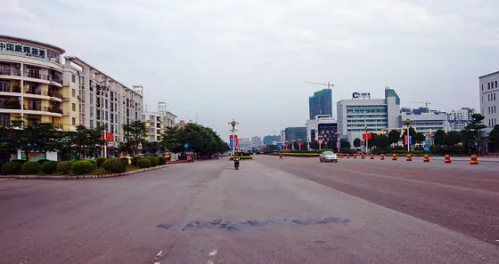
Photo adjustments
Resized and WebP compressed; subject not altered.
- Administrative area
- District · 市辖区
- Part of
- Chongzuo
- Chinese name
- 江州区
- Local areas
- District guide
Area & population
- Area in the source
- 2,902.00 km²
- Population · 2020 census
- 435,438
- Administrative seat
- Jiangnan Subdistrict
Source: cited geographic source, as of the dates shown.
History
In the Mulanshan cave (木榄山智人洞) in Luobai township (罗白乡), excavators found two human teeth in 2007 and the front of a lower jaw in 2008 with features of emerging anatomically modern humans, dated to about 111,000 years ago. From 2007 the Guangxi Institute of Cultural Relics and Archaeology (广西文物考古研究所) also excavated Neolithic shell-midden sites at Chongtang (冲塘) and Hecun (何村), dated to around 6,000 to 7,000 years ago, with stone and bone tools and dozens of burials.
In 214 BC the area belonged to the Qin commandery of Xiang (象郡). In the Song, after Di Qing (狄青) put down the rising of Nong Zhigao (侬智高), the Zuojiang garrison was renamed Taiping stockade (太平寨), the first use of the name Taiping; Chongshan County (崇善县) followed in 1053. From 1369 the area belonged to Taiping Prefecture (太平府), and in 1428, after the local chieftain Zhao Xian (赵暹) rebelled, hereditary rule gave way to appointed officials.
In April 1951 Zuo County (左县) and Chongshan merged, taking one character from each name to form Chongzuo County. In December 2002 the State Council replaced the county with Jiangzhou District as the seat of the new prefecture-level city of Chongzuo, which formally opened on 6 August 2003.
What to see
The Zuojiang Leaning Pagoda (左江斜塔), also called the Guilong Pagoda (归龙斜塔), stands on a rock island in the Zuo River and has been a national key protected monument since 2019; the district government notes that it is called one of the world's eight leaning towers. Huangchao City (黄巢城), 9 km east of the city on the south bank of the Zuo, is a natural stone wall about 100 m long across a valley, pierced by a square gate. Legend says Huang Chao (黄巢) camped here with his troops after a defeat at the end of the Tang, and a stone "horse" kneeling in the water and a rock called the Stone Dwarf (石矮子) have their own stories. The gate, the horse and the Stone Dwarf can all be seen from a boat on the Zuo.
The district also lists the Nongguan white-headed langur park (弄官白头叶猴生态公园), Shijinglin (石景林) and the Heishui River (黑水河), known as a "stone forest on the water".
Highlights
- Zuojiang Leaning Pagoda 左江斜塔: Pagoda on a rock island in the Zuo River, a national key protected monument since 2019.
- Huangchao City 黄巢城: Natural stone wall with a square gate on the south bank of the Zuo, 9 km east of the city, tied to legends of Huang Chao.
- Mulanshan cave 木榄山智人洞: Cave in Luobai township where a jaw about 111,000 years old with early modern-human features was found in 2008.
- Nongguan white-headed langur park 弄官白头叶猴生态公园: Park for the endangered white-headed langur listed among the district's sights.
Sources for this guide
2025年江州区基本概况 - 江州概况 - 广西崇左市江州区人民政府门户网站 · Jiangzhou District People's Government, Chongzuo
历史沿革 - 历史沿革 - 广西崇左市江州区人民政府门户网站 · Jiangzhou District People's Government, Chongzuo
【古代遗址】 - 历史沿革 - 广西崇左市江州区人民政府门户网站 · Jiangzhou District People's Government, Chongzuo
黄巢城 - 人文旅游 - 广西崇左市江州区人民政府门户网站 · Jiangzhou District People's Government, Chongzuo
左江斜塔 - 维基百科,自由的百科全书 · Chinese Wikipedia · CC BY-SA 4.0
Original English written from the listed sources and checked sentence by sentence against quoted extracts by a separate reviewer. Updated 2026-09-24.
Explore Jiangzhou District
Core places to explore, with English and Chinese names.
Places to explore around Jiangzhou District
 AI illustration · AI
 Plan your visit
Getting there
Jiangzhou District is about 5 km in a straight line from central Chongzuo. Search for 江州区 in a map app to find stations and your accommodation.
Where to stay →Build your route
Start with Taiping Ancient City. The linked place guides have entrance and visit details.
Continue with Chongzuo →More in Chongzuo
Sources & geographic information
Administrative names and parent areas: Official geographic directory · Reference date 2026-09-06.
Some facts checked against 左江斜塔 — Wikipedia contributors, CC BY-SA 4.0.
Map data © OpenStreetMap contributors. Pins mark approximate centres, not entrances or boundaries.