


Get to know Heshan
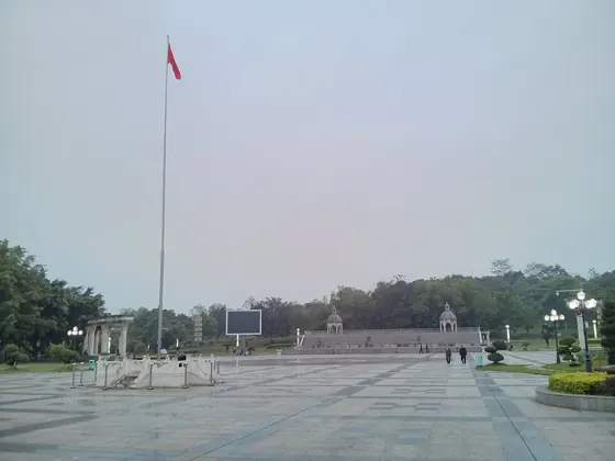
Photo adjustments
Resized and WebP compressed; subject not altered.
- Administrative area
- County-level city · 县级市
- Part of
- Laibin
- Chinese name
- 合山市
- Local areas
- County-level city guide
Area & population
- Area in the source
- 350.00 km²
- Population · 2020
- 98,938
- Administrative seat
- Lingnan (岭南镇)
Source: cited geographic source, as of the dates shown.
Setting and landscape
Heshan sits in a basin of eroded limestone and hilly valleys that slopes from higher ground in the north and east down to the southwest. Its highest ridge is Siyueba Ridge (四月八岭) at 593 m, followed by Luosi Mountain (螺蛳山) and Siyan Mountain (司烟山). The Hongshui River, part of the Pearl River system, runs 25.3 km along the southwest of the city, and four underground rivers flow beneath it. The climate is subtropical monsoon, averaging 21.2°C over the years.
History
From 1020 until the Republic the area belonged to Qianjiang County (迁江县). After coal seams were found in 1905, miners sank Guangxi's first coal shaft on Heling Hill (合岭山), north of today's town. In 1919 two men from Gui County and Guiping opened a mine there under the name Heshan Qianshan Company (合山迁善公司), which gave the place its name. Qianjiang was merged into Laibin County in 1952, and the State Council approved Heshan as a city on 29 June 1981.
What to see
The Dongkuang section (东矿园区) of the Heshan National Mine Park (合山国家矿山公园) occupies the former east mine of the Heshan Mining Bureau beside National Road 322. It has a mine museum, an underground coal-mining experience area, a steam locomotive and the ruins of a coal-washing building, and was rated a national 4A scenic area in 2021. The Century-Old Mine and First Well scenic area (百年老矿·第一口井历史文化景区) at Laokuang hamlet in Liyang village, Lingnan town (岭南镇), marks the 1905 shaft with mining sculptures and a gallery on coal-mining history; it became a 3A scenic area in 2018.
Heshan is also a source of collectable stones. Caitao stones (彩陶石), named for a skin resembling ancient painted-pottery glaze, come mainly from a 30 km stretch of the Hongshui River between Suhe (溯河) and Ma'an (马安) villages.
Food and local products
Beisi xiaochao (北泗小炒) is a stir-fry of vermicelli with shredded cabbage, pork, wood-ear fungus and radish in a scallion, ginger and wine sauce, served at weddings and banquets. Heshan fried rice cakes (合山名馍) are made by spreading a batter of soybean and rice flour on an iron mould, adding a vegetable filling and deep-frying. Yumeng suan (芋檬酸) is whole taro stalk pickled without peeling, eaten on its own or cooked with duck or fish. Locals also fry grasshoppers, bamboo worms and cicada pupae, and make five-colour glutinous rice for the Sanyuesan festival (三月三) or Qingming.
Highlights
- Heshan National Mine Park, Dongkuang section 合山国家矿山公园东矿园区: Former east mine with a mine museum and underground mining area; national 4A since 2021.
- Century-Old Mine and First Well scenic area 百年老矿·第一口井历史文化景区: Site of Guangxi's first coal shaft, sunk after coal was found in 1905.
- Caitao stones 彩陶石: Glaze-skinned stones from a 30 km stretch of the Hongshui River.
- Yumeng suan 芋檬酸: Whole taro stalks pickled unpeeled.
- Beisi xiaochao 北泗小炒: Vermicelli and shredded-vegetable stir-fry served at weddings.
Sources for this guide
合山概况 · Heshan City People's Government
合山市简介 · Heshan City People's Government
广西合山国家矿山公园(东矿园区) · Heshan City People's Government
特色美食 | 合山美食 · Heshan City People's Government
合山市百年老矿·第一口井历史文化景区(AAA) · Heshan City People's Government
Original English written from the listed sources and checked sentence by sentence against quoted extracts by a separate reviewer. Updated 2026-09-24.
Explore Heshan
Core places to explore, with English and Chinese names.
Plan your visit
Getting there
Heshan is about 35 km in a straight line from central Laibin. Search for 合山市 in a map app to find stations and your accommodation.
Where to stay →More in Laibin
Sources & geographic information
Administrative names and parent areas: Official geographic directory · Reference date 2026-09-06.
Map data © OpenStreetMap contributors. Pins mark approximate centres, not entrances or boundaries.