


Get to know Xincheng County
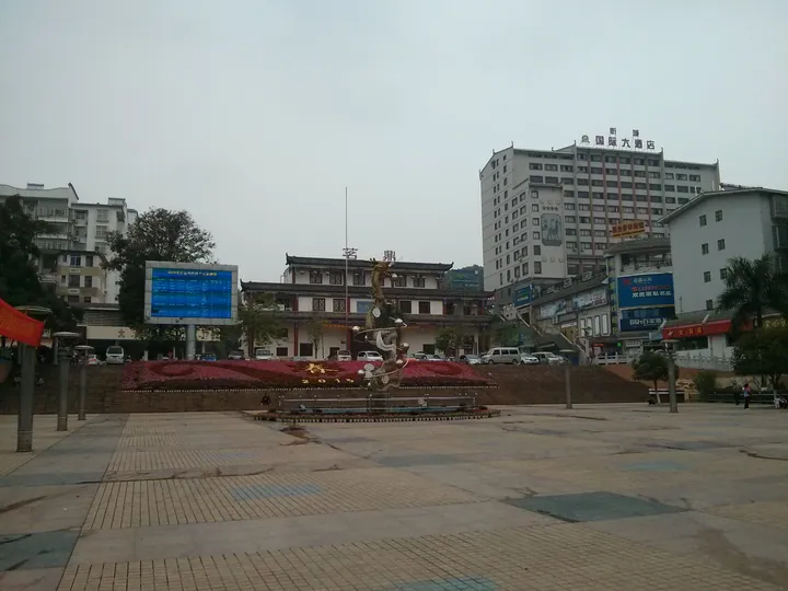
Photo adjustments
Full frame retained; proportionally resized and converted to WebP. No retouching or changes to the photographed subject. Card displays may crop the view.
- Administrative area
- County · 县
- Part of
- Laibin
- Chinese name
- 忻城县
- Local areas
- County guide
Area & population
- Area in the source
- 2,541.00 km²
- Population · 2020
- 297,825
- Administrative seat
- Chengguan
Source: cited geographic source, as of the dates shown.
History
Xincheng County was set up early in the Tang Zhenguan era as the seat of Zhizhou (芝州), which is why the county is still called Zhizhou; it became Xincheng Commandery in 742 and a county again in 1043. The county government counts it among the core of the old Bazhai (八寨) area, where the Ming thinker Wang Yangming (王阳明) worked late in life. The Mo family's yamen was begun in 1582 under Mo Zhenwei (莫镇威), the eighth Mo chieftain, and served until the chieftain system was abolished in 1906. Xincheng passed to Laibin in 2002.
What to see
The Mo Chieftains' Yamen (莫土司衙署) sits at the north foot of Cuiping Hill (翠屏山), facing north, over more than 40,000 square metres. Halls, a garden, ancestral and sacrificial halls line its axis, with officials' mansions, a mausoleum, Longyin Cave (龙吟洞) and a drill ground around them; the drill ground holds an exhibition on Xincheng's chieftains. It became a national key cultural relic site in 1996, and the county calls it the "Forbidden City of the Zhuang homeland" (壮乡故宫).
The Hongshui River runs through Hongdu town (红渡镇), which holds the Letan National Wetland Park (乐滩国家湿地公园), known as the "little Three Gorges" of Guangxi, and Nongxia Mountain (弄霞山), the county's highest peak. Smaller relics include the Meng family watchtower (蒙氏碉楼) in Andong township (安东乡), a four-storey Guangxu-era tower with firing slits on every floor. The Guwan Dam (古万水坝) is a 70 m S-shaped stone weir of the late Ming or early Qing on the Pangjiang River (滂江河) in Gupeng town (古蓬镇) with three water wheels at each end.
Food and local products
Xincheng Zhuang brocade (忻城壮锦) weaving went on the autonomous-region intangible-heritage list in 2010; the county notes that brocade sent as tribute by its chieftains is held in the Palace Museum in Beijing. Honeysuckle and Xincheng waxy maize (忻城糯玉米) carry national geographical-indication protection, and the county also produces traditional-method brown sugar and passion fruit. Sericulture is the mainstay of Hongdu town.
Getting oriented
Hongdu town lies 17 km from the county town. National Road 242 runs through it and the Hongdu Bridge (红渡大桥) links the north and south of the county, making the town the link between Xincheng, Shanglin (上林) in Nanning and Laibin's Xingbin district; the Hezhou–Bama expressway also passes through.
Highlights
- Mo Chieftains' Yamen 莫土司衙署: Chieftains' seat begun in 1582; national key cultural relic site since 1996.
- Letan National Wetland Park 乐滩国家湿地公园: Wetland park in Hongdu town known as the little Three Gorges of Guangxi.
- Xincheng Zhuang brocade 忻城壮锦: Weaving technique on the autonomous-region heritage list since 2010; tribute pieces are in the Palace Museum.
- Meng family watchtower 蒙氏碉楼: Four-storey Qing defensive tower with firing slits in Andong township.
- Xincheng waxy maize 忻城糯玉米: National geographical-indication product.
Sources for this guide
忻城县基本概况 · Xincheng County People's Government
莫土司衙署 · Chinese Wikipedia · CC BY-SA 4.0
【忻城文物】蒙氏碉楼 · Xincheng County People's Government
【忻城文物】古万水坝 · Xincheng County People's Government
红渡镇简介 · Xincheng County People's Government
Original English written from the listed sources and checked sentence by sentence against quoted extracts by a separate reviewer. Updated 2026-09-24.
Explore Xincheng County
Core places to explore, with English and Chinese names.
Xincheng County 忻城县
Plan your visit
Getting there
Xincheng County is about 65 km in a straight line from central Laibin. Search for 忻城县 in a map app to find stations and your accommodation.
Where to stay →More in Laibin
Sources & geographic information
Administrative names and parent areas: Official geographic directory · Reference date 2026-09-06.
Some facts checked against 莫土司衙署 — Wikipedia contributors, CC BY-SA 4.0.
Map data © OpenStreetMap contributors. Pins mark approximate centres, not entrances or boundaries.