


Get to know Xingbin District
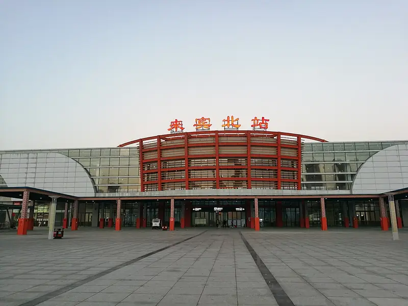
Photo adjustments
EXIF orientation normalized; resized without changing aspect ratio; converted to WebP. No subject edits.
- Administrative area
- District · 市辖区
- Part of
- Laibin
- Chinese name
- 兴宾区
- Local areas
- District guide
Area & population
- Area in the source
- 4,404.00 km²
- Population · 2020 census
- 925,377
- Administrative seat
- Hexi Subdistrict
Source: cited geographic source, as of the dates shown.
Setting and landscape
The district covers about 4,364 square kilometres, higher in the north, south and west and flat in the centre and east. Most of it is karst country of clustered peaks, depressions, peak-forest valleys and isolated peaks rising from plains. The highest summit is Luntao Mountain (伦桃山), 686.9 metres. All its rivers drain to the Red River or the Qian River (黔江) in the Xi River system, and the Red River is the main source of irrigation water. The Tropic of Cancer crosses the middle of Sanwu Town (三五镇).
History
In 743, under the Tang, Huaiyi County was renamed Laibin County, and the seat of Yanzhou (严州), the prefecture it belonged to, stood inside today's district. Laibin County absorbed Qianjiang County (迁江县) in 1952. In September 2002 the State Council abolished Liuzhou Prefecture and Laibin County and created Laibin city with Xingbin as its district. The former county town, Chengxiang (城厢), sits on the Red River; a Chengxiang township is recorded from about 1368, and its old pier is still in use. Most of its buildings were pulled down in 1970 to build a new county town; a few older structures remain, among them the Jiang family ancestral hall and the Moon Well.
What to see
In Qianjiang Town the Wenhui Pagoda (文辉塔), a 35-metre, seven-storey octagonal brick pagoda with a cast-iron pot-shaped cap on the north bank of the Red River, was listed as a national key cultural relic protection unit in 2019; the town government calls it the first pagoda in Guangxi built by a Zhuang native official. Qianjiang Old Street (迁江老街), where the Qingshui River (清水河) meets the Red River, was the county seat from the Yuan dynasty to the Republic and became an autonomous-region historic district in 2020. A cave behind Fuji village held the command post Bai Chongxi (白崇禧) set up for the Battle of Kunlun Pass (昆仑关战役).
Around Baidao village in Sanwu Town, Jiufeng Mountain (九凤山), named for its outline of nine phoenixes, has upland grassland promoted as Laibin's "sky grassland" and a cliff bearing a naturally formed character for "good fortune" (福).
Food and local products
Qidong Township (七洞乡) is known for steamed rice-flour duck (七洞粉蒸鸭), the centrepiece of the Ghost Festival (中元节) meal. Rice is stir-fried and ground on a stone mill, then coated over duck pieces seasoned with salt, ginger and soy sauce, and the duck is steamed on a bed of phrynium leaves (柊叶). Its making was entered on the fourth batch of county-level intangible heritage items.
Highlights
- Wenhui Pagoda 文辉塔: 35-metre seven-storey brick pagoda on the Red River at Qianjiang; national key cultural relic protection unit since 2019.
- Qianjiang Old Street 迁江老街: Former county seat at the Red and Qingshui river confluence; autonomous-region historic district since 2020.
- Jiufeng Mountain 九凤山: Ridge-top grassland near Baidao village with a naturally formed "good fortune" (福) character on a cliff.
- Qidong steamed rice-flour duck 七洞粉蒸鸭: Duck coated in stone-milled roasted rice flour and steamed on phrynium leaves; a county-level heritage item.
Sources for this guide
历史沿革 · Xingbin District People's Government, Laibin (district gazetteer committee)
来宾市兴宾区自然地理 · Xingbin District People's Government, Laibin
被遗忘的来宾老县城——700年历史的城厢古城 · Chengxiang Town People's Government, on the Xingbin District portal
广西烟火丨七洞传家粉蒸鸭 · Qidong Township People's Government, on the Xingbin District portal
【走遍兴宾·网络主题宣传】迁江镇:一方沃土美如画,千年古镇绽新姿 · Qianjiang Town People's Government, on the Xingbin District portal
【走遍兴宾·网络主题宣传】总要来一次九凤山吧,打卡天然形成的福字! · Sanwu Town People's Government, on the Xingbin District portal
Original English written from the listed sources and checked sentence by sentence against quoted extracts by a separate reviewer. Updated 2026-09-24.
Explore Xingbin District
Core places to explore, with English and Chinese names.
Xingbin District 兴宾区
Plan your visit
Getting there
Xingbin District covers the centre of Laibin. Search for 兴宾区 in a map app to find stations and your accommodation.
Where to stay →More in Laibin
Sources & geographic information
Administrative names and parent areas: Official geographic directory · Reference date 2026-09-06.
Map data © OpenStreetMap contributors. Pins mark approximate centres, not entrances or boundaries.