


Get to know Jinxiu Yao Autonomous County
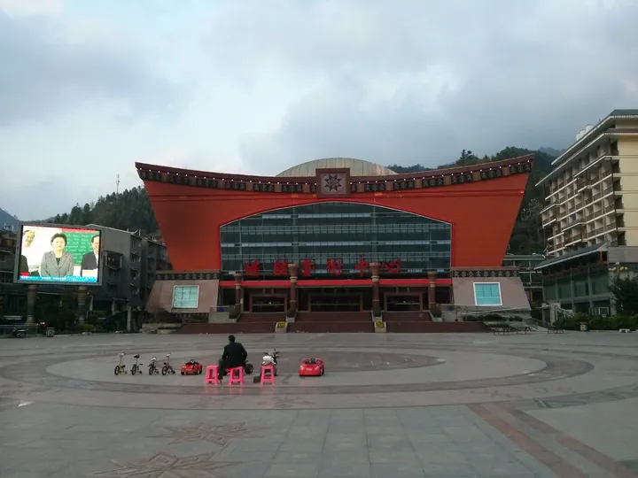
Photo adjustments
Full frame retained; proportionally resized and converted to WebP. No retouching or changes to the photographed subject. Card displays may crop the view.
- Administrative area
- Autonomous county · 自治县
- Part of
- Laibin
- Chinese name
- 金秀瑶族自治县
- Local areas
- Autonomous county guide
Area & population
- Area in the source
- 2,517.00 km²
- Population · 2020
- 130,313
- Administrative seat
- Jinxiu (金秀镇)
Source: cited geographic source, as of the dates shown.
History
According to the county's own history, few people lived in these steep mountains before the Ming; Yao and Zhuang settlers moved in at the start of that dynasty, and from then through the Qing the range was split among several surrounding counties and prefectures. In 1909 the Qing grouped the central mountains into four militia units with Yao headmen. The Nationalist government set up a Jinxiu administrative bureau in 1942. The Dayaoshan Yao Autonomous Region (大瑶山瑶族自治区) was founded on 28 May 1952 and took the name Jinxiu Yao Autonomous County in 1966; the county came under Laibin in 2002.
Each Yao branch keeps its own major festival: the Pan Yao fulfil vows to King Pan (还盘王愿), the Chashan Yao hold a Gongde festival (功德节), the Hualan Yao a festival of the gods, the Ao Yao the Langping festival (浪坪节) and the Shanzi Yao the Dujie rite (度戒节). Dujie is a coming-of-age ceremony for men, whose trials include walking through fire, climbing a ladder of blades and treading on a red-hot ploughshare.
The yellow-mud drum dance (黄泥鼓舞) of the Ao Yao in Liuxiang (六巷乡) and Luoxiang (罗香乡) townships entered the national intangible-heritage list in 2011. Dancers tune the drumheads by smearing them with yellow mud; men with slender "male" drums circle the player of the thicker "female" drum, who sets the rhythm. Guchen hamlet (古陈屯) in Liuxiang, an Ao Yao village, has a folk-art troupe of more than 40 performers from no more than 120 residents, which performed in Japan in 1996.
What to see
Shengtang Mountain lies 38 km south of the county town. Seven of its peaks rise above 1,600 m, and the county ranks the 1,979 m main peak fifth-highest in Guangxi. In May the colour-changing azaleas on the summit bloom, turning from red to purple to white, and an old southern hemlock stands on the mountain; rare species include the Cathaya fir and the Chinese crocodile lizard. It is a national nature reserve and a national 4A scenic area.
The Dayaoshan Panwangjie scenic area (大瑶山盘王界景区), formerly the Lianhua Mountain (莲花山) scenic area, is 15 km northwest of the county town. Its main peak, Nengduo (能多峰), reaches 1,350 m, and the massif takes its old name from a cluster of peaks that looks like a lotus bud. The landform is a quartz-sandstone peak forest of deep gullies and sheer rock walls; it became a 4A scenic area in 2009.
Highlights
- Shengtang Mountain 圣堂山: 1,979 m peak with colour-changing azaleas in May; national nature reserve and 4A scenic area.
- Dayaoshan Panwangjie scenic area (former Lianhua Mountain) 大瑶山盘王界景区: Quartz-sandstone peak forest 15 km northwest of the county town, named for its lotus-bud outline.
- Yellow-mud drum dance 黄泥鼓舞: Ao Yao drum dance tuned with yellow mud; national intangible heritage since 2011.
- Dujie rite 度戒节: Shanzi Yao coming-of-age ceremony with trials of fire and blades.
Sources for this guide
历史沿革 · Jinxiu Yao Autonomous County People's Government
圣堂山景区 · Jinxiu Yao Autonomous County People's Government
大瑶山盘王界景区(原莲花山景区) · Jinxiu Yao Autonomous County People's Government
奇特神韵的瑶山文化 · Jinxiu Yao Autonomous County People's Government
瑶族长鼓舞(黄泥鼓舞) · China Intangible Cultural Heritage Network (ihchina.cn)
Original English written from the listed sources and checked sentence by sentence against quoted extracts by a separate reviewer. Updated 2026-09-24.
Explore Jinxiu Yao Autonomous County
Core places to explore, with English and Chinese names.
Places to explore around Jinxiu Yao Autonomous County
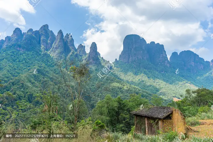 Shengtang Mountain · 圣堂山
Shengtang Mountain圣堂山
Shengtang Shan is the main peak of the Dayao Mountains, 45 kilometres south-west of the Jinxiu county seat in Jinxiu Yao Autonomous County, Laibin, Guangxi, its summit at 1,979 metres elevation, which the Laibin Evening News ranks as Guangxi's fifth-highest peak and the highest in central Guangxi.
Read the place guide → AI illustration · AI 示意图(仅供参考,非该地点实拍)
Lianhua Mountain莲花山
The scenic area the catalogue records as Lianhua Shan, a quartz-sandstone peak-forest landform in Jinxiu Yao Autonomous County, Laibin, Guangxi, whose whole mountain resembles an unopened lotus flower, reopened on 1 January 2025 under the new name Dayaoshan Panwangjie after a large-scale rebuild.
Read the place guide →Plan your visit
Getting there
Jinxiu Yao Autonomous County is about 105 km in a straight line from central Laibin. Search for 金秀瑶族自治县 in a map app to find stations and your accommodation.
Where to stay →Build your route
Shengtang Mountain and Lianhua Mountain are both listed here. The linked place guides have entrance and visit details.
Continue with Laibin →More in Laibin
Sources & geographic information
Administrative names and parent areas: Official geographic directory · Reference date 2026-09-06.
Photo: Shengtang Mountain · Source photographer · License not provided. EXIF orientation normalized; resized without changing aspect ratio; converted to WebP. No subject edits.
Map data © OpenStreetMap contributors. Pins mark approximate centres, not entrances or boundaries.