


Get to know Cenxi
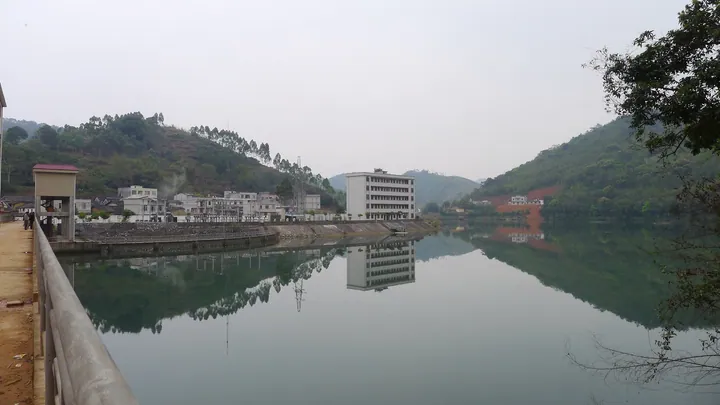
Photo adjustments
Full frame retained; proportionally resized and converted to WebP. No retouching or changes to the photographed subject. Card displays may crop the view.
- Administrative area
- County-level city · 县级市
- Part of
- Wuzhou
- Chinese name
- 岑溪市
- Local areas
- County-level city guide
Area & population
- Area in the source
- 2,783.00 km²
- Population · 2006
- 840,000
- Administrative seat
- Cencheng (岑城镇)
Source: cited geographic source, as of the dates shown.
Setting and landscape
Spurs of the Yunkai range reach into the south, east and centre from Xinyi, and spurs of the Goulou Mountains (勾漏山) enter the west and north from Rong County (容县). Between the ridges run the Huanghua River (黄华河), the Yichang River (义昌江) and the Nuodong River (糯垌河) with small valley plains, a pattern the city government likens to the character chuan (川, "river"). The land falls from Tuzhuding (土柱顶), 1,211 metres high in the south, to the Dumu river valley (都目河谷) at 50 metres in the northwest.
History
In 622, under the Tang, Nanyi prefecture (南义州) was set up here; its repeated abolition and restoration as Yizhou (义州) is why Cenxi is still called "old Yizhou". The name Cenxi dates from 757, when Longcheng County (龙城县) was renamed. The county became a county-level city on 1 December 1995.
What to see
Tianlongding Mountain Park (天龙顶山地公园), in Nandu town (南渡镇), covers 16 square kilometres of forest, gorges, upland meadow and a fault cliff running for 10 li. Its sandstone main peak reaches 1,211 metres, which the Nandu town government calls the highest peak in Wuzhou. It has been a national 4A scenic area since 2017.
Nandu's Yizhou Old Street (义州古街) keeps arcaded qilou (骑楼) buildings of grey brick; CCTV used it as a location for "Top Secret 1950" (绝密1950). In Shuiwen town (水汶镇) stands the "Wushi Yanxiang" (五世衍祥, "five generations of good fortune") memorial arch, built in 1868 of grey brick with plaster figures and paired dragons on the ridge, and set with eight inscribed tablets. It has been an autonomous-region protected site since 2000.
Food and local products
The local stuffed tofu, tofu niang (豆腐酿), is pan-fried slowly for 20 to 30 minutes until both sides are golden, then dressed with soy sauce, fermented red bean curd (南乳) and starch. Nandu is also known for Nandu braised pork (南渡扣肉). Cenxi three-yellow chicken (岑溪三黄鸡), named for its golden feathers, beak and feet, is a national geographical-indication product. Cenxi granite is sold as "Cenxi Red" (岑溪红), and in 2006 the China Stone Material Industry Association named Cenxi China's granite capital.
Getting oriented
The city seat is Cencheng town (岑城镇). National highways G207 and G324 meet in the urban area, and the Luoyang–Zhanjiang railway (洛湛铁路) passes through, with a stop at Cenxi railway station.
Highlights
- Tianlongding Mountain Park 天龙顶山地公园: National 4A mountain park in Nandu town whose 1,211-metre sandstone peak is described as Wuzhou's highest.
- Yizhou Old Street, Nandu 义州古街: Street of grey-brick arcaded qilou buildings, used by CCTV as a location for "Top Secret 1950".
- Wushi Yanxiang memorial arch 五世衍祥牌坊: Grey-brick arch of 1868 in Shuiwen town, an autonomous-region protected site since 2000.
- Tofu niang 豆腐酿: Slow pan-fried stuffed tofu finished with soy sauce, fermented red bean curd and starch.
- Cenxi three-yellow chicken 岑溪三黄鸡: Local chicken with golden feathers, beak and feet; a national geographical-indication product.
Sources for this guide
自然地理 - 广西梧州岑溪市人民政府门户网站 · Cenxi Municipal People's Government
历史沿革 - 广西梧州岑溪市人民政府门户网站 · Cenxi Municipal People's Government
“岭南香格里拉”——天龙顶山地公园 - 广西梧州岑溪市人民政府门户网站 · Nandu Town People's Government, Cenxi (on the Cenxi government portal)
豆腐酿 - 岑溪美食 - 广西梧州岑溪市人民政府门户网站 · Cenxi Municipal People's Government
历史文化商业街——义州古街 - 广西梧州岑溪市人民政府门户网站 · Nandu Town People's Government, Cenxi (on the Cenxi government portal)
自治区级文物保护单位——“五世衍祥”牌坊 - 广西梧州岑溪市人民政府门户网站 · Cenxi Municipal People's Government
岑溪市 - 维基百科 · Wikipedia (Chinese) · CC BY-SA 4.0
Original English written from the listed sources and checked sentence by sentence against quoted extracts by a separate reviewer. Updated 2026-09-24.
Explore Cenxi
Core places to explore, with English and Chinese names.
Plan your visit
Getting there
Cenxi is about 65 km in a straight line from central Wuzhou. Search for 岑溪市 in a map app to find stations and your accommodation.
Where to stay →More in Wuzhou
Sources & geographic information
Administrative names and parent areas: Official geographic directory · Reference date 2026-09-06.
Some facts checked against 岑溪市 — Wikipedia contributors, CC BY-SA 4.0.
Map data © OpenStreetMap contributors. Pins mark approximate centres, not entrances or boundaries.