


Get to know Puding County
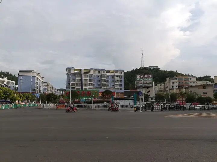
Photo adjustments
Full-frame source proportionally resized and converted to WebP for display. No subject alteration. Source-supplied marks and edits remain; cards may crop the view.
- Administrative area
- County · 县
- Part of
- Anshun City
- Chinese name
- 普定县
- Local areas
- County guide
Area & population
- Area in the source
- 1,090.49 km²
- Population · 2010
- 378,288
- Administrative seat
- Dingnan Subdistrict
Source: cited geographic source, as of the dates shown.
History
The county government explains the name as "the Puli pacified", Puli (普里) being a tribe of the area. The first county here was Shi'an (始安县), set up in 630 with its seat at Xibao (西堡), today's Machang (马场). In 1257, under the Yuan, the area became the ten-thousand-household unit of Puding (普定万户) and soon afterwards Puding Prefecture (普定府), the first time the name Puding was used for an administrative unit. The Ming built Puding's walls in 1381 and set up the Puding Guard (普定卫) the next year; the Qing replaced the guard with Puding County in 1671. In 1914 the seat moved to Dingnan (定南), today's county town, and outlying pieces of neighbouring counties were merged in to form the present county.
What to see
The Chuandong Ancient Human Museum (穿洞古人类博物馆) stands at a national key protected site. It displays traces of human life from 16,000 years ago, with many bone and stone tools and two complete fossil human skulls; the county calls the site "the lamp of Asian civilisation".
Yelang Lake, a provincial scenic area 7 km north-west of the county town, is a man-made lake 42 km long and up to 2.5 km wide, winding between steep peaks and narrow gorges.
In the south, Maguan town (马官镇) was among the first land Ming troops took in Anshun prefecture; soldiers farmed it and left a pattern of garrison villages still known as the "nine tun and eighteen bao" (九屯十八堡). The town keeps flower-lantern opera (花灯), dixi (地戏) and storytelling traditions, and the county bills it as China's home of flower-lantern opera.
Food and local products
Huachu town (化处镇) grows Duobei tribute tea (朵贝贡茶), sent to court as tribute under the Ming; the county says Zhou Enlai praised it when passing through Guiyang in 1960, and a local tea tree has been dated by the China tea research institute to a thousand years. Huachu also has 5,000 mu of ginkgo and the county's largest rapeseed fields.
Puding guojuan (普定裹卷) is a snack that dates from the 1990s: white wrappers rolled around colourful fillings, served cold and spicy. In winter the chilli dressing is heated. Suoshai peaches (梭筛桃) carry a Chinese geographical-indication listing.
Highlights
- Chuandong Ancient Human Museum 穿洞古人类博物馆: National key protected site with bone and stone tools and two complete human skulls.
- Yelang Lake 夜郎湖: Provincial scenic area; a 42 km man-made lake between steep peaks.
- Maguan town 马官镇: Ming garrison villages with flower-lantern opera and dixi.
- Duobei tribute tea 朵贝贡茶: Ming-era tribute tea from Huachu town.
- Puding guojuan 普定裹卷: Cold, spicy rolled snack dating from the 1990s.
Sources for this guide
普定简介-普定县人民政府 · Puding County People's Government
历史沿革-普定县人民政府 · Puding County People's Government
穿洞古人类博物馆 · Puding County People's Government
夜郎湖 · Puding County People's Government
中国花灯之乡、屯堡文化奇葩——马官 · Puding County People's Government (Maguan town)
贡茶之乡——化处 · Puding County People's Government
普定裹卷 · Puding County People's Government
普定县 · Wikipedia (Chinese) · CC BY-SA 4.0
Original English written from the listed sources and checked sentence by sentence against quoted extracts by a separate reviewer. Updated 2026-09-24.
Explore Puding County
Core places to explore, with English and Chinese names.
Puding County 普定县
Plan your visit
Getting there
Puding County is about 20 km in a straight line from central Anshun City. Search for 普定县 in a map app to find stations and your accommodation.
Where to stay →More in Anshun City
Sources & geographic information
Administrative names and parent areas: Official geographic directory · Reference date 2026-09-06.
Some facts checked against 普定县 — Wikipedia contributors, CC BY-SA 4.0.
Map data © OpenStreetMap contributors. Pins mark approximate centres, not entrances or boundaries.