


Get to know Weining Yi, Hui, and Miao Autonomous County
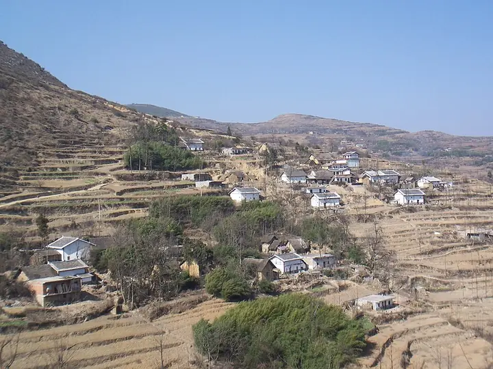
Photo adjustments
Full-frame source proportionally resized and converted to WebP for display. No subject alteration. Source-supplied marks and edits remain; cards may crop the view.
- Administrative area
- Autonomous county · 自治县
- Part of
- Bijie City
- Chinese name
- 威宁彝族回族苗族自治县
- Local areas
- Autonomous county guide
Area & population
- Area in the source
- 9,296.00 km²
- Population · 2020 census
- 1,280,116
- Administrative seat
- Haibian Subdistrict
Source: cited geographic source, as of the dates shown.
Setting and landscape
Caohai, named for its dense water plants, is listed by Chinese Wikipedia as China's largest tectonic karst lake and Guizhou's largest natural lake, covering 19.8 square kilometres at about 2,172 metres. More than 400 black-necked cranes winter there each year, and it has been a national nature reserve since 1992. The county government links the low latitude, high altitude, strong sunshine and wide temperature swings to the county's names as a home of potatoes, herbs, livestock, cool-season vegetables and bitter buckwheat.
History
According to the county government, dozens of chipped stone tools dug up near Wangjiayuan (王家院), south-west of Caohai, point to people living here about 150,000 years ago. The area was long known as Wusa (乌撒); the Ming set up Wusa prefecture in 1382 together with a military guard. After Wu Sangui (吴三桂) conquered Wusa in 1664, it was renamed Weining in 1665, meaning roughly "peace after a show of force", and became a prefecture, reduced to a department under Dading in 1730. The Red Army's 2nd and 6th Army Groups crossed the county from 17 to 21 March 1936. The autonomous county was founded on 11 November 1954. The Zhongshui site (中水遗址) was named one of China's ten major archaeological discoveries of 2005.
What to see
Chinese Wikipedia lists the Zhongshui Han tombs (中水汉墓群), Yi sky-facing graves (彝族向天坟), remains of the Shexiang post road (奢香古驿道遗址), Fengshan Temple (凤山寺), a Ming boundary stele, Wu Sangui's Golden Hall (吴三桂金殿) and Baicaoping (百草坪) among the county's sights. At Shimenkan (石门坎) is the grave of Sam Pollard (柏格里), the British Methodist missionary whose work made the village known in the early 20th century. The county government names the torch festival and the Huashan festival among its ethnic festivals.
Getting oriented
The county measures 116 kilometres east to west and borders Yiliang (彝良), Zhaotong (昭通), Ludian (鲁甸), Huize (会泽) and Xuanwei (宣威) in Yunnan to the north-west, west and south, as well as Liupanshui (六盘水). National roads 326 and 356 and the Neijiang–Kunming railway cross it.
Highlights
- Caohai Lake 草海: Karst lake of 19.8 square kilometres where more than 400 black-necked cranes winter; national reserve since 1992.
- Zhongshui site 中水遗址: Named one of China's ten major archaeological discoveries of 2005.
- Pollard grave at Shimenkan 石门坎柏格里墓: Grave of the British Methodist missionary Sam Pollard.
Sources for this guide
威宁简介 · Weining Yi, Hui and Miao Autonomous County People's Government
地域特色 · Weining Yi, Hui and Miao Autonomous County People's Government
威宁史话 · Weining Yi, Hui and Miao Autonomous County People's Government
威宁彝族回族苗族自治县 · Wikipedia (Chinese) · CC BY-SA 4.0
草海 · Wikipedia (Chinese) · CC BY-SA 4.0
Weining Yi, Hui, and Miao Autonomous County · Wikipedia (English) · CC BY-SA 4.0
Original English written from the listed sources and checked sentence by sentence against quoted extracts by a separate reviewer. Updated 2026-09-25.
Explore Weining Yi, Hui, and Miao Autonomous County
Core places to explore, with English and Chinese names.
Places to explore around Weining Yi, Hui, and Miao Autonomous County
 AI illustration · AI
 Local life & food
Weining Yi, Hui, and Miao Autonomous County local specialties
威宁彝族回族苗族自治县特色美食 · 1 specialties to discover
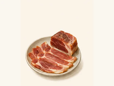 Weining cured ham 威宁火腿AI dish illustration / AI 菜品示意图
The ham has a firm texture and concentrated savouriness. Thin slices and a small quantity can season a much larger vegetable dish.
Source ↗Read the dish guide →All dish names · 全部菜名 (1)
More dishes from across Guizhou are in the Guizhou food guide.
Plan your visit
Getting there
Weining Yi, Hui, and Miao Autonomous County is about 115 km in a straight line from central Bijie City. Search for 威宁彝族回族苗族自治县 in a map app to find stations and your accommodation.
Where to stay →Build your route
Start with Caohai Lake Viewing Area. The linked place guides have entrance and visit details.
Continue with Bijie City →More in Bijie City
Sources & geographic information
Administrative names and parent areas: Official geographic directory · Reference date 2026-09-06.
Some facts checked against 威宁彝族回族苗族自治县 — Wikipedia contributors, CC BY-SA 4.0.
Some facts checked against 草海 — Wikipedia contributors, CC BY-SA 4.0.
Some facts checked against Weining Yi, Hui, and Miao Autonomous County — Wikipedia contributors, CC BY-SA 4.0.
Map data © OpenStreetMap contributors. Pins mark approximate centres, not entrances or boundaries.