


Get to know Panzhou City
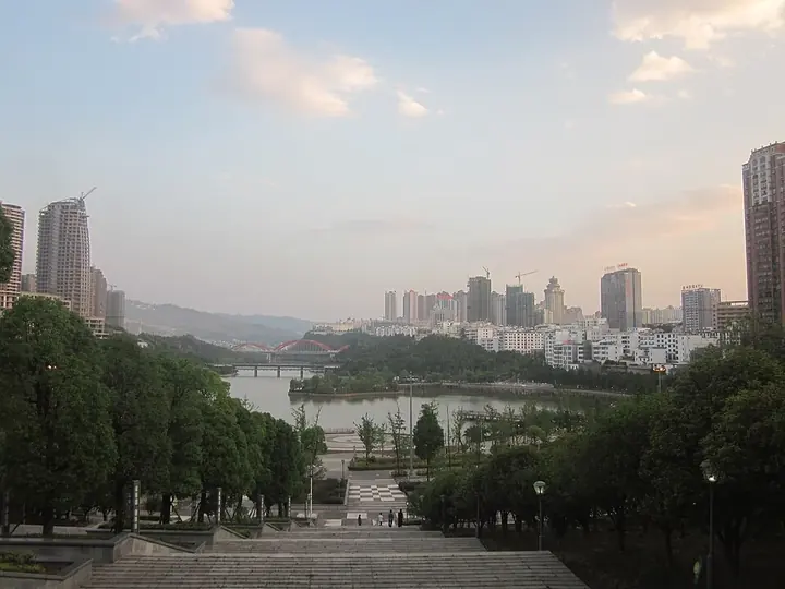
Photo adjustments
Full frame retained; proportionally resized and converted to WebP. No retouching or changes to the photographed subject. Card displays may crop the view.
- Administrative area
- County-level city · 县级市
- Part of
- Liupanshui City
- Chinese name
- 盘州市
- Local areas
- County-level city guide
Area & population
- Area in the source
- 4,056.70 km²
- Administrative seat
- Yizi Subdistrict
Source: cited geographic source, as of the dates shown.
Setting and landscape
Panzhou borders Pu'an County (普安县) to the east, Xingyi (兴义市) to the south, Fuyuan (富源县) and Xuanwei (宣威市) in Yunnan to the west, and Shuicheng (水城区) to the north. The land is highest in the north-west, lower in the east and south, and raised in the centre-south: the main peak of Niupeng Liangzi (牛棚梁子) in the north reaches 2,865 metres, while the Gesuo River (格所河) valley in the north-east lies at 735 metres. Tributaries of the Nanpan (南盘江) and Beipan (北盘江) rivers have cut deep valleys between the ranges.
Three provincial scenic areas lie in the city: the Tuole ancient ginkgoes (妥乐古银杏), the Dadong bamboo sea (大洞竹海) and the Wumeng Grassland (乌蒙大草原). Niangniang Mountain (娘娘山) is a national wetland park.
History
Human teeth more than 200,000 years old from the Pan County Dadong cave (盘县大洞) show features between Homo erectus and early Homo sapiens and were named "Dadong Man". In 634 the Tang renamed Xiping prefecture (西平州) Panzhou after the Pan River (盘江). The name returned in 1909 as Panzhou subprefecture (盘州厅), to avoid a clash with Pu'an County and because the Nanpan headwaters lie here; it became Pan County in 1913. The geographer Xu Xiake (徐霞客) visited in 1638 and described the karst cave of Biyun (碧云洞). The city government also lists the Shuangfeng old town (双凤古城), more than 600 years old, and the meeting site of the Red Army's 2nd and 6th Army Groups in Pan County.
What to see
Tuole village (妥乐村) in Shiqiao town (石桥镇) has more than 10,000 ginkgo trees; over 1,450 of them are more than 300 years old, and the oldest is more than 1,500 years old. Local festivals include the Yi torch festival and Buyi song festivals, and folk dances include the sea-horse dance (海马舞) and the sheepskin-drum dance (羊皮鼓舞).
Food and local products
Pan County ham (盘县火腿) is ranked with Xuanwei and Jinhua ham as one of China's three great hams. It became a national geographical-indication product in 2012 and joined the China–EU mutual-recognition list of geographical indications in 2021. Families cure hams when the new-year pig is killed, between the tenth and twelfth lunar months; a ham must hang for more than a year, and hams over three years old can be eaten raw.
Getting oriented
The Shanghai–Kunming high-speed railway crosses the city from east to west. From the main urban area of Hongguo (红果), the Nanning–Kunming railway runs south and the Shuicheng–Hongguo railway north, and the Shanghai–Kunming and Bijie–Shuicheng–Xingyi expressways meet at Hongguo.
Highlights
- Tuole ancient ginkgoes 妥乐古银杏: More than 1,450 ginkgoes over 300 years old; the oldest is more than 1,500 years old.
- Pan County Dadong 盘县大洞: Cave site whose human teeth, over 200,000 years old, were named Dadong Man.
- Wumeng Grassland 乌蒙大草原: Provincial scenic area.
- Pan County ham 盘县火腿: National geographical-indication product since 2012.
Sources for this guide
盘州简介 · Panzhou Municipal People's Government
历史沿革 · Panzhou Municipal People's Government
自然地理 · Panzhou Municipal People's Government
【新春走基层】时间孕育的美味!盘县火腿香飘全国 · Panzhou Municipal People's Government (Panzhou Media Centre report)
千年银杏披金装!妥乐村“金色浪漫”醉游人 · Panzhou Municipal People's Government (Panzhou Media Centre report)
Original English written from the listed sources and checked sentence by sentence against quoted extracts by a separate reviewer. Updated 2026-09-25.
Explore Panzhou City
Core places to explore, with English and Chinese names.
Places to explore around Panzhou City
 Wumeng Grassland · 乌蒙大草原
Wumeng Grassland乌蒙大草原
Wumeng Grassland spreads across high ground in Panzhou, where open grassy slopes contrast with areas of low-growing rhododendron. The broad skyline is the main attraction outside the flowering season; when the shrubs bloom…
Read the place guide → Tuole Ancient Ginkgo Village · 妥乐古银杏村
Tuole Ancient Ginkgo Village妥乐古银杏村
Tuole is a village in Panzhou, Liupanshui, in western Guizhou, and gives its name to the ancient ginkgo scenic area there. The municipal government counts more than 1,450 old ginkgo trees in a core area of under three square kilometres and describes them as relicts of the Quaternary glaciation.
Read the place guide →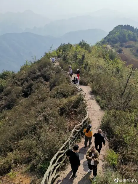 Niangniang Mountain · 娘娘山
Niangniang Mountain娘娘山
Niangniangshan is a karst plateau massif on the border of Panzhou and Shuicheng District in Liupanshui, western Guizhou, rising to 2,319 metres at its main peak. Its valleys hold an unusual upland wetland of peat moss, and the national wetland park and tourist area on it take their name from the mountain.
Read the place guide →Plan your visit
Getting there
Panzhou City is about 105 km in a straight line from central Liupanshui City. Search for 盘州市 in a map app to find stations and your accommodation.
Where to stay →Build your route
Wumeng Grassland and Tuole Ancient Ginkgo Village are both listed here. The linked place guides have entrance and visit details.
Continue with Liupanshui City →More in Liupanshui City
Sources & geographic information
Administrative names and parent areas: Official geographic directory · Reference date 2026-09-06.
Photo: Wumeng Grassland · Source photographer · License not provided. EXIF orientation normalized; resized without changing aspect ratio; converted to WebP. No subject edits.
Photo: Tuole Ancient Ginkgo Village · Source photographer · License not provided. EXIF orientation normalized; resized without changing aspect ratio; converted to WebP. No subject edits.
Photo: Niangniang Mountain · Source photographer · License not provided. EXIF orientation normalized; resized without changing aspect ratio; converted to WebP. No subject edits.
Map data © OpenStreetMap contributors. Pins mark approximate centres, not entrances or boundaries.