


Get to know Songtao Miao Autonomous County
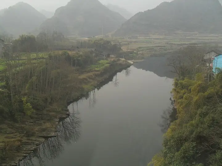
Photo adjustments
Full-frame source proportionally resized and converted to WebP for display. No subject alteration. Source-supplied marks and edits remain; cards may crop the view.
- Administrative area
- Autonomous county · 自治县
- Part of
- Tongren City
- Chinese name
- 松桃苗族自治县
- Local areas
- Autonomous county guide
Area & population
- Area in the source
- 3,400.00 km²
- Population · 2020 census
- 487,737
- Administrative seat
- Liaogao Subdistrict
Source: cited geographic source, as of the dates shown.
History
Polished stone axes and patterned pottery sherds collected at Hudukou (虎渡口) in 1980 were identified by the provincial museum as Neolithic, and Western Han bronzes, including a chunyu drum-bell with a tiger-shaped knob (虎钮錞于), were dug up there between 1962 and 1984.
The Qing set up a subprefecture for Miao affairs at Zhengdaying (正大营) in 1704. In 1730 it moved to Changchong (长冲, now Lao Songtao) as Songtao Subprefecture (松桃厅), and the name Songtao has been used ever since; in 1733 a new town was built below Liaogao Hill (蓼皋山), today's county town. The subprefecture became Songtao County in 1913. In 1934 He Long's Third Red Army set up a revolutionary committee for the Yanjiapo (严家坡) district here.
What to see
Miaowangcheng (苗王城), which the Guizhou Department of Culture and Tourism calls the "first stronghold of the Miao frontier", was first built in the Hongwu reign of the early Ming as the fortress of successive Miao kings. Stilt houses, old gates and a maze of connecting lanes survive, and shows of Miao feats include fire eating and climbing a ladder of blades.
Qianlong Cave (潜龙洞), in Qianlong village (黔龙村) of Wuluo town (乌罗镇) in the west of the county, is a karst cave in dolomite. Explored for 1,481 metres, it has nine halls; the largest, Qianlong Hall, covers more than 10,000 square metres and averages 80 metres high. French cave specialists noted its unusually dense stalagmites, and it is nicknamed the "underground Guilin". The county also lists the red maples of Laershan (腊尔山), Danxia landforms and the hanging-coffin site of Yunluotun (云落屯), dated to the Western Jin.
Crafts and performance
The county government lists Miao Nuo drama, feats of climbing a ladder of blades and walking through fire, the Miao flower drum dance (苗家花鼓舞) and rolling-dragon dance (滚龙) among its traditions, and Songtao has been named Guizhou's home of flower-drum art and China's home of rolling-dragon art. Songtao Miao embroidery (松桃苗绣), on the national intangible heritage list since 2021, is stitched on handmade cloth without sketches, in techniques such as flat, counted-thread, seed and braid stitch, with subjects ranging from myths and history to flowers, birds, sun and moon.
Highlights
- Miaowangcheng 苗王城: Early Ming fortress of the Miao kings with stilt houses, gates and maze-like lanes.
- Qianlong Cave 潜龙洞: Dolomite karst cave in Wuluo with nine halls, the largest over 10,000 square metres.
- Songtao Miao embroidery 松桃苗绣: Freehand embroidery on handmade cloth, on the national intangible heritage list since 2021.
Sources for this guide
松桃简介 · Songtao Miao Autonomous County People's Government
历史沿革 · Songtao Miao Autonomous County People's Government
自然地理 · Songtao Miao Autonomous County People's Government
冬游贵州 | 铜仁市松桃县苗王城 · Songtao Miao Autonomous County People's Government (material from the Guizhou Department of Culture and Tourism)
地下桂林——潜龙洞 · Songtao Miao Autonomous County People's Government
苗绣(松桃苗绣) - 中国非物质文化遗产网 · China Intangible Cultural Heritage Network (Chinese National Academy of Arts)
Original English written from the listed sources and checked sentence by sentence against quoted extracts by a separate reviewer. Updated 2026-09-24.
Explore Songtao Miao Autonomous County
Core places to explore, with English and Chinese names.
Places to explore around Songtao Miao Autonomous County
 AI illustration · AI
 Plan your visit
Getting there
Songtao Miao Autonomous County is about 45 km in a straight line from central Tongren City. Search for 松桃苗族自治县 in a map app to find stations and your accommodation.
Where to stay →Build your route
Start with Miaowangcheng Village. The linked place guides have entrance and visit details.
Continue with Tongren City →More in Tongren City
Sources & geographic information
Administrative names and parent areas: Official geographic directory · Reference date 2026-09-06.
Map data © OpenStreetMap contributors. Pins mark approximate centres, not entrances or boundaries.