


Get to know Kaiping District
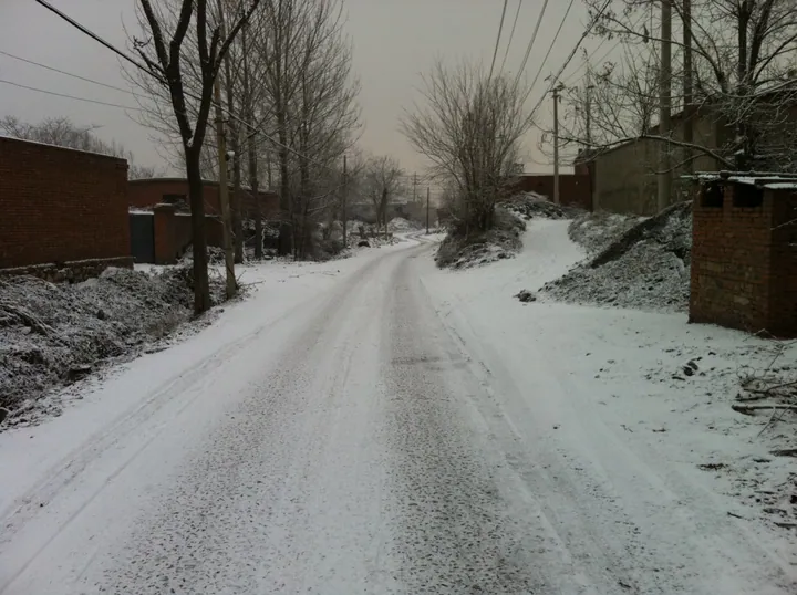
Photo adjustments
Full frame retained; proportionally resized and converted to WebP. No retouching or changes to the photographed subject. Card displays may crop the view.
- Administrative area
- District · 市辖区
- Part of
- Tangshan
- Chinese name
- 开平区
- Local areas
- District guide
Area & population
- Area in the source
- 236.00 km²
- Population · 2012
- 240,000
Source: cited geographic source, as of the dates shown.
History
In the Tang dynasty the area was the seat of Shicheng County (石城县). The name Kaiping dates from the first year of the Yongle reign of the Ming, when the Kaiping Middle Garrison (开平中屯卫) was moved here from Shaling (沙岭) in Daning (大宁). The garrison town grew into one of the four famous market towns of eastern Hebei, and a local saying called it the Kaiping town that could never be filled. Under the Qing it belonged to Luanzhou (滦州).
In 1878 Tang Tingshu (唐廷枢) set up the Kaiping Mining Bureau at Kaiping and began mining coal with Western methods south of a hill then called Tangshan, southwest of the town. The mining settlement that grew up there came to be called Tangshan after the hill, and the bureau's mines became the origin of the city.
What to see
Tangshan Flower Sea (唐山花海) spreads across the border with Lubei District (路北区) on ground once mined by the Kailuan Majiagou (马家沟) colliery; it has three parts, a garden-expo area in the north, a flower park in the middle and flower fields in the south, and a greenway runs straight to Nanhu (南湖). The Taoist Yuqing Temple (玉清观) was destroyed in the 1976 earthquake and rebuilt outside the north gate of the old Kaiping town, where the Tangshan Taoist Association now has its seat.
Douhe Reservoir (陡河水库) in Shuangqiao (双桥镇) was the first large reservoir built in Hebei. Its dam was badly damaged in the 1976 Tangshan earthquake and repaired between October 1976 and May 1977, and it now serves as the terminal reservoir of the project that carries Luan River water to Tangshan.
Food and local products
Xiazhuang (夏庄), a village founded in the Sui and Tang period and a stop on a Kaiping flower-viewing route promoted by the Hebei Department of Agriculture and Rural Affairs, is described by the department as Tangshan's largest Hui village; its halal cooking centres on hand-held mutton, clear-stewed beef and lamb spine. Renxintun (任信屯) in Zhengzhuangzi (郑庄子镇), in the north of the district, grows tomatoes that are rich in selenium, sweet and juicy, and visitors can pick them.
Getting oriented
The Tangshan–Jingtang Port Expressway (S64) begins at the ring-road interchange in Yuehe (越河镇) in Kaiping and runs 80.2 kilometres through Fengnan and Luannan to Jingtang Port in Laoting County. The district government sits at No. 2 Xinyuan Road (新苑路).
Highlights
- Douhe Reservoir 陡河水库: Hebei's first large reservoir, repaired after the 1976 earthquake.
- Tangshan Flower Sea 唐山花海: Three-part flower park on former Majiagou colliery land at the Lubei border.
- Yuqing Temple 玉清观: Taoist temple rebuilt outside the north gate of old Kaiping after the 1976 earthquake.
- Xiazhuang village 夏庄村: Described by the Hebei agriculture department as Tangshan's largest Hui village, known for halal mutton and beef dishes.
Sources for this guide
开平区 · Wikipedia (Chinese) · CC BY-SA 4.0
唐山4条!河北推出“春观花”线路 · Huanbohai News (Tangshan), republishing the Hebei Provincial Department of Agriculture and Rural Affairs
陡河水库 · Wikipedia (Chinese) · CC BY-SA 4.0
唐山市 · Wikipedia (Chinese) · CC BY-SA 4.0
唐山—京唐港高速公路 · Wikipedia (Chinese) · CC BY-SA 4.0
Original English written from the listed sources and checked sentence by sentence against quoted extracts by a separate reviewer. Updated 2026-09-24.
Explore Kaiping District
Core places to explore, with English and Chinese names.
Kaiping District 开平区
Plan your visit
Getting there
Kaiping District is about 9 km in a straight line from central Tangshan. Search for 开平区 in a map app to find stations and your accommodation.
Where to stay →More in Tangshan
Sources & geographic information
Administrative names and parent areas: Official geographic directory · Reference date 2026-09-06.
Some facts checked against 开平区 — Wikipedia contributors, CC BY-SA 4.0.
Some facts checked against 陡河水库 — Wikipedia contributors, CC BY-SA 4.0.
Some facts checked against 唐山市 — Wikipedia contributors, CC BY-SA 4.0.
Some facts checked against 唐山—京唐港高速公路 — Wikipedia contributors, CC BY-SA 4.0.
Map data © OpenStreetMap contributors. Pins mark approximate centres, not entrances or boundaries.