


Get to know Mohe

Photo adjustments
Proportionally resized and converted to WebP without cropping, retouching or changing the photographed subject.
- Administrative area
- County-level city · 县级市
- Part of
- Daxing'anling Prefecture
- Chinese name
- 漠河市
- Local areas
- County-level city guide
Area & population
- Area in the source
- 18,233.00 km²
- Population · 2020 census
- 54,036
- Administrative seat
- Xilinji
Source: cited geographic source, as of the dates shown.
Setting and landscape
Mohe lies on the northern slopes of the Greater Khingan range (大兴安岭), with Tahe County (塔河县) to the east and Inner Mongolia's Ergun (额尔古纳市) and Genhe (根河市) to the west and south. After the border river, its largest river is the Emur (额木尔河), which rises on the Yilehuli Mountains (伊勒呼里山) and joins the Heilongjiang at Gucheng Island (古城岛) in Xing'an town (兴安镇). The city government puts forest cover at 92.75 per cent and lists three national wetland parks: Dalin River (大林河), Jiuqu Shiba Wan (九曲十八湾) and Amur (阿木尔).
Winter is long and severe. The city government records monthly averages below freezing for more than seven months a year, a low of −52.3 °C at Beiji Village and a city record of −53 °C; it describes Mohe as the only place in China to see the northern lights and to experience "polar day and polar night".
History
The city is named after a river in its territory, also called Mohe (墨河, "ink river") because its water is as black as ink. Settlement at Mohe village, today's Beiji Village (北极村), began in 1860, and in 1887–1888 the Qing government opened the Mohe gold mine at Laogou (老沟). A county was set up in 1917, merged into Huma County (呼玛县) in 1947 and restored in 1981, with its seat at Xilinji (西林吉镇); Mohe became a city in 2018.
What to see
China Daily lists Beiji Village as Mohe's one national 5A scenic area, mentions sights labelled the northernmost household, post office and sentry post, and describes the Mohe Beiji Christmas Village (漠河北极圣诞村). Chinese Wikipedia notes that Beihong Village (北红村) is the country's northernmost village. China Daily lists the Longjiang First Bend (龙江第一湾), the Tuqiang forestry museum (图强林业博物馆), the Amur blueberry winery (阿木尔蓝莓酒庄) and Beiji Island (北极岛) among the city's 3A scenic areas, and names the Wusuli shoal (乌苏里浅滩) as China's northernmost point.
Food and local products
China Daily recommends farm chicken stewed with mushrooms (小笨鸡炖蘑菇) in Mohe to keep out the cold, and names blueberries, hazelnuts, wood-ear fungus and mushrooms as mountain produce of the Greater Khingan range.
Highlights
- Beiji Village 北极村: Former Mohe village, settled in 1860; now a national 5A scenic area.
- Beihong Village 北红村: Described by Chinese Wikipedia as China's northernmost village.
- Longjiang First Bend 龙江第一湾: One of Mohe's 3A scenic areas, as listed by China Daily.
- Wusuli shoal 乌苏里浅滩: Named by China Daily as the northernmost point of China.
Sources for this guide
漠河市 - 维基百科,自由的百科全书 · Wikipedia (Chinese) · CC BY-SA 4.0
踏上寻北之旅 神州北极的浪漫远不止“漠河舞厅” - 中国日报网 · China Daily (Heilongjiang bureau)
漠河概况_漠河市人民政府 · Mohe Municipal People's Government
Original English written from the listed sources and checked sentence by sentence against quoted extracts by a separate reviewer. Updated 2026-09-25.
Explore Mohe
Core places to explore, with English and Chinese names.
Places to explore around Mohe
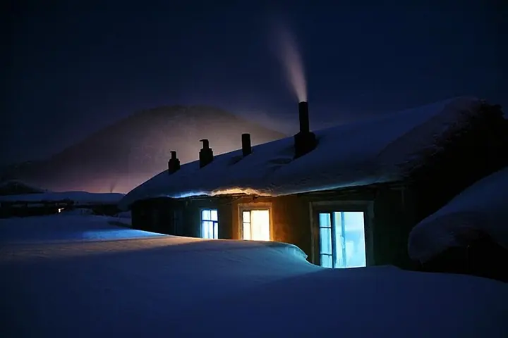 A snow-covered house in Beiji Village · 北极村 Photograph date recorded by the source: 13 September 2011 (original upload date).
Beiji Village北极村
Beiji Village builds its identity around northern latitude and the Heilongjiang border river. The Shenzhou Beiji monument gives that theme a visible centre, while the public riverside places the village opposite Russia's wooded…
Read the place guide →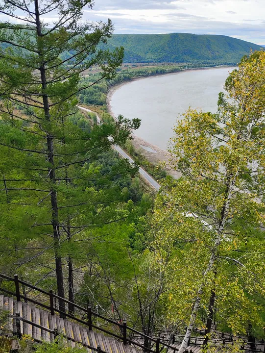 The horseshoe bend of the Heilongjiang (Amur) River seen from the Longjiang First Bend viewpoint, Mohe, Heilongjiang · 黑龙江漠河龙江第一湾观景台俯瞰黑龙江河曲 Source-recorded photograph date: 2024-09-04.
Longjiang First Bend龙江第一湾
Longjiang First Bend (龙江第一湾) is an omega-shaped sweep of the Heilongjiang River in Mohe's forested border landscape.
Read the place guide → The riverside edge of Beihong Village · 北红村 Photograph date recorded by the source: 4 September 2024.
Beihong Village北红村
Beihong is a northern border village where log-built mukeleng houses provide a tangible link to local Russian-influenced domestic architecture. The settlement is surrounded by forest, with the Heilongjiang River forming the…
Read the place guide →Local life & food
Mohe local specialties
漠河市特色美食 · 3 specialties to discover
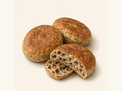 Beihong dark-wheat raised pancakes 漠河北红黑小麦发面饼AI dish illustration / AI 菜品示意图
The grain contributes a pronounced wheat flavour and a darker crumb. Freshly cooked cakes have a warmer, softer texture than cooled takeaway portions.
Source ↗Read the dish guide → Mohe pike-ball soup 漠河狗鱼丸子汤AI dish illustration / AI 菜品示意图
The balls offer a gentle spring against the warm broth. Their flavour is more concentrated than an empty starch dumpling.
Source ↗Read the dish guide →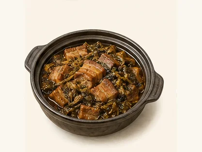 Mohe pork stewed with dried greens 漠河野菜干煲黑猪肉AI dish illustration / AI 菜品示意图
The combination is earthy and hearty, with the greens balancing the richness of the meat. It differs markedly from a quick fresh-leaf stir-fry.
Source ↗Read the dish guide →More dishes from across Heilongjiang are in the Heilongjiang food guide.
Plan your visit
Getting there
Mohe is about 105 km in a straight line from central Daxing'anling Prefecture. Search for 漠河市 in a map app to find stations and your accommodation.
Where to stay →Build your route
Beiji Village and Longjiang First Bend are both listed here. The linked place guides have entrance and visit details.
Continue with Daxing'anling Prefecture →More in Daxing'anling Prefecture
Sources & geographic information
Administrative names and parent areas: Official geographic directory · Reference date 2026-09-06.
Some facts checked against 漠河市 — Wikipedia contributors, CC BY-SA 4.0.
Photo: Beiji Village · funcn · CC BY 3.0. Full frame retained; proportionally resized and converted to WebP. No retouching or changes to the photographed subject. Card displays may crop the view.

Photo: Longjiang First Bend · HCCB3947 · CC BY-SA 4.0. Full frame retained; proportionally resized and converted to WebP. No retouching or changes to the photographed subject. Card displays may crop the view.

Photo: Beihong Village · HCCB3947 · CC BY-SA 4.0. Full frame retained; proportionally resized and converted to WebP. No retouching or changes to the photographed subject. Card displays may crop the view.

Map data © OpenStreetMap contributors. Pins mark approximate centres, not entrances or boundaries.