


Get to know Fangcheng County
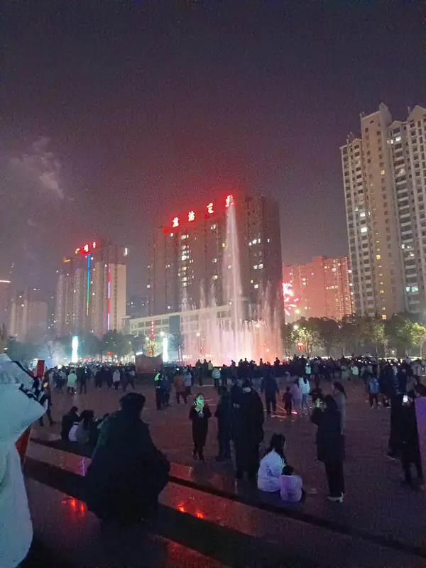
Photo adjustments
EXIF orientation normalized; resized without changing aspect ratio; converted to WebP. No subject edits.
- Administrative area
- County · 县
- Part of
- Nanyang
- Chinese name
- 方城县
- Local areas
- County guide
Area & population
- Area in the source
- 2,542.00 km²
- Population · 2019
- 847,900
Source: cited geographic source, as of the dates shown.
Setting and landscape
Hills, low ridges and plains each cover about a third of the county. The county government describes it as sitting on five dividing lines at once: between the northern subtropics and the southern warm-temperate zone, the Yangtze and Huai basins, the Nanyang Basin and the Huang–Huai plain, the Funiu and Tongbai ranges, and two geological units. In the northeast lies the Fangcheng Gap (方城垭口). The main canal of the Middle Route of the South–North Water Transfer runs 61 kilometres through the county, which the county government calls the longest stretch in any Henan county.
History
The county government traces the name to the city of Zeng (鄫城) of the ancient state of Zeng (缯国) in the Xia era, and calls Fangcheng the ancestral home of the Zeng clan. The Zuo Zhuan records the Chu envoy Qu Wan (屈完) telling the Duke of Qi at Shaoling that Chu had the Fangcheng for its wall and the Han River for its moat, and the Huainanzi lists the Fangcheng among the nine passes of the realm. The Qin set up Yangcheng County here and the Han renamed it Duyang; a Fangcheng County first appeared under the Northern Wei. The Jin created Yuzhou (裕州), which governed Fangcheng, Wuyang and Ye, the Ming folded the county into Yuzhou, and the name Fangcheng County returned in 1913. The county government also calls Fangcheng the fief of Zhang Qian (张骞), Marquis of Bowang (博望侯), and the home of the Western Han judge Zhang Shizhi (张释之).
What to see
The main surviving stretch of the Chu wall is at Daguankou (大关口) in Zhongxinzhuang village (中信庄村), Dushu town (独树镇): three earthen ramparts, 1.5 to 3 metres high, run for more than 1,400 metres between Huangshi Mountain (黄石山) and Duimen Mountain (对门山). The county government says the Xia-period Baliqiao (八里桥) site closely matches the culture of Erlitou, the late Xia capital, and fills a gap in the study of secondary Xia centres. The county lists 114 protected sites, including the site of the Bowang slope fire battle (火烧博望坡遗址). Its national 4A scenic areas are Qifeng Mountain (七峰山), the Seventy-Two Pools (七十二潭) and the Deyun Mountain (德云山) botanical garden.
Food and local products
Fangcheng calls itself China's home of huimian (烩面) noodles, as well as of danshen root (丹参) and Chinese quince (木瓜). Local snacks include mutton huimian (羊肉烩面), Bowang guokui flatbread (博望锅盔), mutton hulatang pepper soup (羊肉胡辣汤) and youcha (油茶).
Getting oriented
The Zhengzhou–Chongqing high-speed railway stops at Fangcheng station.
Highlights
- Daguankou section of the Chu wall 楚长城大关口遗址: Three earthen ramparts over 1,400 metres long, the main surviving remains of the Chu Fangcheng.
- Baliqiao site 八里桥遗址: Xia-period site whose culture closely matches the late Xia capital at Erlitou.
- Qifeng Mountain 七峰山: Eco-tourism area and one of the county's three national 4A scenic areas.
- Bowang guokui 博望锅盔: Flatbread named after Bowang, one of the county's local snacks.
Sources for this guide
县情概况 · Fangcheng County People's Government
历史沿革(人文历史) · Fangcheng County People's Government
方城县 · Wikipedia (Chinese) · CC BY-SA 4.0
Original English written from the listed sources and checked sentence by sentence against quoted extracts by a separate reviewer. Updated 2026-09-24.
Explore Fangcheng County
Core places to explore, with English and Chinese names.
Fangcheng County 方城县
Plan your visit
Getting there
Fangcheng County is about 45 km in a straight line from central Nanyang. Search for 方城县 in a map app to find stations and your accommodation.
Where to stay →More in Nanyang
Sources & geographic information
Administrative names and parent areas: Official geographic directory · Reference date 2026-09-06.
Some facts checked against 方城县 — Wikipedia contributors, CC BY-SA 4.0.
Map data © OpenStreetMap contributors. Pins mark approximate centres, not entrances or boundaries.