


Get to know Nanzhao County
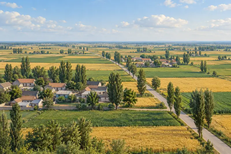
- Administrative area
- County · 县
- Part of
- Nanyang
- Chinese name
- 南召县
- Local areas
- County guide
Area & population
- Area in the source
- 2,946.00 km²
- Population · 2002
- 548,400
Source: cited geographic source, as of the dates shown.
History
"Nanzhao Man" (南召猿人) lived on Xinghua Mountain (杏花山) 500,000 to 600,000 years ago, roughly the age of Peking Man. The neighbouring Xiaokongshan (小空山) cave is, in the county government's account, the second site found in China where Homo erectus had learned to use and control fire. The Qin set up Zhi County (雉县) here in 272 BC; under the Song and Yuan the area was folded into Nanyang County. When the county was re-created in 1476 it took its name from Nanzhao Inn (南召店), a well-known stop for merchants on the road between Nanyang and Luoyang. Nanzhao was taken by the People's Liberation Army on 4 November 1947, and four days later a front-committee meeting of Chen Geng's (陈赓) army at Nanzhao Inn in Yunyang (云阳镇) settled the western Henan campaign plan known as "leading the ox". The county seat then moved to Liqingdian (李青店).
What to see
Baotianman (宝天曼) in Qiaoduan town (乔端镇) rises to 1,830 metres. It became a national nature reserve in 1997, a UNESCO biosphere reserve in 2001 and a world geopark in 2006, and the county government describes its forest as the largest and most intact primeval forest in Henan. Wuduo Mountain (五朵山) in Sikeshu (四棵树乡), a national 4A area within the Funiu Mountain world geopark, is a Taoist pilgrimage site; its highest peak, the Golden Summit, is called the "Northern Summit" as a counterpart to Wudang's "Southern Summit". Danxia Temple (丹霞寺), counted among the eight great temples of the Central Plain, has about 1,200 years of history and takes its name from the red glow that rises from its valleys at dawn and dusk. The temple and its pagoda forest, the Xinghua Mountain and Xiaokongshan sites and the county's section of the Chu wall (南召县楚长城遗址) are all Henan provincial protected sites. Other places the county lists include Yahekou Reservoir (鸭河口水库), the Yunyang stone village (云阳石头村) and rafting on the Bai River.
Food and local products
The county produces monkey-head mushrooms (猴头), fiddlehead ferns (拳菜) and morels (羊肚菌), and the county names Yahe fish (鸭河鱼), Nanzhao black pigs and tussah silkworms among its products. Local dishes include Baitugang spicy chicken (白土岗辣子鸡), Nanzhao pulled noodles (南召扯面) and langguo cai (揽锅菜). Nanzhao also calls itself China's home of the magnolia (玉兰) and of xinyi magnolia buds (辛夷).
Highlights
- Baotianman 宝天曼: National nature reserve since 1997, UNESCO biosphere reserve since 2001 and world geopark since 2006; main peak 1,830 metres.
- Wuduo Mountain 五朵山: National 4A Taoist mountain whose Golden Summit is called the Northern Summit, answering Wudang.
- Danxia Temple 丹霞寺: Temple of about 1,200 years named for its red morning and evening glow; provincial protected site with its pagoda forest.
- Xiaokongshan site 小空山遗址: Cave site where early humans used and controlled fire, next to the Nanzhao Man site on Xinghua Mountain.
- Baitugang spicy chicken 白土岗辣子鸡: Local chicken dish named by the county government among its signature foods.
Sources for this guide
基本概况 · Nanzhao County People's Government
历史沿革 · Nanzhao County People's Government
游在南召 · Nanzhao County People's Government
吃在南召 · Nanzhao County People's Government
河南省文物保护单位 · Wikipedia (Chinese) · CC BY-SA 4.0
南阳八景 · Wikipedia (Chinese) · CC BY-SA 4.0
Original English written from the listed sources and checked sentence by sentence against quoted extracts by a separate reviewer. Updated 2026-09-24.
Explore Nanzhao County
Core places to explore, with English and Chinese names.
Nanzhao County 南召县
Plan your visit
Getting there
Nanzhao County is about 55 km in a straight line from central Nanyang. Search for 南召县 in a map app to find stations and your accommodation.
Where to stay →More in Nanyang
Sources & geographic information
Administrative names and parent areas: Official geographic directory · Reference date 2026-09-06.
Some facts checked against 河南省文物保护单位 — Wikipedia contributors, CC BY-SA 4.0.
Some facts checked against 南阳八景 — Wikipedia contributors, CC BY-SA 4.0.
Map data © OpenStreetMap contributors. Pins mark approximate centres, not entrances or boundaries.