


Get to know Zhenping County
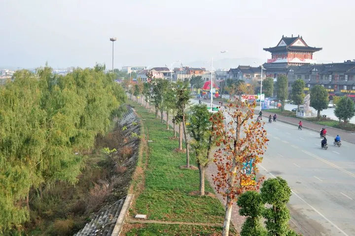
Photo adjustments
Full frame retained; proportionally resized and converted to WebP. No retouching or changes to the photographed subject. Card displays may crop the view.
- Administrative area
- County · 县
- Part of
- Nanyang
- Chinese name
- 镇平县
- Local areas
- County guide
Area & population
- Area in the source
- 1,490.00 km²
- Population · 2019
- 869,400
Source: cited geographic source, as of the dates shown.
Setting and landscape
The county government describes the land as one-third mountain, one-third hill and one-third plain. Thirteen rivers, including the Zhao (赵河), Yanling (沿陵河) and Lao (潦河), run north-south and belong to the Han River (汉水) basin, and the main canal of the middle route of the South-North Water Transfer Project (南水北调中线工程) crosses the county. The climate is northern subtropical monsoon, with a mean temperature of 15.1°C and about 750 millimetres of rain a year.
History
Palaeolithic tools found at Yewan (叶湾) and Shiyanggang (石羊岗) show people here more than 500,000 years ago. The area was long called Nieyang (涅阳), after the Nie River (涅水). The county was created in 1226, under the Jin dynasty, and named Zhenping, "suppress and pacify", after a peasant uprising was put down here; the poet Yuan Haowen (元好问) was its first magistrate. In the Spring and Autumn period this was a front line between Qin and Chu, and the north of the county still keeps stretches of the Chu Great Wall (楚长城), which the county calls the father of China's great walls.
What to see
Wuduo Mountain (五垛山), in the north of Erlong township (二龙乡), is named for its five facing peaks; the highest, Shengduo (圣垛) or Beiding (北顶), rises to 1,665 metres and carries the Zushi Temple (祖师庙), founded in the early Tang by the Taoist Wu Yun (吴筠). Puti Temple (菩提寺), founded in the Yonghui reign of Tang Emperor Gaozong and a Henan provincial protected site since 1982, has 82 rooms in Qing style; its palm-leaf sutra is a national first-grade relic. The Peng Xuefeng Memorial Hall (彭雪枫纪念馆), opened in 1988, honours the New Fourth Army general born south of the county town in 1907. International Jade City (国际玉城), a national 4A scenic area at Shifosi town (石佛寺镇), is laid out in twelve zones for showing and selling carved jade.
Food and local products
Zhenping yellow wine (镇平黄酒) is brewed from millet and glutinous rice with a wheat starter. Zhenping roast chicken (镇平烧鸡), also sold as Hou's roast chicken, was created by Hou Xishan (侯稀山). The county produces no jade of its own, yet the county government calls it the largest centre for jade carving and trading in China, with a special commercial district at Shifosi. It is also the state-named hometown of goldfish and of magnolias, with more than 30 magnolia varieties.
Highlights
- Wuduo Mountain 五垛山: Five-peaked mountain whose 1,665-metre summit carries the Zushi Temple, founded in the early Tang.
- Puti Temple 菩提寺: Temple founded in the Yonghui reign of the Tang; provincial protected site since 1982; holds a palm-leaf sutra of the first grade.
- Peng Xuefeng Memorial Hall 彭雪枫纪念馆: Opened in 1988 for the general born near the county town in 1907.
- International Jade City 国际玉城: National 4A scenic area of jade display and sales at Shifosi.
- Zhenping roast chicken 镇平烧鸡: Also called Hou's roast chicken, created by Hou Xishan.
Sources for this guide
镇平县史_镇平概况_镇平县人民政府 · Zhenping County People's Government
自然资源_镇平概况_镇平县人民政府 · Zhenping County Natural Resources Bureau
风景名胜_镇平概况_镇平县人民政府 · Zhenping County Culture, Radio, Television and Tourism Bureau
地方特产_镇平概况_镇平县人民政府 · Zhenping County People's Government
县情概况_县情概况_镇平县人民政府 · Zhenping County People's Government
Original English written from the listed sources and checked sentence by sentence against quoted extracts by a separate reviewer. Updated 2026-09-24.
Explore Zhenping County
Core places to explore, with English and Chinese names.
Zhenping County 镇平县
Plan your visit
Getting there
Zhenping County is about 30 km in a straight line from central Nanyang. Search for 镇平县 in a map app to find stations and your accommodation.
Where to stay →More in Nanyang
Sources & geographic information
Administrative names and parent areas: Official geographic directory · Reference date 2026-09-06.
Map data © OpenStreetMap contributors. Pins mark approximate centres, not entrances or boundaries.