


Get to know Kwai Tsing District

Photo adjustments
The exact downloaded source bytes are separately retained and hashed. Prepared JPEG is proportionally reduced to a maximum 720-pixel long edge; full frame retained, no subject alteration. Final website rendition: full frame retained, proportionally resized to at most 720 pixels and converted to WebP. No additional retouching or subject alteration. Card displays may crop the view.
- Administrative area
- District · 地區
- Part of
- Hong Kong
- Chinese name
- 葵青
- Local areas
- District guide
Area & population
- Area in the source
- 21.82 km²
- Population · 2016
- 520,572
Source: cited geographic source, as of the dates shown.
Container port and bridges
The container terminals extend along Kwai Chung’s coast towards Stonecutters Island (昂船洲) and Tsing Yi. On Tsing Yi, the Lantau Link Viewing Platform (青嶼幹線觀景台) offers views of Ting Kau Bridge (汀九橋) and Tsing Ma Bridge (青馬大橋). Lai King Hill Road (荔景山路) provides another outlook over the container terminals, especially at sunset.
Chun Kwan’s island shrine
Chun Kwan Temple (真君廟) was built near Tsing Yi’s waterfront around the beginning of the twentieth century and moved to Fung Shue Wo Road (楓樹窩路) in the 1980s. Its deity is associated with a Southern Song legend about a man surnamed Ng (吳) who helped fight pirates. Traditional Cantonese opera forms part of the deity’s annual festival.
Sources for this guide
Hong Kong Fun in 18 Districts - Kwai Tsing District · Hong Kong Home Affairs Department
Hong Kong Fun in 18 Districts - Chun Kwan Temple · Hong Kong Home Affairs Department
Original English written from the listed sources and checked sentence by sentence against quoted extracts by a separate reviewer. Updated 2026-09-27.
Explore Kwai Tsing District
Core places to explore, with English and Chinese names.
Places to explore around Kwai Tsing District
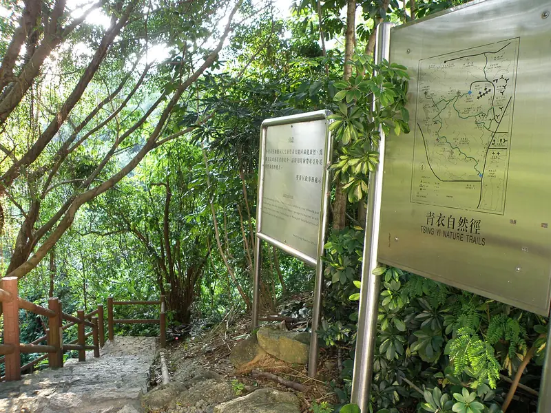 Tsing Yi Nature Trails (青衣自然径), Kwai Tsing. Photograph: "Tsing Yi Nature Trails".
Tsing Yi Nature Trails青衣自然径
Tsing Yi Nature Trails climb through Liu To Valley above the island’s western developments. The main visual reward is the changing view of the Tsing Ma and Ting Kau bridges, with pavilions providing pauses along the hillside…
Read the place guide →Ornamental lake in Tsing Yi Park · 青衣公园观赏湖 Photograph date recorded by the source: 24 March 2008.Tsing Yi Park青衣公园
Tsing Yi Park uses an ornamental lake, waterfall and planted gardens to create a quieter setting among the island’s residential blocks. The European-style layout includes a lookout pavilion and an amphitheatre, with palm and…
Read the place guide →Plan your visit
Getting there
Kwai Tsing District is about 10 km in a straight line from central Hong Kong. Search for 葵青 in a map app to find stations and your accommodation.
Where to stay →Build your route
Tsing Yi Nature Trails and Tsing Yi Park are about 1 km apart in a straight line. The linked place guides have entrance and visit details.
Continue with Hong Kong →More in Hong Kong
Sources & geographic information
Administrative names and parent areas: Official geographic directory · Reference date 2026-09-06.
Photo: Tsing Yi Nature Trails · Exploringlife · CC BY-SA 4.0. Full frame retained; EXIF orientation normalized, proportionally resized to at most 800 pixels and converted to WebP. No generated pixels or subject changes. Cards may crop the display.

Photo: Tsing Yi Park · WiNG · WiNG — HK_Tsing_Yi_Park_Ornamental_Lake.jpg — CC BY 3.0 · CC BY 3.0. The exact downloaded source bytes are separately retained and hashed. Prepared JPEG is proportionally reduced to a maximum 720-pixel long edge; full frame retained, no subject alteration. Final website rendition: full frame retained, proportionally resized to at most 720 pixels and converted to WebP. No additional retouching or subject alteration. Card displays may crop the view.

Map data © OpenStreetMap contributors. Pins mark approximate centres, not entrances or boundaries.