


Get to know Tuen Mun District
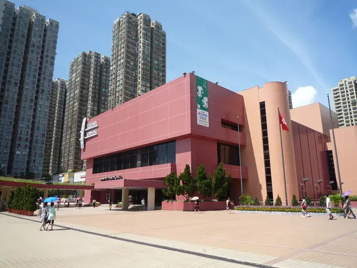
Photo adjustments
Full frame retained; proportionally resized and converted to WebP. No retouching or changes to the photographed subject. Card displays may crop the view.
- Administrative area
- District · 地區
- Part of
- Hong Kong
- Chinese name
- 屯門
- Local areas
- District guide
Area & population
- Population · 2021
- 506,879
Source: cited geographic source, as of the dates shown.
History
The name is thought to be short for a phrase meaning "door of the garrison" (屯兵之門), and Tuen Mun is thought to have been a trading port with a garrison as early as the Tang dynasty, though historians dispute whether the old Tuen Mun lay here or at Nantou (南頭) in today's Shenzhen. Planned as Castle Peak New Town, the new town took the historic name in 1972; it was built on land reclaimed from Castle Peak Bay and on levelled hillsides, and absorbed the old market town of Tuen Mun San Hui (屯門新墟) as its centre.
What to see
The Home Affairs Department dates Tsing Shan Monastery (青山禪院) back more than 1,500 years. Ching Chung Koon (青松觀) is a Taoist temple. The district council's list of places to visit also includes Hung Lau (紅樓), the Dade Institute (達德學校), Miu Fat Buddhist Monastery (妙法寺), the To clan ancestral hall, Tsing Chuen Wai (青磚圍), Sam Shing Hui (三聖墟) with its Sam Shing Temple, and the Emperor's Cave.
Five adjoining beaches run along the south-eastern shore, with the Hong Kong Gold Coast development and its Dolphin Square near Golden Beach. Chinese white dolphins are often seen in Urmston Road off the south-west coast, and there is a dolphin lookout at Lung Kwu Tan (龍鼓灘). Dragon boats race on Castle Peak Bay each year at the Tuen Ng Festival.
Getting oriented
The district council gives Tuen Mun's distance from urban Kowloon as 32 kilometres, with Yuen Long 7 kilometres and Tsuen Wan 18 kilometres away. Inside the district the Light Rail is the main transport. The MTR Tuen Ma line, Tuen Mun Road and Castle Peak Road link it to Kowloon, and the Tuen Mun-Chek Lap Kok Tunnel runs to the airport and North Lantau. The Hong Kong-Shenzhen Western Corridor, opened in mid-2007, strengthened cross-boundary links with the Pan-Pearl River Delta.
Highlights
- Tsing Shan Monastery 青山禅院: Dated back more than 1,500 years by the Home Affairs Department.
- Ching Chung Koon 青松觀: Taoist temple named among Tuen Mun's typical sights by the Home Affairs Department.
- Hong Kong Gold Coast 香港黄金海岸: Coastal development with Dolphin Square near Golden Beach.
- Lung Kwu Tan dolphin lookout 龍鼓灘: Lookout for Chinese white dolphins listed by the Tuen Mun District Council.
Sources for this guide
Home Affairs Department - Tuen Mun District · Home Affairs Department, Hong Kong SAR Government
Tuen Mun District Council - District Highlights · Tuen Mun District Council, Hong Kong SAR Government
Tuen Mun District · Wikipedia · CC BY-SA 4.0
Original English written from the listed sources and checked sentence by sentence against quoted extracts by a separate reviewer. Updated 2026-09-25.
Explore Tuen Mun District
Core places to explore, with English and Chinese names.
Places to explore around Tuen Mun District
 Hong Kong Gold Coast Hotel exterior · 香港黄金海岸酒店外观 Photograph date recorded by the source: 25 January 2006.
Hong Kong Gold Coast香港黄金海岸
Hong Kong Gold Coast’s public-facing waterfront combines a sandy beach, a promenade and the open spaces of Gold Coast Piazza. Dolphin Square is identified by a three-tiered golden dolphin sculpture, while Golden Beach lies in…
Read the place guide → Front gate of Tsing Shan Monastery · 青山禅院山门 Photograph date recorded by the source: 14 April 2009.
Tsing Shan Monastery青山禅院
Tsing Shan Monastery occupies a wooded slope above Tuen Mun, with a series of religious buildings rather than a single hall. The Tai Hung Po Din roof carries Shiwan glazed ceramic figures drawn from opera, while the mountain…
Read the place guide →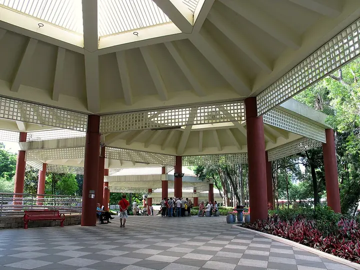 Entrance pavilion of Tuen Mun Park, Hong Kong · 香港屯门公园入口亭 Photograph date recorded by the source: 19 July 2012.
Tuen Mun Park屯门公园
Tuen Mun Park lies between the town centre and the Tuen Mun River. Artificial water features, a model-boat pool and planted public areas create a recreational landscape beside the transport interchange. The Reptile House adds a…
Read the place guide →Plan your visit
Getting there
Tuen Mun District is about 20 km in a straight line from central Hong Kong. Search for 屯門 in a map app to find stations and your accommodation.
Where to stay →Build your route
Hong Kong Gold Coast and Tsing Shan Monastery are about 4 km apart in a straight line. The linked place guides have entrance and visit details.
Continue with Hong Kong →More in Hong Kong
Sources & geographic information
Administrative names and parent areas: Official geographic directory · Reference date 2026-09-06.
Some facts checked against Tuen Mun District — Wikipedia contributors, CC BY-SA 4.0.
Photo: Hong Kong Gold Coast · WiNG · WiNG — Hong_Kong_Gold_Coast_Hotel_2006.jpg — CC BY 3.0 · CC BY 3.0. The exact downloaded source bytes are separately retained and hashed. Prepared JPEG is proportionally reduced to a maximum 720-pixel long edge; full frame retained, no subject alteration. Final website rendition: full frame retained, proportionally resized to at most 720 pixels and converted to WebP. No additional retouching or subject alteration. Card displays may crop the view.

Photo: Tsing Shan Monastery · Chong Fat · Chong Fat — HK_TsingShanMonastry_FrontGate.JPG — CC BY-SA 3.0 · CC BY-SA 3.0. The exact downloaded source bytes are separately retained and hashed. Prepared JPEG is proportionally reduced to a maximum 720-pixel long edge; full frame retained, no subject alteration. Final website rendition: full frame retained, proportionally resized to at most 720 pixels and converted to WebP. No additional retouching or subject alteration. Card displays may crop the view.

Photo: Tuen Mun Park · Wing1990hk · Wing1990hk — Tuen_Mun_Park_Pavilion_201207.jpg — CC BY 3.0 · CC BY 3.0. Full frame retained; proportionally resized and converted to WebP. No retouching or changes to the photographed subject. Card displays may crop the view.

Map data © OpenStreetMap contributors. Pins mark approximate centres, not entrances or boundaries.