


Get to know Yuen Long District
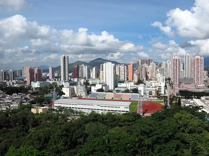
Photo adjustments
Full frame retained; proportionally resized and converted to WebP. No retouching or changes to the photographed subject. Card displays may crop the view.
- Administrative area
- District · 地區
- Part of
- Hong Kong
- Chinese name
- 元朗
- Local areas
- District guide
Area & population
- Area in the source
- 138.56 km²
- Population · 2021
- 668,080
Source: cited geographic source, as of the dates shown.
Ping Shan’s clan landscape
The approximately 1.6-kilometre Ping Shan Heritage Trail (屏山文物徑) links Hang Tau Tsuen (坑頭村), Hang Mei Tsuen (坑尾村) and Sheung Cheung Wai (上璋圍). The Tang clan (鄧氏) has lived here since the twelfth century. Ancestral halls, study halls and Tsui Sing Lau Pagoda (聚星樓) illustrate the area’s architectural and communal traditions. The Ping Shan Tang Clan Gallery (屏山鄧族文物館) occupies the former police station, built in 1900.
Rural and urban settings
The wider district includes the new towns of Yuen Long and Tin Shui Wai (天水圍), developed from the 1970s onward. Its natural landscapes include Mai Po Nature Reserve (米埔自然保護區), Hong Kong Wetland Park (香港濕地公園), Nam Sang Wai (南生圍) and Pak Nai (白泥).
Sources for this guide
Hong Kong Fun in 18 Districts - Yuen Long District · Hong Kong Home Affairs Department
Hong Kong Fun in 18 Districts - Ping Shan Heritage Trail · Hong Kong Home Affairs Department
Original English written from the listed sources and checked sentence by sentence against quoted extracts by a separate reviewer. Updated 2026-09-27.
Explore Yuen Long District
Core places to explore, with English and Chinese names.
Places to explore around Yuen Long District
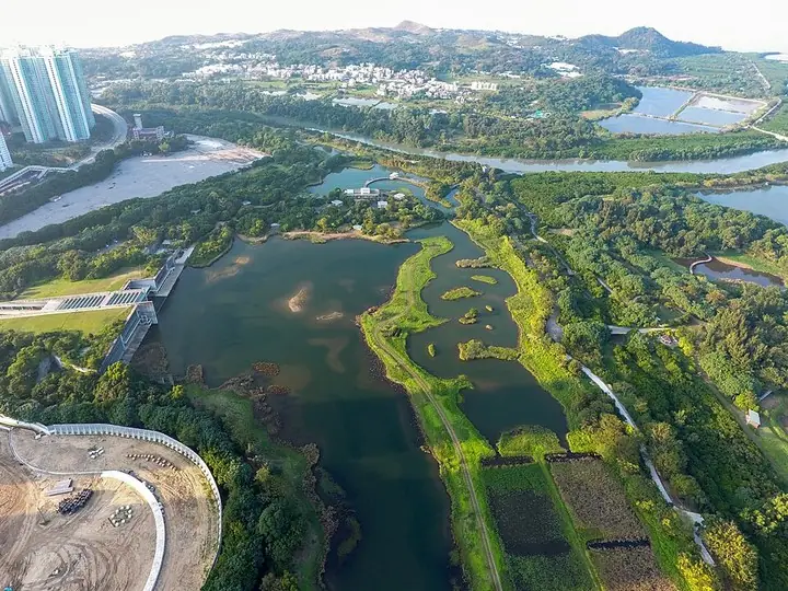 Lakes and marsh landscape at Hong Kong Wetland Park · 香港湿地公园湖泊与湿地景观 Photograph date recorded by the source: 22 December 2016.
Hong Kong Wetland Park香港湿地公园
Hong Kong Wetland Park is currently best planned around its outdoor reserve. The Mangrove Boardwalk reveals exposed roots and habitat adaptations, while the Riverside and Fishpond hides provide sheltered places to watch birds…
Read the place guide →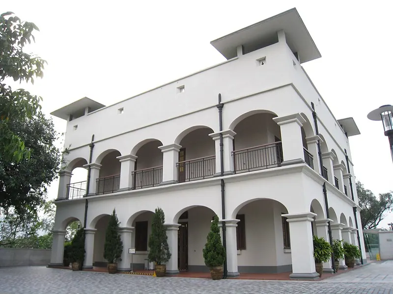 Ping Shan Tang Clan Gallery on the Ping Shan Heritage Trail. Photograph date recorded by the source: 2013-09-29 17:58:53.
Ping Shan Heritage Trail屏山文物径
Ping Shan Heritage Trail connects monuments associated with the Tang clan through the villages around Hang Tau, Hang Mei and Sheung Cheung Wai. Tsui Sing Lau Pagoda, the Tang Ancestral Hall and Kun Ting Study Hall give the route…
Read the place guide →Plan your visit
Getting there
Yuen Long District is about 20 km in a straight line from central Hong Kong. Search for 元朗 in a map app to find stations and your accommodation.
Where to stay →Build your route
Hong Kong Wetland Park and Ping Shan Heritage Trail are about 3 km apart in a straight line. The linked place guides have entrance and visit details.
Continue with Hong Kong →More in Hong Kong
Sources & geographic information
Administrative names and parent areas: Official geographic directory · Reference date 2026-09-06.
Photo: Hong Kong Wetland Park · Wpcpey · Wpcpey — Hong_Kong_Wetland_Park_overview1_201612.jpg — CC BY-SA 4.0 · CC BY-SA 4.0. The exact downloaded source bytes are separately retained and hashed. Prepared JPEG is proportionally reduced to a maximum 720-pixel long edge; full frame retained, no subject alteration. Final website rendition: full frame retained, proportionally resized to at most 720 pixels and converted to WebP. No additional retouching or subject alteration. Card displays may crop the view.

Photo: Ping Shan Heritage Trail · Quality of life HK · CC BY-SA 3.0. Full frame retained; proportionally resized and converted to WebP. No retouching or changes to the photographed subject. Card displays may crop the view.

Map data © OpenStreetMap contributors. Pins mark approximate centres, not entrances or boundaries.