


Get to know Jianshi County
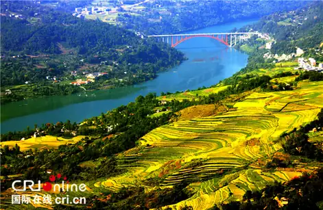
Photo adjustments
EXIF orientation normalized; resized without changing aspect ratio; converted to WebP. No subject edits.
- Administrative area
- County · 县
- Part of
- Enshi Tujia and Miao Autonomous Prefecture
- Chinese name
- 建始县
- Local areas
- County guide
Area & population
- Area in the source
- 2,666.55 km²
- Population · 2020
- 411,622
Source: cited geographic source, as of the dates shown.
Setting and landscape
Rivers mark much of the boundary: the Yesan River (野三河) with Badong to the east, the Taiyang River (太阳河) with Enshi city to the west, and the Chang (长河) and Chaliao (茶寮河) rivers with Hefeng to the south, while Fengjie (奉节) and Wushan (巫山) counties of Chongqing lie to the north. The county government likens its outline to a mushroom, 89 kilometres from north to south and only 12.5 kilometres across at its narrowest. Elevations run from 213 metres to 2,090 metres. Selenium-bearing rock is exposed over nearly 480 square kilometres, and the county government says Jianshi is known as a "selenium-rich kingdom".
History
At Juyuan Cave (巨猿洞) the Chinese Academy of Sciences found fossils of "Jianshi Homo erectus" dated to 1.95 to 2.15 million years ago; the county government presents them as the earliest ancient humans found in China, even in Asia, and the site is a national key protected site. The county itself was founded in 260 under the Wu state of the Three Kingdoms. The county government reads its name as a stock auspicious phrase and rejects the popular gloss "beginning of the county". In the Northern Song the seat moved to today's Yezhou town (业州镇), and in 1736 Jianshi passed from Kuizhou prefecture in Sichuan to the new Shinan prefecture (施南府) in Hubei. The Republican-era official Wu Kuo-chen (吴国桢) and the writer Wei Junyi (韦君宜) were born here.
What to see
The Dixingu scenic area (地心谷), rated 4A, lists the old Ba salt road (巴盐古道) and a Giant Ape Underground River (巨猿暗河) among its named sights. The county also points visitors to the Yesan River valley, the Jingyang River (景阳河) reach of the Qing, and the Chaoyangguan (朝阳观) and Changlinggang (长岭岗) scenic areas. Provincially protected sites include Shizhuguan (石柱观), the Wuyang Academy (五阳书院) and the Jingyang Catholic Church (景阳天主教堂).
Food, products and music
The county's selenium-rich local products include Jianxiang kiwifruit (建香猕猴桃), Guankou grapes (关口葡萄), Jingyang walnuts (景阳核桃) and Mapo tea (马坡茶). The folk song "Huang Si Jie" (黄四姐) comes from Jianshi, and its intangible heritage includes silk-string gong-and-drum music (丝弦锣鼓) and the Tujia back-drum dance (土家背鼓舞). National highways 209 and 318, the Shanghai–Chongqing expressway and the Yichang–Wanzhou railway pass through.
Highlights
- Jianshi Homo erectus site 建始直立人遗址: National key protected site where fossils dated to about two million years were found in Juyuan Cave.
- Dixingu scenic area 地心谷: 4A scenic area with the old Ba salt road and the Giant Ape Underground River.
- Jingyang Catholic Church 景阳天主教堂: Provincially protected historic church.
- Huang Si Jie 黄四姐: Folk song from Jianshi.
Sources for this guide
建始县情概况 · Jianshi County People's Government
历史沿革 · Jianshi County People's Government
建始县 - 维基百科 · Wikipedia (Chinese) · CC BY-SA 4.0
蝶舞清江·地心谷景区 · Enshi Prefecture People's Government (Jianshi County Culture and Tourism Bureau)
Original English written from the listed sources and checked sentence by sentence against quoted extracts by a separate reviewer. Updated 2026-09-24.
Explore Jianshi County
Core places to explore, with English and Chinese names.
Places to explore around Jianshi County
 AI illustration · AI
 Plan your visit
Getting there
Jianshi County is about 45 km in a straight line from central Enshi Tujia and Miao Autonomous Prefecture. Search for 建始县 in a map app to find stations and your accommodation.
Where to stay →Build your route
Start with Dixin Valley. The linked place guides have entrance and visit details.
Continue with Enshi Tujia and Miao Autonomous Prefecture →More in Enshi Tujia and Miao Autonomous Prefecture
Sources & geographic information
Administrative names and parent areas: Official geographic directory (dmfw.mca.gov.cn) · Reference date 2026-09-06.
Some facts checked against 建始县 — Wikipedia contributors, CC BY-SA 4.0.
Map data © OpenStreetMap contributors. Pins mark approximate centres, not entrances or boundaries.