


Get to know Laifeng County
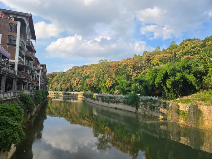
Photo adjustments
Full frame retained; proportionally resized and converted to WebP. No retouching or changes to the photographed subject. Card displays may crop the view.
- Administrative area
- County · 县
- Part of
- Enshi Tujia and Miao Autonomous Prefecture
- Chinese name
- 来凤县
- Local areas
- County guide
Area & population
- Area in the source
- 1,319.90 km²
- Population · 2020
- 283,255
Source: cited geographic source, as of the dates shown.
Setting and getting oriented
The Wuling Mountains (武陵山) run through the county and the Youshui cuts through it from end to end. The county town, Xiangfeng (翔凤镇), is 130 kilometres south of Enshi, 190 kilometres north of Zhangjiajie (张家界) and 100 kilometres east of Qianjiang (黔江). The county takes its name from Xiangfeng Mountain (翔凤山) just east of the town, which the Tongzhi-era county gazetteer describes as shaped like a phoenix spreading its wings. The Qianjiang–Zhangjiajie–Changde railway stops at Laifeng station.
History
In 1294 the Yuan set up the Dawang pacification office (大旺宣抚司) here, and by the early Ming seven hereditary chiefdoms, among them Sanmao (散毛) and Maodong (卯峒), shared the area. The chiefs were replaced by appointed officials in 1735 and Laifeng County was created in 1736. The county government describes Laifeng as the first place in China to introduce regional autonomy for the Tujia; it was a Tujia autonomous county from December 1979 until December 1983.
What to see
The Xianfo Temple grottoes (仙佛寺), in Xianfo village 4.5 kilometres from the county town, face Longshan across the Youshui. Carving began in the Xiankang years of the Eastern Jin, more than 1,700 years ago; the main Buddha stands about 6 metres tall, and the site is a national key protected site of the sixth batch and a 4A scenic area. The county government calls them the earliest Buddhist carvings south of the Yangtze.
In Baifusi town (百福司镇), the 4A Maodong scenic area (卯洞) covers the Maodong Gorge of the Youshui, with the Baifu natural bridge (百福天生桥) and karst caves along the river. In Sanhu township (三胡乡), more than 20 kilometres from the county town, Yangmei old village (杨梅古寨) keeps more than 10,000 old Chinese bayberry trees, the oldest put at 1,200 years, and an old opera stage where Nan opera (南剧) is still staged at festivals.
Songs, dances and bayberries
The county government says Laifeng is known as a home of song and dance. The Tujia hand-waving dance (摆手舞), nicknamed the "Oriental disco", spread from here to become a signature Tujia art, and earth-dragon lanterns (地龙灯), three-stick drumming (三棒鼓) and bridal laments (哭嫁歌) are still part of local custom. Summer is bayberry season in Yangmei old village, where the fruit is also dried, made into jam and brewed into wine.
Highlights
- Xianfo Temple grottoes 仙佛寺: Cliff carvings begun in the Eastern Jin, with a main Buddha about 6 metres tall; national key protected site.
- Maodong scenic area 卯洞: A gorge of the Youshui in Baifusi town with the Baifu natural bridge.
- Yangmei old village 杨梅古寨: Over 10,000 old bayberry trees, the oldest put at 1,200 years, and an old opera stage.
- Tujia hand-waving dance 摆手舞: Dance nicknamed the "Oriental disco" that spread from Laifeng to become a signature Tujia art.
Sources for this guide
来凤县 - 维基百科 · Wikipedia (Chinese) · CC BY-SA 4.0
来凤概况 · Laifeng County People's Government
历史沿革 · Laifeng County People's Government
来凤仙佛石窟 · Enshi Prefecture People's Government (Laifeng County Culture and Tourism Bureau)
来凤卯洞 · Enshi Prefecture People's Government (Laifeng County Culture and Tourism Bureau)
来凤杨梅古寨 · Enshi Prefecture People's Government (Laifeng County Culture and Tourism Bureau)
Original English written from the listed sources and checked sentence by sentence against quoted extracts by a separate reviewer. Updated 2026-09-24.
Explore Laifeng County
Core places to explore, with English and Chinese names.
Places to explore around Laifeng County
 AI illustration · AI
 Plan your visit
Getting there
Laifeng County is about 85 km in a straight line from central Enshi Tujia and Miao Autonomous Prefecture. Search for 来凤县 in a map app to find stations and your accommodation.
Where to stay →Build your route
Start with Xianfo Temple Grottoes. The linked place guides have entrance and visit details.
Continue with Enshi Tujia and Miao Autonomous Prefecture →More in Enshi Tujia and Miao Autonomous Prefecture
Sources & geographic information
Administrative names and parent areas: Official geographic directory · Reference date 2026-09-06.
Some facts checked against 来凤县 — Wikipedia contributors, CC BY-SA 4.0.
Map data © OpenStreetMap contributors. Pins mark approximate centres, not entrances or boundaries.