


Get to know Lichuan
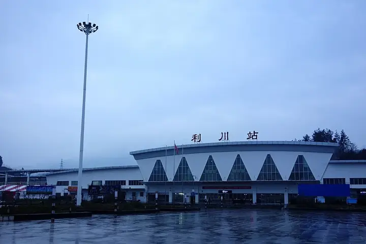
Photo adjustments
Full frame retained; resized proportionally to a maximum dimension of 960 pixels and converted to WebP quality 88. No crop, retouch, generated elements, or subject alteration. Final website rendition: full frame retained, proportionally resized to at most 720 pixels and converted to WebP. No additional retouching or subject alteration. Card displays may crop the view.
- Administrative area
- County-level city · 县级市
- Part of
- Enshi Tujia and Miao Autonomous Prefecture
- Chinese name
- 利川市
- Local areas
- County-level city guide
Area & population
- Area in the source
- 4,612.19 km²
- Population · 2020
- 750,670
- Administrative seat
- Duting Subdistrict (都亭街道)
Source: cited geographic source, as of the dates shown.
History
Under the Qin the area belonged to Qianzhong Commandery (黔中郡). In the Yuan and Ming it was part of the Shinan (施南) chieftaincy; after the Zhiluo (支罗) chieftain Huang Zhong (黄中) rebelled and was put down in 1565, the Ming replaced the chieftain with a garrison post. The Qing made it a county, and it became a city in 1986. Most of the population belongs to minority groups, chiefly Tujia.
What to see
Tenglong Cave (腾龙洞), 4 kilometres from the city, is a world geopark and national 5A scenic area. Its explored passages run for 59.8 kilometres on five levels, and the dry entrance is 72 metres high and 64 metres wide. The Qing River drops more than 30 metres where it enters the water cave and flows on underground. A Tujia song-and-dance show, Yishui Lichuan (夷水丽川), has been staged in a theatre built inside the cave since September 2005.
Two groups of old buildings are national protected sites. The Dashuijing complex (大水井古建筑群) at Baiyangba (柏杨坝) began as the house of the Huang chieftains and was taken over and rebuilt by the Li family; its ancestral hall, built between 1846 and 1849, faces south, and the group also includes the Li manor and a residence built in the 1940s. Yumuzhai (鱼木寨) at Moudao (谋道) is a Tujia hilltop stronghold first built under the Ming by a chieftain of the Ma family, ringed by cliffs and entered through four gates; about a hundred households, mostly Tujia, still live inside, among a Qing gate tower and more than 30 old tombs.
Songs and local products
Lichuan lantern songs (利川灯歌) are on the national intangible-heritage list (2011). Tujia singers perform them at festivals along streets and village lanes, with a decorated dragon boat and a cart lantern as props; they date from the early Qing, and the decorated dragon-boat prop imitates the dragon-boat races held to honour Qu Yuan (屈原). Lichuan yam (利川山药) is a national geographical-indication product.
Highlights
- Tenglong Cave 腾龙洞: World geopark and 5A area with 59.8 kilometres of explored passages on five levels.
- Dashuijing complex 大水井古建筑群: Li family ancestral hall and manor at Baiyangba, a national protected site since 2001.
- Yumuzhai 鱼木寨: Cliff-ringed Tujia stronghold at Moudao, a national protected site since 2006.
- Lichuan lantern songs 利川灯歌: National intangible heritage, listed in 2011.
Sources for this guide
利川腾龙洞 - 恩施州人民政府门户网站 · Enshi Tujia and Miao Autonomous Prefecture People's Government
利川市 (湖北省) - 维基百科,自由的百科全书 · Wikipedia (Chinese) · CC BY-SA 4.0
大水井古建筑群 - 维基百科,自由的百科全书 · Wikipedia (Chinese) · CC BY-SA 4.0
鱼木寨 - 维基百科,自由的百科全书 · Wikipedia (Chinese) · CC BY-SA 4.0
利川灯歌 - 中国非物质文化遗产网·中国非物质文化遗产数字博物馆 · China Intangible Cultural Heritage Network (China Intangible Cultural Heritage Protection Centre)
Original English written from the listed sources and checked sentence by sentence against quoted extracts by a separate reviewer. Updated 2026-09-25.
Explore Lichuan
Core places to explore, with English and Chinese names.
Places to explore around Lichuan
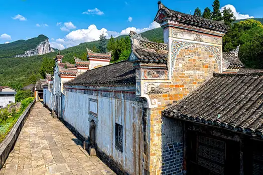 Dashuijing Ancient Architectural Complex · 大水井古建筑群
Dashuijing Ancient Architectural Complex大水井古建筑群
Li clan manor, ancestral hall and 1940s house in Baiyangba, Lichuan, grown from the former home of the Huang tusi chieftains.
Read the place guide →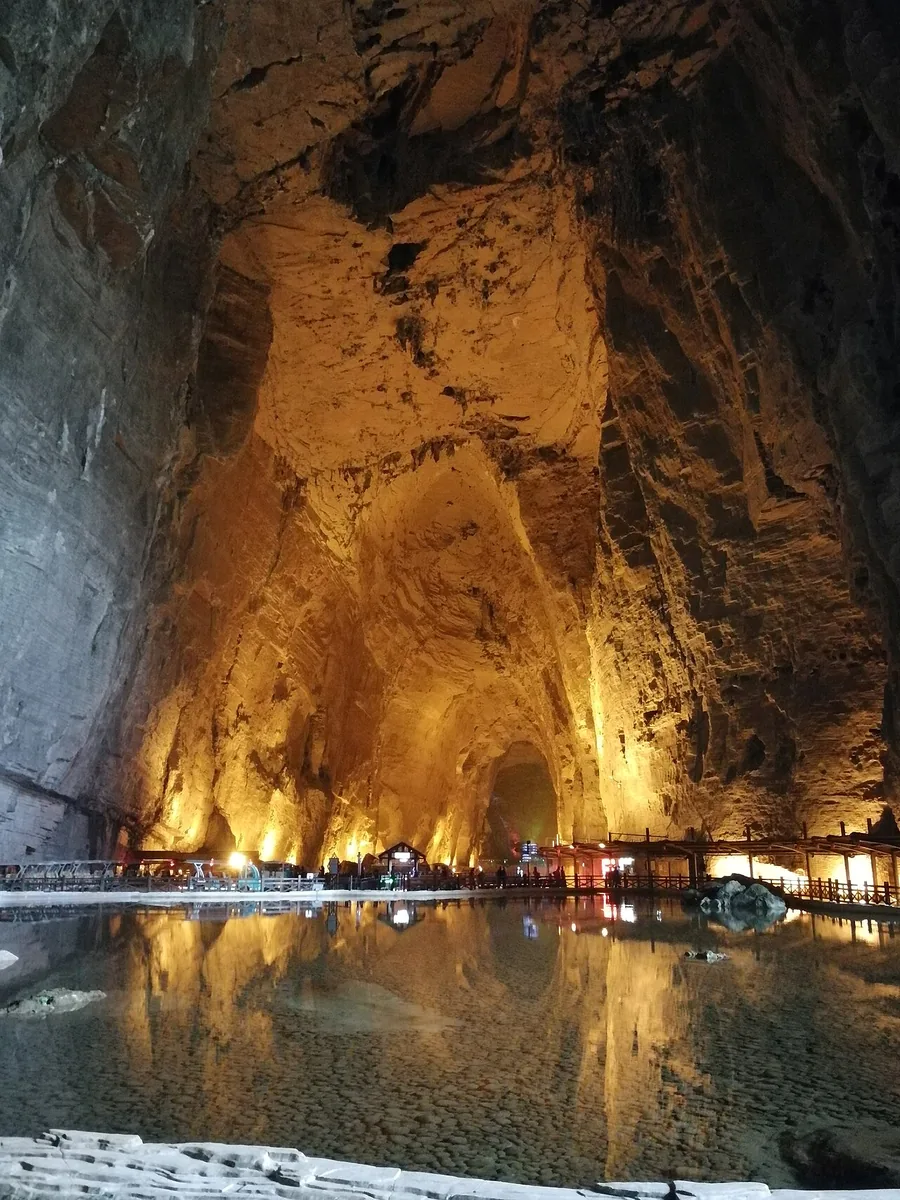 The high interior chamber and water inside Tenglong Cave, Lichuan, Hubei; 19 November 2020.
Tenglong Cave腾龙洞
Tenglong Cave near Lichuan is striking for the scale of its entrance and its connection with the Qing River’s underground course. At the water-cave mouth, the river drops into the feature known as Wolong Tunjiang, or Sleeping…
Read the place guide →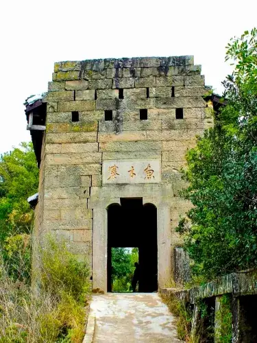 Yumuzhai Village · 鱼木寨
Yumuzhai Village鱼木寨
Cliff-top Tujia stronghold in Lichuan, Hubei, founded by a Ma-family chief in the early Ming and still home to over a hundred households.
Read the place guide →Plan your visit
Getting there
Lichuan is about 55 km in a straight line from central Enshi Tujia and Miao Autonomous Prefecture. Search for 利川市 in a map app to find stations and your accommodation.
Where to stay →Build your route
Dashuijing Ancient Architectural Complex and Tenglong Cave are both listed here. The linked place guides have entrance and visit details.
Continue with Enshi Tujia and Miao Autonomous Prefecture →More in Enshi Tujia and Miao Autonomous Prefecture
Sources & geographic information
Administrative names and parent areas: Official geographic directory (dmfw.mca.gov.cn) · Reference date 2026-09-06.
Some facts checked against 利川市 (湖北省) — Wikipedia contributors, CC BY-SA 4.0.
Some facts checked against 大水井古建筑群 — Wikipedia contributors, CC BY-SA 4.0.
Some facts checked against 鱼木寨 — Wikipedia contributors, CC BY-SA 4.0.
Photo: Dashuijing Ancient Architectural Complex · Source photographer · License not provided. EXIF orientation normalized; resized without changing aspect ratio; converted to WebP. No subject edits.
Photo: Tenglong Cave · Whisper of the heart · CC BY-SA 4.0. Proportionally resized and converted to WebP without cropping, retouching or changing the photographed subject.

Photo: Yumuzhai Village · Source photographer · License not provided. EXIF orientation normalized; resized without changing aspect ratio; converted to WebP. No subject edits.
Map data © OpenStreetMap contributors. Pins mark approximate centres, not entrances or boundaries.