


Get to know Zhushan County
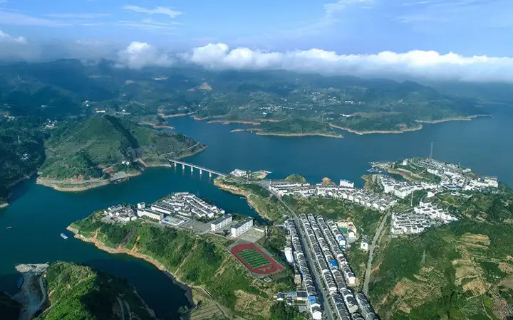
Photo adjustments
EXIF orientation normalized; resized without changing aspect ratio; converted to WebP. No subject edits.
- Administrative area
- County · 县
- Part of
- Shiyan
- Chinese name
- 竹山县
- Local areas
- County guide
Area & population
- Area in the source
- 3,590.00 km²
- Population · 2020
- 346,069
Source: cited geographic source, as of the dates shown.
History and culture
The county government identifies Zhushan with the capital of the ancient state of Yong (庸国) and says the later name, "bamboo mountain", came from the dense bamboo forests. It is the home town of Zhang Zhenwu (张振武), one of the leaders of the first uprising of the 1911 Revolution, and of Shi Yang (施洋), a lawyer for labour.
The Nüwa legend (女娲传说), stories about Nüwa, the ancestral goddess who in legend mended the sky, entered the national intangible-heritage list in 2021 under Zhushan's name. Its core area is Baofeng (宝丰镇) in the Du River basin, where villagers around Nüwa Mountain (女娲山) still tell the stories, sing Nüwa songs and keep rites for her alongside folk customs such as the lotus boat (采莲船).
What to see
Shengshui Lake (圣水湖), a sports-tourism area with a core zone of more than 8 square kilometres, was chosen as one of China's 2025 quality sports-tourism projects. It hosts boat-angling contests, dragon boats and paddleboarding, serves as a training water for the Hubei rowing team, and stages single-bamboo drifting (独竹漂) performances and painted-boat trips. The county presents a boat trip on the lake as a way to take in the history of old Shangyong.
Among the county's other scenic areas, Taihe Plum Valley (太和梅花谷) is known for wild wintersweet that flowers in winter, and Wuling Gorge (武陵峡) runs between five rock walls; Xinhua called it a "modern Peach Blossom Land".
Food and local products
The county calls itself China's home of turquoise and says 70 per cent of China's reserves lie in Zhushan; in its Turquoise Town (绿松石小镇) carvers work the stone into pieces on the sky-mending theme. Local foods include selenium-rich tea grown along the Du River, Liulin cured pork (柳林腊肉), which is glossy red and rich without being greasy, and shiitake sauce.
Highlights
- Nüwa legend 女娲传说: National intangible heritage since 2021, centred on Baofeng and Nüwa Mountain in the Du River basin.
- Shengshui Lake 圣水湖: Sports-tourism area with a core zone of more than 8 square kilometres; a 2025 national quality sports-tourism project.
- Wuling Gorge 武陵峡: A gorge between five rock walls, called a "modern Peach Blossom Land" by Xinhua.
- Zhushan turquoise 竹山绿松石: The county says 70 per cent of China's turquoise reserves are here; turquoise carving is among its intangible-heritage crafts.
- Liulin cured pork 柳林腊肉: Glossy red cured pork, rich but not greasy.
Sources for this guide
灵秀竹山(竹山县简介) · Zhushan County People's Government
千年古县・康养秘境——竹山欢迎您 · Zhushan County People's Government
竹山圣水湖体育旅游景区入选2025中国体育旅游精品项目 · Zhushan County People's Government
女娲传说 · China Intangible Cultural Heritage Network (ihchina.cn)
Original English written from the listed sources and checked sentence by sentence against quoted extracts by a separate reviewer. Updated 2026-09-24.
Explore Zhushan County
Core places to explore, with English and Chinese names.
Places to explore around Zhushan County
 AI illustration · AI
 Plan your visit
Getting there
Zhushan County is about 70 km in a straight line from central Shiyan. Search for 竹山县 in a map app to find stations and your accommodation.
Where to stay →Build your route
Start with Shangyong Ancient Town and Shengshui Lake. The linked place guides have entrance and visit details.
Continue with Shiyan →More in Shiyan
Sources & geographic information
Administrative names and parent areas: Official geographic directory · Reference date 2026-09-06.
Map data © OpenStreetMap contributors. Pins mark approximate centres, not entrances or boundaries.