


Get to know Nanxian
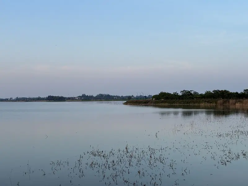
Photo adjustments
Full frame retained; EXIF orientation normalized, proportionally resized to at most 800 pixels and converted to WebP. No generated pixels or subject changes. Cards may crop the display.
- Administrative area
- County · 县
- Part of
- Yiyang
- Chinese name
- 南县
- Local areas
- County guide
Area & population
- Area in the source
- 1,321.00 km²
Source: cited geographic source, as of the dates shown.
Setting and landscape
The county is an alluvial plain of diked polders (垸) at an average height of about 28 metres; its highest point, Mingshan (明山), reaches only 78 metres. Five branches of the Ouchi River (藕池河), part of the Yangtze system, cross the county on their way into Dongting Lake, and the Yangtze itself runs 30 kilometres to the north. The Maocaojie Bridge (茅草街大桥), a steel arch bridge, spans the Songli flood channel (淞澧洪道).
History
After the Yangtze broke through its south bank at Ouchi, silt carried into the lake built up new islands that locals called Nanzhou (南洲), and by 1874 the area between Ouchi and western Dongting had silted up into islands. In 1895 the Qing court created a new sub-prefecture, Nanzhou Zhiliting (南洲直隶厅), from silted land where six counties met; it was renamed Nanxian in 1913. Chinese Wikipedia calls it the last county to appear in the Dongting Lake region. From 9 to 12 May 1943 Japanese troops killed more than 30,000 civilians at Changjiao (厂窖), an event known as the Changjiao massacre (厂窖惨案); the site entered the seventh batch of national key cultural relics protection units in 2013.
What to see
The Changjiao Massacre Memorial Hall (厂窖惨案遇难同胞纪念馆) stands in Changjiao town in the southwest of the county; its 70-mu grounds hold an alarm-bell pavilion, a long corridor, a sculpture group and a feature named the Blood River (血水河). Near Changjiao, the Tianxingzhou (天星洲) wetland is a reed-covered lake island where the county culture and tourism bureau points to wild vegetables in spring and summer and reed blossom and flocks of birds in autumn and winter. The county government also lists the Luowen (罗文) graffiti art scenic area and Dechang Park (德昌公园) among its best-known sights.
Food and local products
Nanxian farms crayfish in its rice paddies, and in 2018 the China Grain Industry Association named it China's home of crayfish-paddy rice (虾稻米), rice grown in fields where crayfish are raised alongside the crop. Nanxian crayfish (南县小龙虾) holds a geographical indication; the county describes the cooked shells as bright red and the meat as white and tender. Other registered local marks include Nanxian Chinese softshell turtle and Nanzhou Dongting crab, and the county also calls itself China's capital of dried noodles (挂面). Tianxingzhou is known for four wild foods: wild celery, wild Artemisia, reed shoots and liaomi (蓼米).
Highlights
- Changjiao Massacre Memorial Hall 厂窖惨案遇难同胞纪念馆: Memorial on the site of the May 1943 massacre, a national key cultural relics protection unit since 2013.
- Tianxingzhou wetland 天星洲湿地: Reed-covered Dongting lake island near Changjiao, with reed blossom and birds in autumn and winter.
- Maocaojie Bridge 茅草街大桥: Steel arch bridge over the Songli flood channel.
- Nanxian crayfish 南县小龙虾: Geographical-indication crayfish raised with rice in the county's paddies.
Sources for this guide
南县 - 维基百科,自由的百科全书 · Chinese Wikipedia · CC BY-SA 4.0
南县概况 · Nanxian County People's Government
厂窖惨案遇难同胞纪念馆 · Nanxian Bureau of Culture, Tourism, Radio, Television and Sports
天星洲湿地 · Nanxian Bureau of Culture, Tourism, Radio, Television and Sports
南县小龙虾 · Nanxian Bureau of Culture, Tourism, Radio, Television and Sports
Original English written from the listed sources and checked sentence by sentence against quoted extracts by a separate reviewer. Updated 2026-09-25.
Explore Nanxian
Core places to explore, with English and Chinese names.
Places to explore around Nanxian
 Nanzhou Wetland and Dongting Lake Birdwatching Area ·
 Plan your visit
Getting there
Nanxian is about 75 km in a straight line from central Yiyang. Search for 南县 in a map app to find stations and your accommodation.
Where to stay →Build your route
Start with Nanzhou Wetland and Dongting Lake Birdwatching Area. The linked place guides have entrance and visit details.
Continue with Yiyang →More in Yiyang
Sources & geographic information
Administrative names and parent areas: Official geographic directory · Reference date 2026-09-06.
Some facts checked against 南县 — Wikipedia contributors, CC BY-SA 4.0.
Photo: Nanzhou Wetland and Dongting Lake Birdwatching Area · Source photographer · License not provided. EXIF orientation normalized; resized without changing aspect ratio; converted to WebP. No subject edits.
Map data © OpenStreetMap contributors. Pins mark approximate centres, not entrances or boundaries.