


Get to know Anhua County
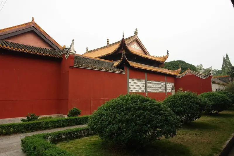
Photo adjustments
EXIF orientation normalized; resized without changing aspect ratio; converted to WebP. No subject edits.
- Administrative area
- County · 县
- Part of
- Yiyang
- Chinese name
- 安化县
- Local areas
- County guide
Area & population
- Area in the source
- 4,945.20 km²
Source: cited geographic source, as of the dates shown.
Setting and landscape
Mountains make up 82 percent of the county, with 63 peaks above 1,000 metres. The Zi River crosses the whole county; at Zhexi (柘溪) it is dammed by the Zhexi hydropower station, described as Hunan's first large hydropower plant, whose reservoir spreads over 85 square kilometres. The county government lists tillite rocks more than 600 million years old, which it says hold 85 percent of the world's reserves, and national-level nature reserve, forest, wetland, geological and rocky-desert parks. Liubuxi (六步溪) is a national nature reserve.
History
The area was anciently called Meishan. It came under Chu in the Warring States period, and the county was founded in 1072 under the Northern Song, its name meaning to turn to peace and be transformed by virtue. The Qing governors-general Tao Shu (陶澍) and Luo Raodian (罗绕典) and the calligrapher Huang Ziyuan (黄自元) grew up here; Tao Shu's tomb park and a Wenwu (civil and military) temple (文武庙) survive. The county government calls Anhua the starting point of the Ten Thousand Li Tea Road.
What to see
Yuntai Mountain (云台山) is a 4A scenic area whose summit is a 9-square-kilometre basin reaching 998.17 metres, called the plain on the mountain; it has the Longquan Cave (龙泉洞), a glass walkway and suspension bridge, a hilltop tea garden viewpoint and a folk-culture village, and is known for sunrise over a sea of cloud. The Anhua Tea Horse Road scenic area (安化茶马古道景区), also 4A and about 3.9 square kilometres, recreates tea-trading streets and has a 700-metre miniature tea-horse trail through Guanshan Gorge (关山峡谷).
Food and local products
Qujiang bopian (渠江薄片) tea from Anhua was a Tang tribute, and in the Ming Wanli reign Anhua dark tea was made official tea for sale to the northwest. In 1821 merchants began stamping it into cylinders of 100 liang, raised in 1863 to 1,000 liang, the origin of Anhua qianliang tea (安化千两茶). Its making ends with 55 days of sun and night dew, and the technique entered the national intangible heritage list in 2008. Cured pork and leicha (擂茶), a pounded tea, are other local products.
Highlights
- Anhua qianliang tea 安化千两茶: Dark tea stamped into 1,000-liang cylinders since 1863; making technique on the national intangible heritage list since 2008.
- Yuntai Mountain 云台山: 4A scenic area with a 9-square-kilometre summit basin and a hilltop tea garden.
- Anhua Tea Horse Road scenic area 安化茶马古道景区: 4A area with recreated tea-trading streets and a trail through Guanshan Gorge.
- Zhexi Reservoir 柘溪水库: Reservoir of 85 square kilometres on the Zi River behind the Zhexi dam.
Sources for this guide
安化县 - 维基百科,自由的百科全书 · Chinese Wikipedia · CC BY-SA 4.0
安化概况 · Anhua County People's Government
黑茶制作技艺(千两茶制作技艺) - 中国非物质文化遗产网·中国非物质文化遗产数字博物馆 · China Intangible Cultural Heritage Network (Chinese National Academy of Arts)
安化茶马古道景区 · Anhua County Bureau of Culture, Tourism, Radio, TV and Sports (county government portal)
云台山景区 · Anhua County Bureau of Culture, Tourism, Radio, TV and Sports (county government portal)
Original English written from the listed sources and checked sentence by sentence against quoted extracts by a separate reviewer. Updated 2026-09-25.
Explore Anhua County
Core places to explore, with English and Chinese names.
Places to explore around Anhua County
 Yuntai Mountain · 云台山
Yuntai Mountain云台山
Yuntaishan (云台山) is a karst mountain west of Malu town in Anhua County, Yiyang, Hunan, rising to 998.17 m above a summit that flattens into a basin of about nine square kilometres. It is the place of origin of Yuntaishan large-leaf tea and carries a national AAAA scenic-area designation.
Read the place guide → AI illustration · AI 示意图(仅供参考,非该地点实拍)
Anhua Tea Horse Road Scenic Area茶马古道开放景区
The Anhua Tea Horse Road scenic area (茶马古道) lies in the mountains of Anhua County, Yiyang, Hunan, on the northern foot of the Daxiongshan forest park. It is built around a surviving stretch of the bluestone packhorse road that carried Anhua dark tea out of the hills.
Read the place guide →Plan your visit
Getting there
Anhua County is about 100 km in a straight line from central Yiyang. Search for 安化县 in a map app to find stations and your accommodation.
Where to stay →Build your route
Yuntai Mountain and Anhua Tea Horse Road Scenic Area are both listed here. The linked place guides have entrance and visit details.
Continue with Yiyang →More in Yiyang
Sources & geographic information
Administrative names and parent areas: Official geographic directory · Reference date 2026-09-06.
Some facts checked against 安化县 — Wikipedia contributors, CC BY-SA 4.0.
Photo: Yuntai Mountain · 江上清风1961 · CC BY 3.0. EXIF orientation normalized; resized without changing aspect ratio; converted to WebP. No subject edits.

Map data © OpenStreetMap contributors. Pins mark approximate centres, not entrances or boundaries.