


Get to know Alxa League
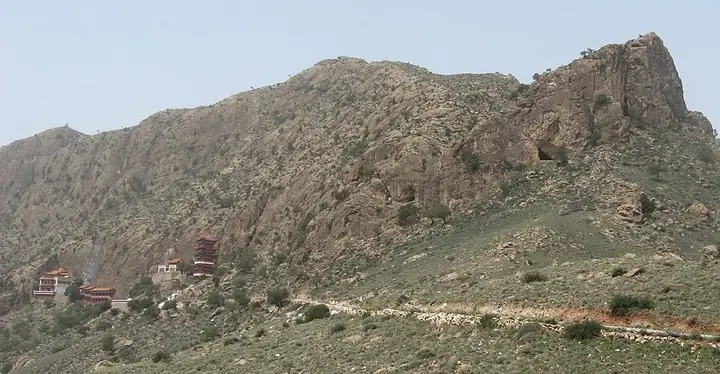
Photo adjustments
Full frame retained; resized proportionally to a maximum dimension of 960 pixels and converted to WebP quality 88. No crop, retouch, generated elements, or subject alteration. Final website rendition: full frame retained, proportionally resized to at most 720 pixels and converted to WebP. No additional retouching or subject alteration. Card displays may crop the view.
- Administrative area
- League · 盟
- Part of
- Inner Mongolia
- Chinese name
- 阿拉善盟
- Local areas
- 3 local areas
Area & population
- Area in the source
- 240,080.00 km²
- Population · 2010
- 231,334
- Administrative seat
- Alxa Left Banner (Bayanhot)
Source: cited geographic source, as of the dates shown.
Explore Alxa League
Core places to explore, with English and Chinese names.
Badain Jaran Desert 巴丹吉林沙漠
Khara-Khoto 黑城遗址
Tengger Desert 腾格里沙漠
Juyan Lake 居延海
Ejin Banner 额济纳旗
Ejina Poplar Forest Tourism Area 额济纳胡杨林旅游区
Badain Jaran Desert Scenic Area 巴丹吉林沙漠开放旅游区
Tengger Desert Scenic Area 腾格里沙漠开放旅游区
Helan Mountain Guangzong Monastery 贺兰山广宗寺
Strange Tree Forest 怪树林
Alxa Left Banner 阿拉善左旗
Alxa Right Banner 阿拉善右旗
Ejin Banner 额济纳旗
Places to explore around Alxa League
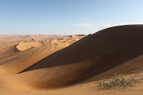 Badan Jaran Desert · 巴丹吉林沙漠
Badain Jaran Desert巴丹吉林沙漠
Badain Jaran's great dunes rise above a network of lakes in the Alxa plateau. The contrast between steep sand slopes, water and narrow vegetated margins is its defining landscape. An introductory visit can focus on Badan Lake…
Read the place guide → Outer ruins and stupas at Khara-Khoto · 黑城遗址 Photograph date recorded by the source: 2012-10-16 07:13:46.
Khara-Khoto黑城遗址
Khara-Khoto, the Black City, was a fortified settlement on routes linking the Hexi Corridor with the Mongolian steppe. Its surviving rectangular walls, projecting defensive platforms and religious remains make the former town…
Read the place guide → Sand dunes at the southern fringe of the Tengger Desert · 腾格里沙漠南缘沙丘 Source-recorded photograph date: 22 November 2007 (original upload date).
Tengger Desert腾格里沙漠
Tengger is a broad dune desert crossed by lake basins and patches of pasture, extending across the borders of Inner Mongolia, Ningxia and Gansu. For an Alxa-side introduction, Moon Lake offers a named reception route into this…
Read the place guide →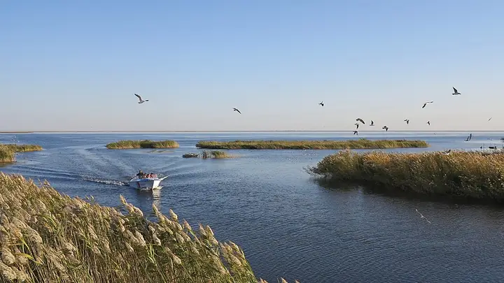 Reed beds and open water at Juyan Lake in Ejina · 额济纳居延海的芦苇与开阔水面 Source-recorded photograph date: Taken on 4 October 2015.
Juyan Lake居延海
The visitor destination known as Juyan Lake is East Juyan Lake, or Sogo Nuur, at the end of the Heihe river system. Its water and reed margins form an oasis in the arid country north of Dalai Hob. Restoration of downstream water…
Read the place guide → Reeds and water at Juyan Lake wetland park in Ejin Banner. Photograph date recorded by the source: Taken on 4 October 2015.
Ejin Banner额济纳旗
Ejin's settlements and poplar groves depend on the rivers descending from the Qilian Mountains into the desert. Dalai Hob provides the practical base for this wide territory. Start with Ejin Museum's account of Juyan and the…
Read the place guide → AI illustration · AI 示意图(仅供参考,非该地点实拍)
Ejina Poplar Forest Tourism Area额济纳胡杨林旅游区
Ejina's poplar forest tourism area links named bridge sections through desert-poplar woodland near Dalaihub Town.
Read the place guide → AI illustration · AI 示意图(仅供参考,非该地点实拍)
Badain Jaran Desert Scenic Area巴丹吉林沙漠开放旅游区
World Heritage desert in Alxa Right Banner with megadunes up to about 500 m, salt lakes between them, singing sand and a lakeside temple.
Read the place guide →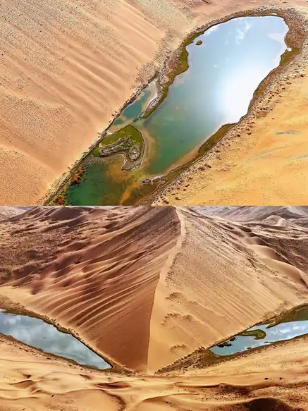 Tengger Desert Scenic Area · 腾格里沙漠开放旅游区
Tengger Desert Scenic Area腾格里沙漠开放旅游区
Tengger Desert Scenic Area (腾格里沙漠开放旅游区) is a grasslands & deserts entry in Alxa Left Banner, Inner Mongolia. Its listed highlights include desert landscapes.
Read the place guide → Helan Mountain Guangzong Monastery (贺兰山广宗寺), Alxa Left Banner. Photograph: "A picture from China every day 289".
Helan Mountain Guangzong Monastery贺兰山广宗寺
Helan Mountain Guangzong Monastery (贺兰山广宗寺), also called South Temple, is a Tibetan Buddhist complex on the western slopes of the Helan Mountains in Alxa Left Banner.
Read the place guide →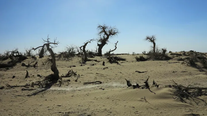 Dead poplar trees standing in the desert sand at Guaishulin ("Strange Tree Forest"), Ejin Banner · 额济纳旗怪树林,沙地中矗立的枯死胡杨树 Source-recorded photograph date: Taken on 4 October 2015.
Strange Tree Forest怪树林
Strange Tree Forest (怪树林) is an area of dead poplar trees in Ejin Banner, where standing trunks and fallen wood create the distinctive 'strange forest' landscape.
Read the place guide →Local life & food
Alxa League local specialties
阿拉善盟特色美食 · 11 specialties to discover
 Alxa camel meat pie 驼肉馅饼AI illustration · AI 示意图
Expect a crisp-to-tender dough contrast and a substantial, savory meat center. The exact flavor depends on the cut and recipe, so avoid expecting every camel pie to taste identical.
Source ↗Read the dish guide → Alxa shami jelly 沙米凉粉AI illustration · AI 示意图
The jelly is smooth and slippery, with a mild base that carries the dressing. It should be distinguished from ordinary mung-bean jelly by its ingredient.
Source ↗Read the dish guide →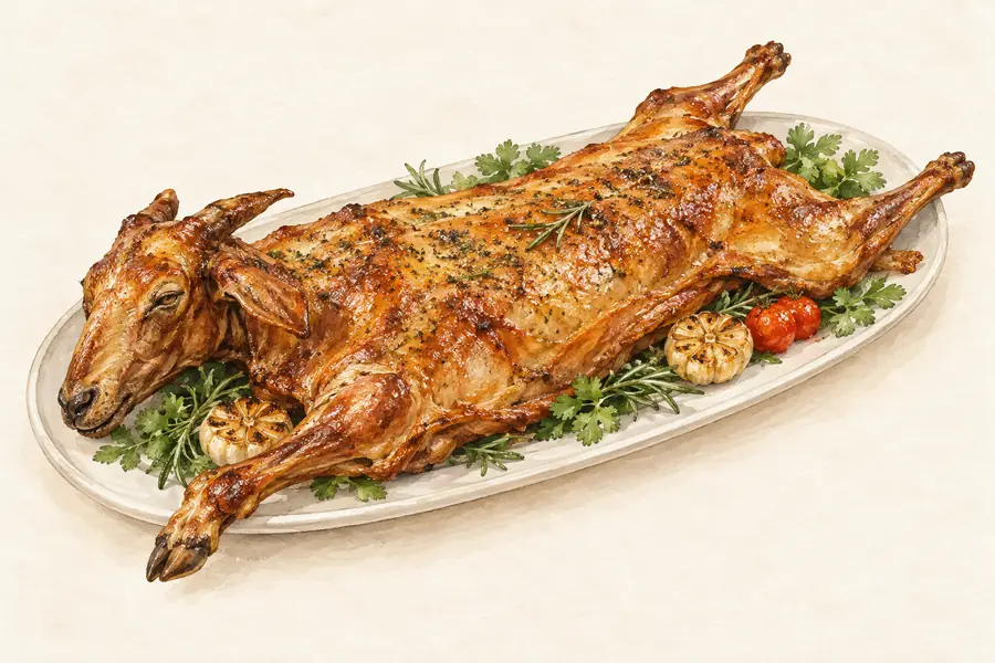 Alxa Whole Roast Lamb 阿拉善烤全羊AI illustration · AI 示意图(仅供参考,非实拍)
Alxa Whole Roast Lamb (阿拉善烤全羊) is a whole sheep roasted in the Alxa League (阿拉善盟) of Inner Mongolia.
Read the dish guide →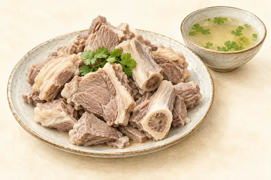 Hand-Held Boiled Mutton 手扒羊肉AI illustration · AI 示意图(仅供参考,非实拍)
Hand-Held Boiled Mutton (手扒羊肉) is lamb boiled in large pieces and eaten with the fingers, one of the Mongolian dishes served in the city of Wuhai (乌海), Inner Mongolia.
Read the dish guide → Scrambled Eggs with Sand Onion 沙葱炒蛋
Scrambled Eggs with Sand Onion (沙葱炒蛋) is a quick stir-fry of eggs and sand onion (沙葱), a wild desert allium also called Mongolian chive (蒙古韭, Allium mongolicum).
Read the dish guide →Photo adjustments
EXIF orientation normalized; resized without changing aspect ratio; converted to WebP. No subject edits.
 Salty Milk Tea 奶茶AI illustration · AI 示意图(仅供参考,非实拍)
Salty Milk Tea (奶茶) is Mongolian milk tea: green brick tea (青砖茶) boiled and mixed with fresh milk and salt.
Read the dish guide →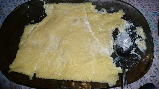 Mongolian Milk Skin 奶皮子
Mongolian Milk Skin (奶皮子), called öröm (өрөм) in Mongolian, is one of the milk foods of the Mongolian people: a dairy product that forms as a skin on the surface of slowly boiled fresh milk.
Source ↗Read the dish guide →
Photo adjustments
Resized and WebP compressed; subject not altered.
Lamb Stewed with Suoyang Herb 锁阳炖羊肉AI illustration · AI 示意图(仅供参考,非实拍)
Lamb Stewed with Suoyang Herb (锁阳炖羊肉) is listed among the local specialties of Alxa League, Inner Mongolia. The name includes 羊肉 (lamb or mutton). 炖 describes slow simmering.
Read the dish guide →All dish names · 全部菜名 (11)
More dishes from across Inner Mongolia are in the Inner Mongolia food guide.
Counties & districts in Alxa League
3 areas belong directly to Alxa League.
3 areas
Alxa Left Banner 阿拉善左旗
Alxa Left Banner (Mongolian: ᠠᠯᠠᠱᠠ ᠵᠡᠭᠦᠨ ᠬᠣᠰᠢᠭᠤ; Chinese: 阿拉善左旗) is a banner (administrative division) in the southwest of Inner Mongolia, China.
Explore the area →BannerAlxa Right Banner 阿拉善右旗
Alxa Right Banner (Mongolian: ᠠᠯᠠᠱᠠ ᠪᠠᠷᠠᠭᠤᠨ ᠬᠣᠰᠢᠭᠤ; Chinese: 阿拉善右旗) is a banner in the southwest of Inner Mongolia, China, bordering Gansu province to the south and southwest.
Explore the area →BannerEjin Banner 额济纳旗
Ejin (Mongolian: ᠡᠵᠡᠨ ᠡ ᠬᠣᠰᠢᠭᠤ; Chinese: 额济纳旗) is a banner in the far west of Inner Mongolia, China. It is under the administration of Alxa League and is the westernmost county-level division of Inner…
Explore the area →No areas match this name.
Plan your visit
Getting there
Search for 阿拉善盟 in a map app to find stations and your accommodation.
Where to stay →Build your route
Badain Jaran Desert and Khara-Khoto are about 210 km apart in a straight line. The linked place guides have entrance and visit details.
Continue with Inner Mongolia →More in Inner Mongolia
Sources & geographic information
Administrative names and parent areas: Official geographic directory · Reference date 2026-09-06.
Background text adapted from Alxa League — Wikipedia contributors, under CC BY-SA 4.0. Text has been shortened and reorganized; source revision 1345865078.
Photo: Badain Jaran Desert · Sjoerd van Oort · CC BY-SA 3.0. Wikimedia thumbnail; fitted to the ranking-card frame.

Photo: Khara-Khoto · Fandorine1959 · CC BY-SA 3.0. Full frame retained; proportionally resized and converted to WebP. No retouching or changes to the photographed subject. Card displays may crop the view.

Photo: Tengger Desert · The original uploader was Earthstronaut at English Wikipedia. · CC BY-SA 3.0. Full frame retained; proportionally resized and converted to WebP. No retouching or changes to the photographed subject. Card displays may crop the view.

Photo: Juyan Lake · Nyx Ning · CC BY-SA 3.0. Full-frame source proportionally resized and converted to WebP for display. No subject alteration. Source-supplied marks and edits remain; cards may crop the view.

Photo: Ejin Banner · Nyx Ning · CC BY-SA 3.0. Full frame retained; proportionally resized and converted to WebP. No retouching or changes to the photographed subject. Card displays may crop the view.

Photo: Tengger Desert Scenic Area · Source photographer · License not provided. EXIF orientation normalized; resized without changing aspect ratio; converted to WebP. No subject edits.
Photo: Helan Mountain Guangzong Monastery · Carsten Ullrich from Shanghai, China · CC BY-SA 2.0. Full frame retained; EXIF orientation normalized, proportionally resized to at most 800 pixels and converted to WebP. No generated pixels or subject changes. Cards may crop the display.

Photo: Strange Tree Forest · Nyx Ning · CC BY-SA 3.0. Full frame retained; proportionally resized and converted to WebP. No retouching or changes to the photographed subject. Card displays may crop the view.
.jpg)
Map data © OpenStreetMap contributors. Pins mark approximate centres, not entrances or boundaries.