


Get to know Tongliao

Photo adjustments
Full frame retained; proportionally resized and converted to WebP. No retouching or changes to the photographed subject. Card displays may crop the view.
- Administrative area
- Prefecture-level city · 地级市
- Part of
- Inner Mongolia
- Chinese name
- 通辽市
- Local areas
- 8 local areas
Area & population
- Area in the source
- 58,862.00 km²
- Population · 2020 census
- 2,873,168
- Administrative seat
- Horqin District
Source: cited geographic source, as of the dates shown.
The original Mongolian name for Tongliao city proper (i.e. Horqin District) is Bayitalai, while the original name of the prefecture-level city is Jirem. The Mongolian dialect spoken in this area is Khorchin Mongolian.
Transport
Tongliao railway station is a railway hub in both Inner Mongolia and Northeast China. Tongliao-Beijing Railway conveniently connects the city with Beijing. Jining–Tongliao railway connects Inner Mongolia. There are also railways connecting Tongliao with Shenyang and Daqing. State Highway 111, State Highway 303, State Highway 304 and State Highway 204 run through the city and extend to harbor cities such as Tianjin, Dalian, and Qinhuangdao. The city is served by Tongliao Airport.
Explore Tongliao
Core places to explore, with English and Chinese names.
Daqinggou 大青沟
Khan Mountain 可汗山
Naiman Prince's Mansion 奈曼王府
Baogutu Desert 宝古图沙漠
Kulun Three Temples 库伦三大寺
Yinshawan Desert 银沙湾
Hamin Archaeological Site 哈民遗址
Xiaozhuang Park 孝庄园
Horqin District 科尔沁区
Horqin Left Middle Banner 科尔沁左翼中旗
Horqin Left Rear Banner 科尔沁左翼后旗
Kailu County 开鲁县
Hure Banner 库伦旗
Naiman Banner 奈曼旗
Jarud Banner 扎鲁特旗
Holingol 霍林郭勒市
Places to explore around Tongliao
 Daqinggou · 大青沟
Daqinggou大青沟
Daqinggou's wooded ravines cut through the much drier Horqin sandy landscape. Springs feed streams beneath mature broadleaf trees, creating a striking change between the exposed ground above and the sheltered valley floor. The…
Read the place guide → Khan Mountain · 可汗山
Khan Mountain可汗山
Khan Mountain is a modern monumental sculpture landscape north of Holingol. Large heads of Mongol and Yuan rulers rise on the hillside above ranks of sculpted warriors, turning the slope into an open-air historical tableau. The…
Read the place guide → AI illustration · AI 示意图(仅供参考,非该地点实拍)
Naiman Prince's Mansion奈曼王府
Naiman Prince's Mansion (奈曼王府) is a Qing princely residence in Naiman Banner, built in 1863 around enclosed courts and painted timber halls.
Read the place guide → AI illustration · AI 示意图(仅供参考,非该地点实拍)
Baogutu Desert宝古图沙漠
Baogutu is a dune landscape in Naiman Banner, where long ridges of fine yellow sand form the setting for a developed desert tourism area.
Read the place guide → Kulun Three Temples · 库伦三大寺
Kulun Three Temples库伦三大寺
Kulun's Three Temples bring together Xingyuan, Xiangjiao and Fuyuan, Qing-period Buddhist complexes that once served different religious, educational and administrative roles.
Read the place guide →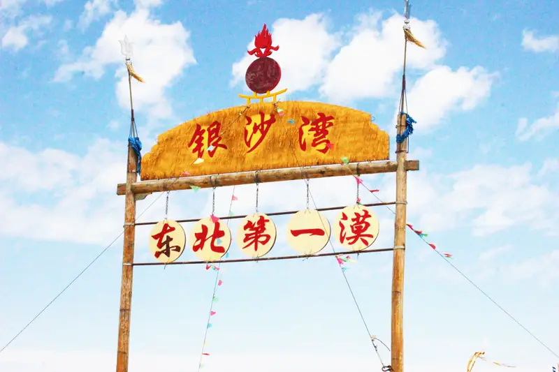 Yinshawan Desert · 银沙湾
Yinshawan Desert银沙湾
Yinshawan is a section of the Tamin Chagan Desert in Kulun Banner where the Yangchumu River separates northern dunes from southern hills.
Read the place guide →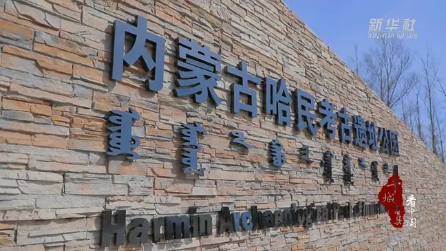 Hamin Archaeological Site · 哈民遗址
Hamin Archaeological Site哈民遗址
Hamin Archaeological Site (哈民遗址) is a late Neolithic settlement in Horqin Left Middle Banner, known for orderly rows of houses built partly below ground.
Read the place guide →AI illustration · AI 示意图(仅供参考,非该地点实拍)Xiaozhuang Park孝庄园
Xiaozhuang Park (孝庄园) is a cultural complex in Horqin Left Middle Banner centred on a reconstructed Darhan princely palace and the history of Empress Dowager Xiaozhuang's Mongol family.
Read the place guide →Local life & food
Tongliao local specialties
通辽市特色美食 · 10 specialties to discover
 Horqin meat pies 科尔沁蒙古馅饼AI illustration · AI 示意图
The crust is tender with crisp browned patches, while the center releases savory meat juices. It is usually less bread-heavy than a thick baked bun.
Source ↗Read the dish guide →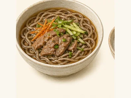 Hure buckwheat noodles 库伦荞面AI dish illustration / AI 菜品示意图
Buckwheat brings a darker colour and an earthy grain taste. A wheat blend can make the noodles more elastic.
Source ↗Read the dish guide →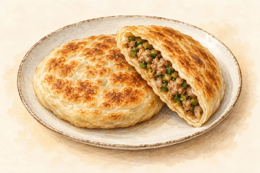 Mongolian Meat Pie 蒙古馅饼AI illustration · AI 示意图(仅供参考,非实拍)
Mongolian Meat Pie (蒙古馅饼) is listed among the local specialties of Chifeng, Inner Mongolia. The term 饼 points to cakes or flatbreads.
Read the dish guide → Shoubarou 手把肉
The meat's own flavor leads, with tender flesh contrasting with richer fatty sections. The broth can be a valuable part of the meal.
Source ↗Read the dish guide →
Photo adjustments
EXIF orientation applied where present; resized proportionally to at most 640 px on the long edge and encoded as WebP. No crop, retouching, recoloring or subject changes.
 Naiman Whole Lamb Banquet 奈曼全羊宴
Naiman Whole Lamb Banquet (奈曼全羊宴) is listed among the local specialties of Tongliao, Inner Mongolia. The name includes 羊 (sheep).
Read the dish guide →Photo adjustments
EXIF orientation normalized; resized without changing aspect ratio; converted to WebP. No subject edits.
 Horqin Beef Jerky 科尔沁牛肉干AI illustration · AI 示意图(仅供参考,非实拍)
Horqin Beef Jerky (科尔沁牛肉干) is air-dried beef from Tongliao (通辽) in Inner Mongolia.
Read the dish guide → Milk Tea with Roasted Millet 炒米奶茶AI illustration · AI 示意图(仅供参考,非实拍)
Milk Tea with Roasted Millet (炒米奶茶) pairs Mongolian milk tea with roasted millet (炒米), and in Tongliao (通辽), Inner Mongolia, roasted millet can be soaked in milk tea with butter and fresh milk curd.
Read the dish guide → Roast Lamb Ribs 烤羊排
Roast Lamb Ribs (烤羊排) belong to the barbecue of Wuhai (乌海), the Inner Mongolian city on the Yellow River with the Ordos grassland (鄂尔多斯草原) at its back.
Read the dish guide →Photo adjustments
EXIF orientation normalized; resized without changing aspect ratio; converted to WebP. No subject edits.
More dishes from across Inner Mongolia are in the Inner Mongolia food guide.
Counties & districts in Tongliao
8 areas belong directly to Tongliao.
8 areas
Horqin District 科尔沁区
Horqin District (Mongolian: ᠬᠣᠷᠴᠢᠨ ᠲᠣᠭᠣᠷᠢᠭ; Chinese: 科尔沁区) is an administrative district of the prefecture-level city of Tongliao, Inner Mongolia, China, and its seat of government.
Explore the area →BannerHorqin Left Middle Banner 科尔沁左翼中旗
Horqin Left Middle Banner (Mongolian: ᠬᠣᠷᠴᠢᠨ ᠵᠡᠭᠦᠨ ᠭᠠᠷᠤᠨ ᠳᠤᠮᠳᠠᠳᠤ ᠬᠣᠰᠢᠭᠤ; Chinese: 科尔沁左翼中旗), formerly known as Darhan Banner (Mongolian: Дархан хошуу), is a banner of eastern Inner Mongolia, China, bordering…
Explore the area →BannerHorqin Left Rear Banner 科尔沁左翼后旗
Horqin Left Rear Banner (Mongolian: ᠬᠣᠷᠴᠢᠨ ᠵᠡᠭᠦᠨ ᠭᠠᠷᠤᠨ ᠬᠣᠶᠢᠲᠤ ᠬᠣᠰᠢᠭᠤ; Chinese: 科尔沁左翼后旗, original Mongolian name Büve vang qosigu) is a banner of southeastern Inner Mongolia, China, bordering Liaoning province…
Explore the area →CountyKailu County 开鲁县
Kailu County (Mongolian: ᠺᠠᠶᠢᠯᠦ ᠰᠢᠶᠠᠨ; Chinese: 开鲁县) is a county in the east of Inner Mongolia, China. It is under the administration of Tongliao City, 76 kilometres (47 mi) to the east, and China National…
Explore the area →Show fewer areas
Hure Banner 库伦旗
Hure Banner (Mongolian: ᠬᠦᠷᠢᠶ ᠡ ᠬᠣᠰᠢᠭᠤ; Chinese: 库伦旗) is a banner of southeastern Inner Mongolia, China, bordering Liaoning province to the south.
Explore the area →BannerNaiman Banner 奈曼旗
Naiman Banner (Mongolian: ᠨᠠᠢᠮᠠᠨ ᠬᠣᠰᠢᠭᠤ; Chinese: 奈曼旗) is a banner of Inner Mongolia, China. It is under the administration of Tongliao City, 156 kilometres (97 mi) to the northeast, and lies on China…
Explore the area →BannerJarud Banner 扎鲁特旗
Jarud Banner (Mongolian: ᠵᠠᠷᠤᠳ ᠬᠣᠰᠢᠭᠤ; Chinese: 扎鲁特旗) is a banner of eastern Inner Mongolia, China. It is under the administration of Tongliao City, 150 kilometres (93 mi), and the China National Highway 304…
Explore the area →County-level cityHolingol 霍林郭勒市
Holingol (also Huolin Gol; Mongolian: ᠬᠤᠤᠯᠢᠩᠭᠤᠤᠯ ᠬᠣᠲᠠ; Chinese: 霍林郭勒) is a county-level city of Inner Mongolia, China.
Explore the area →No areas match this name.
Plan your visit
Getting there
Search for 通辽市 in a map app to find stations and your accommodation.
Where to stay →Build your route
Daqinggou and Khan Mountain are about 380 km apart in a straight line. The linked place guides have entrance and visit details.
Continue with Inner Mongolia →More in Inner Mongolia
Sources & geographic information
Administrative names and parent areas: Official geographic directory · Reference date 2026-09-06.
Background text adapted from Tongliao — Wikipedia contributors, under CC BY-SA 4.0. Text has been shortened and reorganized; source revision 1339533271.
Photo: Daqinggou · Source photographer · License not provided. EXIF orientation normalized; resized without changing aspect ratio; converted to WebP. No subject edits.
Photo: Khan Mountain · Source photographer · License not provided. EXIF orientation normalized; resized without changing aspect ratio; converted to WebP. No subject edits.
Photo: Kulun Three Temples · Source photographer · License not provided. EXIF orientation normalized; resized without changing aspect ratio; converted to WebP. No subject edits.
Photo: Yinshawan Desert · Source photographer · License not provided. EXIF orientation normalized; resized without changing aspect ratio; converted to WebP. No subject edits.
Photo: Hamin Archaeological Site · Source photographer · License not provided. EXIF orientation normalized; resized without changing aspect ratio; converted to WebP. No subject edits.
Map data © OpenStreetMap contributors. Pins mark approximate centres, not entrances or boundaries.