


Get to know Songshan District
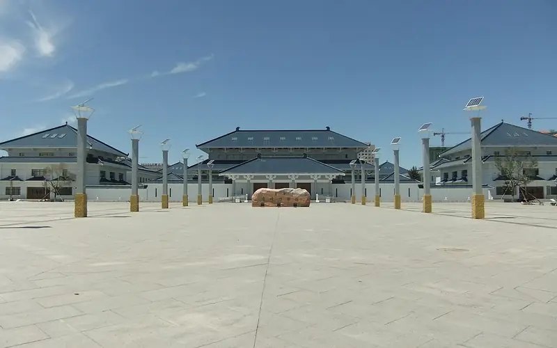
Photo adjustments
Full frame retained; EXIF orientation normalized, proportionally resized to at most 800 pixels and converted to WebP. No generated pixels or subject changes. Cards may crop the display.
- Administrative area
- District · 市辖区
- Part of
- Chifeng
- Chinese name
- 松山区
- Local areas
- District guide
Area & population
- Area in the source
- 5,629.00 km²
- Population · 2020
- 706,312
- Administrative seat
- Mujiayingzi
Source: cited geographic source, as of the dates shown.
History
In 1013 the Liao set up Songshan County (松山县), with its seat at today's Chengzi village in Chengzi township (城子乡), and the Jin, Yuan and Ming kept it. Under the Qing the area belonged to the Ongniud Right Wing Banner (翁牛特右翼旗), whose seat moved to today's Wangyefu village in Wangfu (王府镇). Chifeng County was created in 1778, with its seat at Chifeng Street, now in Hongshan District. After being merged with and split from the city in 1947 and 1948, it became Chifeng's suburban district in 1983, and in 1993 it took the old Liao name Songshan.
The district's local-history office calls Songshan the core area and naming place of the Hongshan culture (红山文化), dated to about 4710 to 2920 BC: the Hongshanhou site (红山后遗址) at Xishuidi (西水地), then in Chifeng County, was excavated on a large scale in 1935 and gave the culture its name in 1954. Xiajiadian village (夏家店村), where a two-layered site was found in 1960, gave its name to two Bronze Age cultures: the Lower Xiajiadian culture of about 1900 to 1400 BC, known for stone-walled hill towns, and the Upper Xiajiadian culture of about 1000 to 300 BC.
What to see
Kuijia Mountain (盔甲山), at 1,498 metres, is listed by the district government as the second-highest peak in Chifeng. Its name, "armour mountain", comes from a story that the Kangxi Emperor, touring north in 1698, rode to the top and took off his armour. Secondary forest of birch, pine and linden covers nearly ten thousand hectares around it.
Huangjia Mandian (皇家漫甸), "imperial meadow", lies in Dafuyingzi township (大夫营子乡) 120 kilometres from the city; the district government describes it as the grassland closest to the city. Tradition holds that Kangxi hunted here as part of the Mulan hunting grounds (木兰围场). Dangpudi (当铺地) village, in the district's Manchu ethnic township, is a national model of forestry work, and its former Party secretary Chen Hongen (陈洪恩) was held up as a model of sand control; the township has developed it as a folk village with Manchu decoration and snacks.
Highlights
- Kuijia Mountain 盔甲山: 1,498 m peak named after a story of the Kangxi Emperor removing his armour in 1698.
- Huangjia Mandian 皇家漫甸: Grassland in Dafuyingzi, 120 km from the city, linked by tradition to the Mulan hunting grounds.
- Dangpudi Folk Village 当铺地民俗村: National model forestry village developed as a Manchu folk village.
- Xiajiadian 夏家店: Village whose 1960 excavation named the Lower and Upper Xiajiadian cultures.
Sources for this guide
松山区 (赤峰市) - 维基百科,自由的百科全书 · Chinese Wikipedia · CC BY-SA 4.0
区名由来 - 建置沿革 - 松山区人民政府 · Songshan District Local Chronicles Office
古文化 - 历史文化 - 松山区人民政府 · Songshan District Local Chronicles Office
盔甲山风景区 - 名胜古迹 - 松山区人民政府 · Songshan District People's Government
当铺地民俗村 - 名胜古迹 - 松山区人民政府 · Songshan District People's Government
皇家漫甸景区 - 名胜古迹 - 松山区人民政府 · Songshan District People's Government
Original English written from the listed sources and checked sentence by sentence against quoted extracts by a separate reviewer. Updated 2026-09-26.
Explore Songshan District
Core places to explore, with English and Chinese names.
Songshan District 松山区
Plan your visit
Getting there
Songshan District is about 6 km in a straight line from central Chifeng. Search for 松山区 in a map app to find stations and your accommodation.
Where to stay →More in Chifeng
Sources & geographic information
Administrative names and parent areas: Official geographic directory · Reference date 2026-09-06.
Some facts checked against 松山区 (赤峰市) — Wikipedia contributors, CC BY-SA 4.0.
Map data © OpenStreetMap contributors. Pins mark approximate centres, not entrances or boundaries.