


Get to know Hexigten Banner
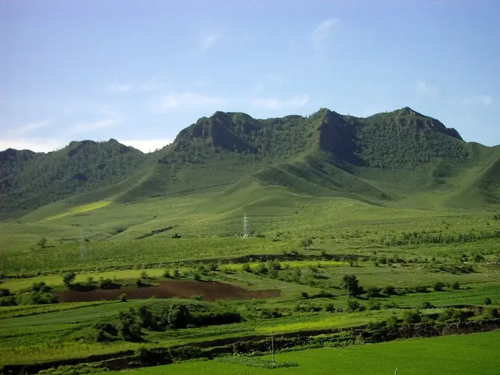
Photo adjustments
Full frame retained; resized proportionally to a maximum dimension of 960 pixels and converted to WebP quality 88. No crop, retouch, generated elements, or subject alteration. Final website rendition: full frame retained, proportionally resized to at most 720 pixels and converted to WebP. No additional retouching or subject alteration. Card displays may crop the view.
- Administrative area
- Banner · 旗
- Part of
- Chifeng
- Chinese name
- 克什克腾旗
- Local areas
- Banner guide
Area & population
- Area in the source
- 20,637.00 km²
- Population · 2020
- 186,143
- Administrative seat
- Jingpeng
Source: cited geographic source, as of the dates shown.
Setting and landscape
The banner sits where the Otindag (浑善达克) and Horqin (科尔沁) sandy lands meet, at an average altitude of 1,100 m. The banner government lists Quaternary glacial remains, granite landforms, grassland lakes, river gorges, volcanoes with hot springs and upland wetlands among its landforms, and counts 119 rivers. Rain falls mostly in June, July and August. Its glacial potholes, granite stone forest, Dalinor volcanoes and Reshuitang hot springs became a national geopark in 2001 and a world geopark on 12 February 2005.
History
The banner government notes that excavated finds mostly belong to the Hongshan and Xiajiadian cultures, and glosses Hexigten as Mongolian for bodyguards. Under the Yuan the area was Yingchang (应昌), and the ruins of the late-Yuan Yingchang Lu city lie in the Dali Lake area. The Qing created the banner in 1652. In 1934 Manchukuo merged Jingpeng County into it; Jingpeng County was abolished in 1948, and from 1969 to 1979 the banner belonged to Liaoning.
What to see
Asihatu Stone Forest (阿斯哈图石林), a national 5A scenic area on Beida Mountain (北大山) in the north-east of the banner, is a field of granite pillars 5 to 30 m tall on a ridge; its Mongolian name is glossed as "steep rocks". Ulan Butung (乌兰布统) combines forest, grassland, lakes, sand and wetland; sights there include Jiangjun Paozi (将军泡子) and Princess Lake (公主湖), and television dramas such as My Fair Princess (还珠格格) were filmed there.
Dali Lake (达里湖), the core of a national 4A scenic area, covers 228 square kilometres, and the banner government describes it as the second-largest inland lake in Inner Mongolia; tens of thousands of swans stop there in spring and autumn, and 297 bird species are recorded. Gongger Grassland (贡格尔草原) spreads across the west of the banner. In the Huanggangliang (黄岗梁) area, the banner government lists Huanggang Peak (黄岗峰), at 2,036 m, as the highest summit of the Greater Khingan; the massif is made up of 27 peaks and holds natural primeval forest.
Getting oriented
The banner lies between Chifeng, Xilingol League and Chengde. The Jining–Tongliao Railway and national highways 303 and 306 cross it, and the banner government puts both Chifeng Yulong Airport and Xilinhot Airport within 200 km.
Highlights
- Asihatu Stone Forest 阿斯哈图石林: Granite pillars 5-30 m tall on Beida Mountain; national 5A scenic area and one of the nine areas of the Hexigten world geopark.
- Dali Lake 达里湖: 228 sq km lake where tens of thousands of swans stop each spring and autumn; 297 bird species recorded.
- Ulan Butung 乌兰布统: Forest, grassland and lakes with Jiangjun Paozi and Princess Lake; film location for My Fair Princess.
- Gongger Grassland 贡格尔草原: Grassland in the west of the banner where cranes, swans and geese gather in spring.
- Huanggangliang 黄岗梁: Area around 2,036 m Huanggang Peak, listed by the banner government as the highest in the Greater Khingan; the massif has 27 peaks.
Sources for this guide
克什克腾旗基本情况 · Hexigten Banner People's Government
乌兰布统景区 · Hexigten Banner People's Government
达里湖景区 · Hexigten Banner People's Government
阿斯哈图石林 · Hexigten Banner People's Government
贡格尔草原 · Hexigten Banner People's Government
黄岗梁景区 · Hexigten Banner People's Government
克什克腾旗 · Wikipedia (Chinese) · CC BY-SA 4.0
Original English written from the listed sources and checked sentence by sentence against quoted extracts by a separate reviewer. Updated 2026-09-25.
Explore Hexigten Banner
Core places to explore, with English and Chinese names.
Places to explore around Hexigten Banner
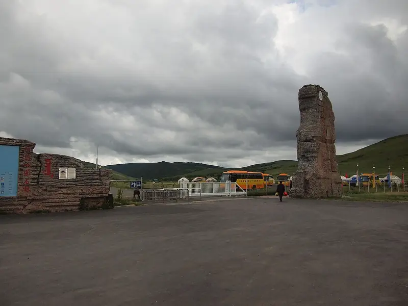 Asihatu Stone Forest · 阿斯哈图石林
Asihatu Stone Forest阿斯哈图石林
Asihatu Stone Forest stands on Beidashan in northeastern Hexigten Banner, where tall rock formations rise above grassland and birch woodland.
Read the place guide → Grassland with autumn colour at Wulanbutong, Keshiketeng Banner, Inner Mongolia · 内蒙古赤峰市克什克腾旗乌兰布统秋季草原 Source-recorded photograph date: 2010-09-19.
Wulanbutong Grassland乌兰布统
Wulanbutong in southwestern Hexigten Banner combines rolling grassland, birch woodland, wetlands and sandy country around the historic Ulan Butong battlefield.
Read the place guide → Asihatu Stone Formations · 阿斯哈图石阵
Asihatu Stone Formations阿斯哈图石阵
Asihatu's granite stone formations rise on Beida Mountain in northeastern Hexigten Banner, at a meeting point of mountain meadow and woodland.
Read the place guide →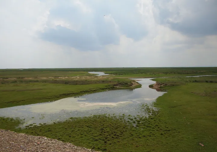 Grassland and a meandering river on the Gongger Grasslands, Hexigten Banner · 克什克腾旗贡格尔草原河流蜿蜒 Source-recorded photograph date: Taken on 1 July 2011.
Gongger Grassland贡格尔草原
Gongger is an open grassland landscape in Hexigten Banner, with the Gongger River and seasonal demoiselle cranes among its distinguishing features.
Read the place guide →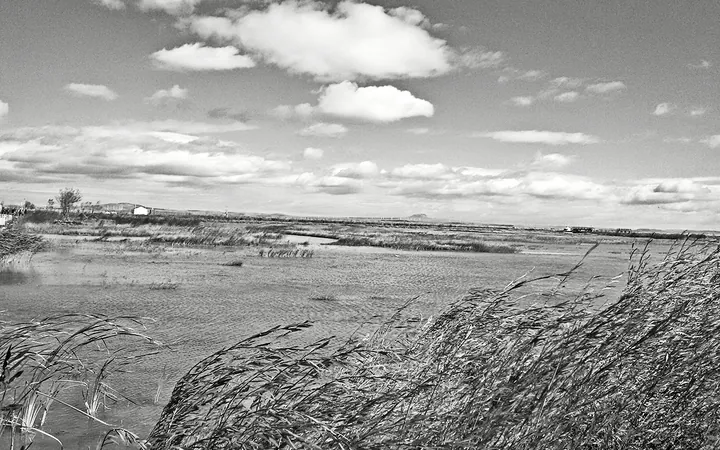 Wetland shoreline at Dali Lake (Dalai Nur), Keshiketeng Banner · 克什克腾旗达里湖湿地岸边景色 Source-recorded photograph date: 23 January 2016 (original upload date).
Dali Lake达里湖
Lava-dammed saline lake in Hexigten Banner, part of the Hexigten Global Geopark, where tens of thousands of swans stop each spring and autumn.
Read the place guide →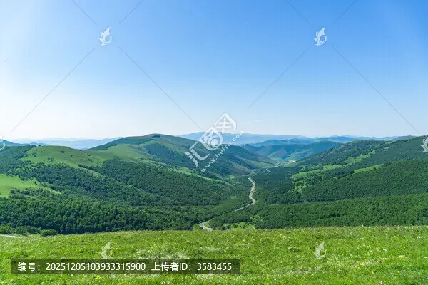 Huanggangliang Mountain · 黄岗梁
Huanggangliang Mountain黄岗梁
Huanggangliang in Hexigten Banner is a mountain landscape where conifer and broadleaf woodland meets grassland, river valleys and lakes.
Read the place guide →Plan your visit
Getting there
Hexigten Banner is about 160 km in a straight line from central Chifeng. Search for 克什克腾旗 in a map app to find stations and your accommodation.
Where to stay →Build your route
Asihatu Stone Forest and Wulanbutong Grassland are both listed here. The linked place guides have entrance and visit details.
Continue with Chifeng →More in Chifeng
Sources & geographic information
Administrative names and parent areas: Official geographic directory · Reference date 2026-09-06.
Some facts checked against 克什克腾旗 — Wikipedia contributors, CC BY-SA 4.0.
Photo: Asihatu Stone Forest · Source photographer · License not provided. EXIF orientation normalized; resized without changing aspect ratio; converted to WebP. No subject edits.

Photo: Wulanbutong Grassland · Cfqjw · CC BY-SA 3.0. Full frame retained; proportionally resized and converted to WebP. No retouching or changes to the photographed subject. Card displays may crop the view.

Photo: Asihatu Stone Formations · Source photographer · License not provided. EXIF orientation normalized; resized without changing aspect ratio; converted to WebP. No subject edits.
Photo: Gongger Grassland · rheins · CC BY 3.0. Full frame retained; proportionally resized and converted to WebP. No retouching or changes to the photographed subject. Card displays may crop the view.

Photo: Dali Lake · leej1118bj · CC BY 3.0. Full frame retained; proportionally resized and converted to WebP. No retouching or changes to the photographed subject. Card displays may crop the view.

Photo: Huanggangliang Mountain · Source photographer · License not provided. EXIF orientation normalized; resized without changing aspect ratio; converted to WebP. No subject edits.
Map data © OpenStreetMap contributors. Pins mark approximate centres, not entrances or boundaries.