


Get to know Linxi County
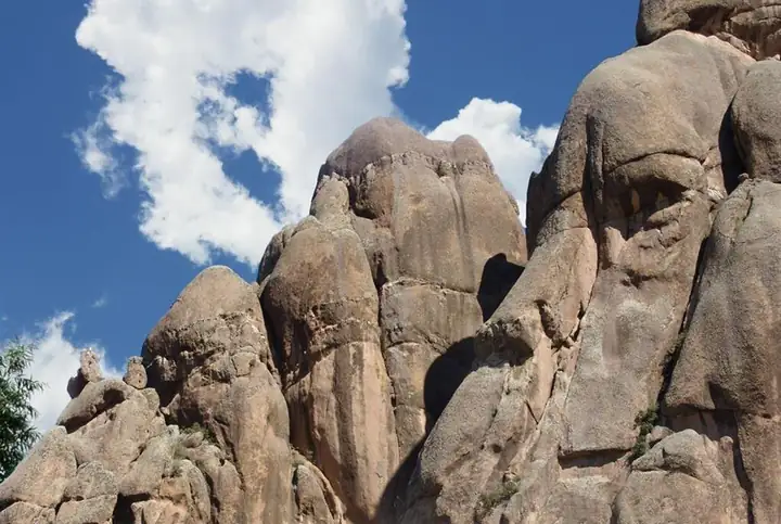
Photo adjustments
EXIF orientation normalized; resized without changing aspect ratio; converted to WebP. No subject edits.
- Administrative area
- County · 县
- Part of
- Chifeng
- Chinese name
- 林西县
- Local areas
- County guide
Area & population
- Area in the source
- 3,621.00 km²
- Population · 2020
- 186,663
- Administrative seat
- Linxi Town
Source: cited geographic source, as of the dates shown.
Setting and landscape
Chinese Wikipedia places Bairin Right Banner (巴林右旗) to the east, Hexigten Banner (克什克腾旗) to the west, West Ujimqin Banner (西乌珠穆沁旗) of Xilingol to the north and Ongniud Banner (翁牛特旗) to the south. Elevation ranges from 1,879.2 metres on Beida Mountain (北大山) down to 670 metres, under a mid-temperate continental monsoon climate. The rivers belong to the West Liao (西辽河) system; the main ones are the Xar Moron (西拉木伦河), the Chagan Muren (查干木伦河) and the Gasitai (嘎斯汰河).
History
The county has a microlithic site at Guochengzi Mountain (锅撑子山) dated to more than 5,000 years ago, and the Baiyinchanghan site (白音长汗遗址) of the Neolithic Xiaohexi culture (小西河文化). From the Warring States period onward it lay north of the Great Wall as grazing land, held in turn by peoples such as the Donghu (东胡), the Xianbei (鲜卑) and the Khitan (契丹); from 1644 it was pasture of the Bairin Right Wing Banner. The county itself was created in 1908 on the proposal of the Rehe military governor, with its seat at the mouth of the Wuliangsutai valley, today's Linxi town (林西镇). It was first to be called "Baxi", west of the Bairin, before the name Linxi was settled. Japanese troops entered the county town on 6 March 1933.
What to see
The Dajing ancient copper mine lies one kilometre north of Dajing hamlet in Zhongxing village, Guandi (官地镇), and covers about 2.5 square kilometres of ridges and slopes. The Inner Mongolia Daily counted 47 open-cut mining pits, the longest 102 metres and seven to nine metres deep, with stone hammers and picks still scattered on the ground and oval, horseshoe-shaped and multi-chamber furnaces surrounded by slag, charcoal and crucible fragments. Dated to 2,900 to 2,700 years ago, the mine is called the "ancient northern copper capital of China", and the Inner Mongolia Daily describes it as the world's only known ancient site where bronze was smelted directly from a paragenetic ore. A nearby grave of a bronze craftsman held a horse-head clay bellows nozzle and stone casting moulds.
Food and local products
Linxi is one of Inner Mongolia's main wheat-growing counties, and it produces the medicinal herbs zhimu (知母, anemarrhena), liquorice (甘草) and huangqi (黄芪, astragalus).
Highlights
- Dajing ancient copper mine 大井古铜矿遗址: Mine and smelting site of 2,900 to 2,700 years ago with 47 open-cut pits.
- Guochengzi Mountain microlithic site 锅撑子山细石器文化遗址: Microlithic site dated to more than 5,000 years ago.
- Baiyinchanghan site 白音长汗遗址: Neolithic site of the Xiaohexi culture.
Sources for this guide
林西县 - 维基百科,自由的百科全书 · Chinese Wikipedia · CC BY-SA 4.0
【北国风光·文化】触摸草原的青铜记忆 - - 内蒙古新闻网 - 新闻中心 · Inner Mongolia Daily (nmgnews.com.cn)
Original English written from the listed sources and checked sentence by sentence against quoted extracts by a separate reviewer. Updated 2026-09-26.
Explore Linxi County
Core places to explore, with English and Chinese names.
Linxi County 林西县
Plan your visit
Getting there
Linxi County is about 165 km in a straight line from central Chifeng. Search for 林西县 in a map app to find stations and your accommodation.
Where to stay →More in Chifeng
Sources & geographic information
Administrative names and parent areas: Official geographic directory · Reference date 2026-09-06.
Some facts checked against 林西县 — Wikipedia contributors, CC BY-SA 4.0.
Map data © OpenStreetMap contributors. Pins mark approximate centres, not entrances or boundaries.