


Get to know Togtoh County
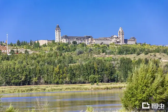
Photo adjustments
EXIF orientation normalized; resized without changing aspect ratio; converted to WebP. No subject edits.
- Administrative area
- County · 县
- Part of
- Hohhot
- Chinese name
- 托克托县
- Local areas
- County guide
Area & population
- Area in the source
- 1,313.00 km²
- Population · 2020
- 166,192
- Administrative seat
- Shuanghe Town
Source: cited geographic source, as of the dates shown.
History
People lived here in the Neolithic: the Haishengbulang culture (海生不浪文化), which the county dates to five or six thousand years ago and assigns to the later Yangshao period, is named after Haishengbulang Village (海生不浪村) in the county, where its remains were first found. In 390 BC Marquis Wu of Zhao (赵武侯) built the walled town of Yunzhong (云中), and in 307 BC King Wuling of Zhao (赵武灵王) made it the seat of Yunzhong Commandery, which the Qin kept as one of its 36 commanderies after 221 BC. The Ming built the Dongsheng garrison town (东胜卫) in 1392. The county's name comes from 'Tuotuo' (妥妥), an adopted son of Altan Khan (阿拉坦汗) who grazed his herds at Dongsheng from the tenth year of the Jiajing reign (嘉靖).
What to see
The walls of the Dongsheng garrison town are described by the county as the largest and best-preserved Ming town site in Inner Mongolia and one of the most complete rammed-earth walled towns in China. They are protected at regional level and form the core of the Dongshengwei Cultural Tourism Area (东胜卫文化旅游区), which also presents Yellow River and local folk culture. The county also names the old town of Hekou (河口古镇) among its historic sites. Its two 4A scenic areas are the Shenquan scenic area (神泉景区), which combines Yellow River scenery, desert and a spring, and the Yellow River Maiyegu scenic area (黄河麦野谷景区).
Food and local products
Togtoh is known for Yellow River carp stewed in the local way; the county says the fish was once sent as tribute to the imperial court, and it credits the flavour to red pepper fried until bright red and a measured amount of fennel. Fish-sellers' cries include 'kaihe yu' (开河鱼, fish caught when the river thaws). Togtoh Red Pepper (托县红辣椒), nicknamed 'lantern red' (灯笼红), is a national geographical-indication product of Hohhot, known as fragrant rather than hot: the dried peppers are pounded by hand in an iron mortar and flashed in hot huyou oil (葫油) from Wushen (五申), and they season Togtoh fish stew, stewed tofu and fentang (粉汤) soup.
Highlights
- Dongsheng garrison town 东胜卫故城: Ming town built in 1392; the county calls it Inner Mongolia's largest and best-preserved Ming town site.
- Haishengbulang site 海生不浪文化遗址: Site of a Neolithic culture of the later Yangshao period, first found in the county.
- Shenquan scenic area 神泉景区: National 4A site combining Yellow River scenery, desert and a spring.
- Togtoh stewed carp 托县炖鱼: Yellow River carp stewed with fried red pepper and fennel; once a tribute fish.
- Togtoh Red Pepper 托县红辣椒: Geographical-indication pepper, hand-pounded and flashed in hot oil; fragrant rather than hot.
Sources for this guide
托克托县人民政府_自然概况 · Togtoh County People's Government
托克托县人民政府_海生不浪文化遗址 · Togtoh County People's Government
托克托县人民政府_东胜卫文化旅游区 · Togtoh County People's Government
托克托县人民政府_托县炖鱼 · Togtoh County People's Government
托克托县人民政府_托县红辣椒 · Togtoh County People's Government
Original English written from the listed sources and checked sentence by sentence against quoted extracts by a separate reviewer. Updated 2026-09-25.
Explore Togtoh County
Core places to explore, with English and Chinese names.
Togtoh County 托克托县
Plan your visit
Getting there
Togtoh County is about 80 km in a straight line from central Hohhot. Search for 托克托县 in a map app to find stations and your accommodation.
Where to stay →More in Hohhot
Sources & geographic information
Administrative names and parent areas: Official geographic directory · Reference date 2026-09-06.
Map data © OpenStreetMap contributors. Pins mark approximate centres, not entrances or boundaries.