


Get to know Tumed Left Banner
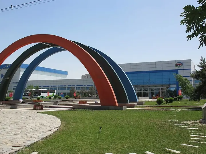
Photo adjustments
Full frame retained; proportionally resized and converted to WebP. No retouching or changes to the photographed subject. Card displays may crop the view.
- Administrative area
- Banner · 旗
- Part of
- Hohhot
- Chinese name
- 土默特左旗
- Local areas
- Banner guide
Area & population
- Area in the source
- 2,776.00 km²
- Population · 2020
- 263,131
- Administrative seat
- Qasq
Source: cited geographic source, as of the dates shown.
History
In the fifth century the Northern Wei moved the Chile (敕勒) people here from around Lake Baikal, which is why the plain is also called the Chile Plain (敕勒川); the old 'Song of Chile' (敕勒歌), with its line about wind bending the grass to reveal cattle and sheep, describes this land below the Yin Mountains. The Liao dynasty set up the prefectures of Fengzhou (丰州) and Yunnei (云内州) here, and from the mid-15th century it was the grazing land of the Mongol Tumed (土默特) tribe. In the 16th century Altan Khan (阿勒坦汗) opened trade between the Mongols and the Ming. Under the Qing the Tumed lost their pastures and turned from herding to farming, while large numbers of Han settlers from northern Shanxi, Zhangjiakou and Yulin came to farm the land.
What to see
Hasu Lake (哈素海), a lake of about 27.7 square kilometres, is a national wetland park that the banner government calls the 'West Lake beyond the frontier'. Local legend tells that the lake burst from a jade bowl smashed while a Mongol boy named Hala Usu (哈拉乌素) defended it from robbers, and that the lake was named in his memory.
Lama Cave Monastery (喇嘛洞召), named Guanghua Temple (广化寺) by the Qing court in 1784, is a Gelug Tibetan Buddhist monastery in Bikeqi Town (毕克齐镇), built against the cliffs of the Daqing Mountains. It grew from the cave where the Tibetan monk Bogda Chagan Lama (博格达察罕喇嘛) meditated until his death in 1627; halls were added below from 1658. A 124-step stone stair leads down the hill, and a rock face more than 100 metres long beside the cave is carved with Buddhas and inscriptions in Mongolian, Tibetan and Sanskrit. The banner government also lists the White Pagoda Temple (白塔寺) and the Jinluan Hall (金銮殿) among its historic sights.
The Tumed area plays the western style of errentai (二人台), a two-person folk opera that took shape in the late Qing from Mongolian songs and yangge dance; 'Going Beyond the West Pass' (走西口) is one of its best-known pieces. In Bikeqi, three troupes from different lanes perform naoge (脑阁), in which children in opera costume ride on iron frames strapped to a performer's back, every Lantern Festival.
Highlights
- Hasu Lake 哈素海: National wetland park of about 27.7 sq km, called the 'West Lake beyond the frontier'.
- Lama Cave Monastery 喇嘛洞召: Gelug monastery built around a meditation cave, with rock carvings in Mongolian, Tibetan and Sanskrit.
- White Pagoda Temple 白塔寺: Listed by the banner government among its historic sights.
- Naoge performances 脑阁: Costumed children carried on performers' backs in Bikeqi every Lantern Festival.
Sources for this guide
土左概况 _ 土默特左旗人民政府网站 · Tumed Left Banner People's Government
历史沿革 _ 土默特左旗人民政府网站 · Tumed Left Banner People's Government
民俗风情 _ 土默特左旗人民政府网站 · Tumed Left Banner People's Government
哈素海 - 维基百科,自由的百科全书 · Chinese Wikipedia · CC BY-SA 4.0
喇嘛洞召 - 维基百科,自由的百科全书 · Chinese Wikipedia · CC BY-SA 4.0
Original English written from the listed sources and checked sentence by sentence against quoted extracts by a separate reviewer. Updated 2026-09-25.
Explore Tumed Left Banner
Core places to explore, with English and Chinese names.
Places to explore around Tumed Left Banner
 AI illustration · AI
 Plan your visit
Getting there
Tumed Left Banner is about 50 km in a straight line from central Hohhot. Search for 土默特左旗 in a map app to find stations and your accommodation.
Where to stay →Build your route
Start with Hasuhai Lake. The linked place guides have entrance and visit details.
Continue with Hohhot →More in Hohhot
Sources & geographic information
Administrative names and parent areas: Official geographic directory · Reference date 2026-09-06.
Some facts checked against 哈素海 — Wikipedia contributors, CC BY-SA 4.0.
Some facts checked against 喇嘛洞召 — Wikipedia contributors, CC BY-SA 4.0.
Map data © OpenStreetMap contributors. Pins mark approximate centres, not entrances or boundaries.