


Get to know Wuchuan County
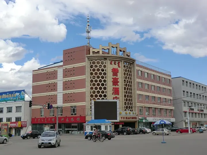
Photo adjustments
Full frame retained; proportionally resized and converted to WebP. No retouching or changes to the photographed subject. Card displays may crop the view.
- Administrative area
- County · 县
- Part of
- Hohhot
- Chinese name
- 武川县
- Local areas
- County guide
Area & population
- Area in the source
- 4,885.00 km²
- Population · 2020
- 95,869
- Administrative seat
- Hoh Ereg
Source: cited geographic source, as of the dates shown.
History
Daqingshan Township (大青山乡) keeps remains of a Northern Wei (北魏) site for sacrifices to Heaven, walls from the Qin and Han periods and a Wei emperor's travelling palace. In 1938 the Eighth Route Army's Daqingshan detachment entered Wuchuan and set up the Daqingshan anti-Japanese guerrilla base, commanded from Jing'ergou (井尔沟) and Deshenggou (得胜沟), where Mongol and Han soldiers and civilians waged a guerrilla war behind Japanese lines. The county has restored the base museum in Deshenggou Township (得胜沟乡) and the former headquarters, and improved a 3-kilometre hill trail.
What to see
Hadamen National Forest Park (哈达门国家森林公园), a 3A scenic area by Wudaogou Village (五道沟村) in Daqingshan Township, is at its best in September and October, when the birch and pine woods on its slopes turn colour. The same township has the alpine meadows of Jing'erliang (井尔梁) and a revolutionary martyrs' cemetery. The county also has its own museum, the Wuchuan Museum (武川博物馆).
Food and local products
Naked oats are Wuchuan's signature crop. The county lies at 1,600 to 2,200 metres, and the county government describes its cool upland climate and soils as ideal for them. Wuchuan has been named a 'home of oats' (燕麦之乡); its traditional dryland oat-farming system is listed among China's Important Agricultural Heritage Systems, and the craft of making youmian (莜面), food made from naked-oat flour, is on Inner Mongolia's intangible heritage list. Oats head the traditional 'three treasures of the back hills' (后山三宝), and the county promotes them through an oat culture festival.
Getting oriented
The county seat, Kekeyiligeng (可可以力更镇, usually shortened to Kezhen), is 33 kilometres north of Hohhot. Wuchuan borders Hohhot's Xincheng and Huimin districts and Tumed Left Banner to the south, Baotou's Tumed Right Banner and Guyang County to the west, Darhan Muminggan and Siziwang banners to the north and Zhuozi County to the east. The Hohhot–Bayan Obo (白云鄂博) and Hohhot–Xilinhot (锡林浩特) roads connect it with Hohhot, Baotou and the neighbouring banners and counties.
Highlights
- Hadamen National Forest Park 哈达门国家森林公园: 3A forest park in Daqingshan Township, best in September and October.
- Daqingshan anti-Japanese guerrilla base 大青山抗日游击根据地: Base set up by the Eighth Route Army in 1938; museum and former headquarters in Deshenggou.
- Jing'erliang meadows 井尔梁: Alpine meadow landscape in Daqingshan Township.
- Wuchuan naked oats and youmian 武川莜面: Oat-farming system listed as agricultural heritage; youmian-making on the regional intangible heritage list.
Sources for this guide
武川概况_ 武川县人民政府 · Wuchuan County People's Government
历史沿革_ 武川县人民政府 · Wuchuan County People's Government (Wuchuan county media reports)
源味武川丨一粒燕麦润沃土 特色产业焕新机_武川县人民政府 · Wuchuan County People's Government (Wuchuan county media)
风土文化_ 武川县人民政府 · Wuchuan County People's Government
Original English written from the listed sources and checked sentence by sentence against quoted extracts by a separate reviewer. Updated 2026-09-25.
Explore Wuchuan County
Core places to explore, with English and Chinese names.
Wuchuan County 武川县
Plan your visit
Getting there
Wuchuan County is about 40 km in a straight line from central Hohhot. Search for 武川县 in a map app to find stations and your accommodation.
Where to stay →More in Hohhot
Sources & geographic information
Administrative names and parent areas: Official geographic directory · Reference date 2026-09-06.
Map data © OpenStreetMap contributors. Pins mark approximate centres, not entrances or boundaries.