


Get to know Qingshuihe County
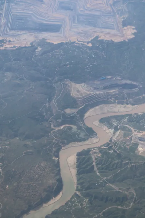
Photo adjustments
Full frame retained; proportionally resized and converted to WebP. No retouching or changes to the photographed subject. Card displays may crop the view.
- Administrative area
- County · 县
- Part of
- Hohhot
- Chinese name
- 清水河县
- Local areas
- County guide
Area & population
- Area in the source
- 2,807.00 km²
- Population · 2020
- 76,674
- Administrative seat
- Chengguan Town
Source: cited geographic source, as of the dates shown.
History
In the late Qing dynasty the Qingshuihe Sub-prefecture (清水河厅) was set up inside the lands of the Guihua Tumed (归化城土默特) to govern Han Chinese settlers, and the Beiyang government turned it into a county in the early Republic. In 2005 the county began a new town 20 kilometres north of the old seat, closer to Hohhot; money ran out in 2007 and the half-built town was left empty.
What to see
The Ministry of Culture and Tourism listed the 9.5-square-kilometre Laoniuwan Yellow River Grand Canyon tourist area as a national 5A scenic area in 2024 and calls it the only place where the Yellow River and the Great Wall meet. Its four core areas are Laoniuwan, Taiji Bend (太极湾), Liuxiang Bend (留香湾) and Cheng Bend (城湾). Xinhua places it on the Inner Mongolia–Shanxi border in the heart of the Yellow River's great 'Ji'-shaped loop (几字弯), where the river winds in an Ω-shaped meander; it was approved as a national geopark in 2015.
On land there are stretches of Ming-dynasty Great Wall, the Wanghe Tower (望河楼), the ruins of the old Ningbian prefecture town (宁边州故城遗址), Shenniu Square (神牛广场), a natural flat of bare rock, and the gorge of the Yangjiachuan (杨家川), a side stream. Laoniuwan Village (老牛湾古村落) is built of stone and is listed as a Chinese traditional village. Boats run past the river-cut cliffs, and the area stages local intangible heritage such as weddings with mule-borne litters (骡驮轿娶亲) and kick-drum yangge dancing (踢鼓子秧歌).
Getting oriented
The county seat is Chengguan Town (城关镇); Hohhot lies more than 100 kilometres to the north. National highways 109 and 209 pass through the county, and the local speech belongs to the Dabao (大包片) group of Jin Chinese (晋语).
Highlights
- Laoniuwan Yellow River Grand Canyon 老牛湾黄河大峡谷: National 5A scenic area since 2024 where the Yellow River meets the Great Wall; national geopark since 2015.
- Laoniuwan Village 老牛湾古村落: Stone-built village listed as a Chinese traditional village.
- Ningbian prefecture town ruins 宁边州故城遗址: Ruined town site inside the Laoniuwan tourist area.
- Wanghe Tower 望河楼: Landmark tower above the river among the area's Great Wall remains.
Sources for this guide
清水河县 - 维基百科,自由的百科全书 · Chinese Wikipedia · CC BY-SA 4.0
文化和旅游部数据服务栏目 - 呼和浩特市老牛湾黄河大峡谷旅游区 · Ministry of Culture and Tourism of the PRC
美丽景区丨老牛湾黄河大峡谷,天下黄河第一湾-新华网 · Xinhua
Qingshuihe County - Wikipedia · English Wikipedia · CC BY-SA 4.0
Original English written from the listed sources and checked sentence by sentence against quoted extracts by a separate reviewer. Updated 2026-09-25.
Explore Qingshuihe County
Core places to explore, with English and Chinese names.
Places to explore around Qingshuihe County
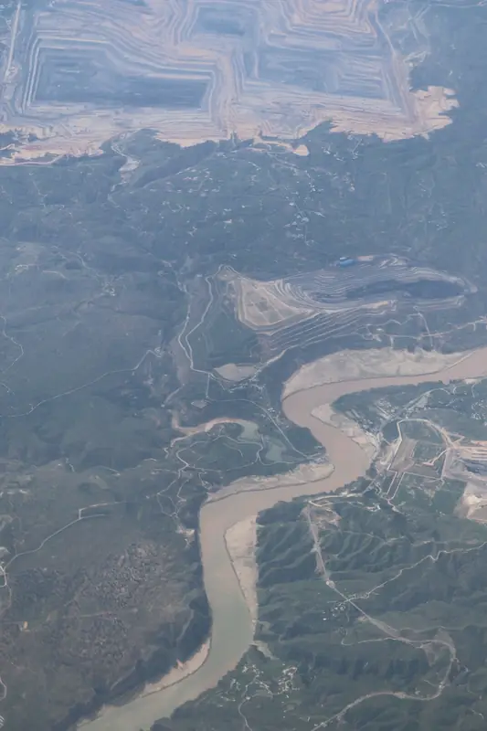 Laoniuwan Yellow River Grand Canyon (
Plan your visit
Getting there
Qingshuihe County is about 105 km in a straight line from central Hohhot. Search for 清水河县 in a map app to find stations and your accommodation.
Where to stay →Build your route
Start with Laoniuwan Yellow River Grand Canyon. The linked place guides have entrance and visit details.
Continue with Hohhot →More in Hohhot
Sources & geographic information
Administrative names and parent areas: Official geographic directory · Reference date 2026-09-06.
Some facts checked against 清水河县 — Wikipedia contributors, CC BY-SA 4.0.
Some facts checked against Qingshuihe County — Wikipedia contributors, CC BY-SA 4.0.
Photo: Laoniuwan Yellow River Grand Canyon · Liuxingy · CC BY-SA 4.0. Full frame retained; EXIF orientation normalized, proportionally resized to at most 800 pixels and converted to WebP. No generated pixels or subject changes. Cards may crop the display.

Map data © OpenStreetMap contributors. Pins mark approximate centres, not entrances or boundaries.