


Get to know Fengzhen
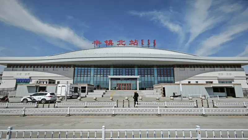
Photo adjustments
EXIF orientation normalized; resized without changing aspect ratio; converted to WebP. No subject edits.
- Administrative area
- County-level city · 县级市
- Part of
- Ulanqab
- Chinese name
- 丰镇市
- Local areas
- County-level city guide
Area & population
- Area in the source
- 2,704.00 km²
- Population · 2020
- 195,229
- Administrative seat
- Beichengqu Subdistrict
Source: cited geographic source, as of the dates shown.
Setting and landscape
Mountains cover about 40 per cent of the land, hills 37 per cent and terraces and plains the rest, and the ground steps down from the west, north and east towards the south-centre. The average elevation is 1,400 metres. The highest point, Huangshiya (黄石崖山) at 2,335 metres, is also the highest peak in Ulanqab; the lowest is the bed of the Yinma River (饮马河) at 1,172 metres. The climate is continental with a monsoon influence, averaging 5.09 °C a year, with Julys around 20.4 °C and Januarys around −13.5 °C; about 400 millimetres of rain falls, most of it from June to August.
History
In 1735 the Qing set up a guard post outside the Great Wall at Yamenkou (衙门口), on the site of the present town, and in 1750 it became Fengzhen subprefecture, its name joined from the first characters of two earlier posts, Fengchuan (丰川卫) and Zhenning (镇宁所). The city government describes it as historically an important trading depot and the main route for Shanxi merchants heading to Mongolia and Russia, and Chinese Wikipedia notes that nearly all residents descend from Shanxi migrants of the "going beyond the western pass" (走西口) movement, so local culture is close to that of northern Shanxi. The subprefecture became a county in 1912, and the county became a city in 1990.
What to see
The Ulanqab investment promotion bureau lists the Ming Great Wall remains as a national protected site, and the Jinlong Dawang Temple (金龙大王庙), Lingyan Temple (灵岩寺) and South Pavilion (南阁) as autonomous-region protected sites. The town of Longshengzhuang (隆盛庄镇) is on the first national list of traditional villages and the sixth list of Chinese historical and cultural towns; its four-legged dragon dance and temple fair, together with the making of mooncakes and dried goods, are on the autonomous region's intangible heritage list.
Food and local products
Chinese Wikipedia names Fengzhen mooncakes (丰镇月饼) as the main local speciality. The city government describes them as golden-brown, soft and crisp, clearly layered when fresh from the oven, and softer and sweeter after storage in a jar. It also names buckwheat hele noodles (荞面饸饹), pressed from buckwheat dough through a hele press straight into the pot. Among local stone, the black diabase sold as "Fengzhen black" (丰镇黑) is well known.
Getting oriented
Beijing is 380 kilometres east and Hohhot 160 kilometres west. The Beijing–Baotou and Datong–Zhungeer railways cross the urban area, and the Jining–Datong–Yuanping high-speed railway serves the city.
Highlights
- Longshengzhuang 隆盛庄镇: Listed Chinese historical and cultural town and national traditional village.
- Jinlong Dawang Temple 金龙大王庙: Autonomous-region protected monument.
- Fengzhen mooncakes 丰镇月饼: Golden-brown, layered mooncakes, the main local speciality.
- Buckwheat hele noodles 荞面饸饹: Buckwheat noodles pressed straight into the pot.
Sources for this guide
丰镇概况 - 丰镇市人民政府 · Fengzhen Municipal People's Government
历史沿革 - 丰镇市人民政府 · Fengzhen Municipal People's Government
自然地理 - 丰镇市人民政府 · Fengzhen Municipal People's Government
丰镇月饼誉满长城内外 - 名优特产 - 丰镇市人民政府 · Fengzhen Municipal People's Government
荞面饸饹 - 丰镇美食 - 丰镇市人民政府 · Fengzhen Municipal People's Government
丰镇市 - 维基百科 · Wikipedia (Chinese) · CC BY-SA 4.0
丰镇市 - 乌兰察布市投资促进局 · Ulanqab Investment Promotion Bureau
Original English written from the listed sources and checked sentence by sentence against quoted extracts by a separate reviewer. Updated 2026-09-26.
Explore Fengzhen
Core places to explore, with English and Chinese names.
Plan your visit
Getting there
Fengzhen is about 60 km in a straight line from central Ulanqab. Search for 丰镇市 in a map app to find stations and your accommodation.
Where to stay →More in Ulanqab
Sources & geographic information
Administrative names and parent areas: Official geographic directory · Reference date 2026-09-06.
Some facts checked against 丰镇市 — Wikipedia contributors, CC BY-SA 4.0.
Map data © OpenStreetMap contributors. Pins mark approximate centres, not entrances or boundaries.