


Get to know Sonid Right Banner
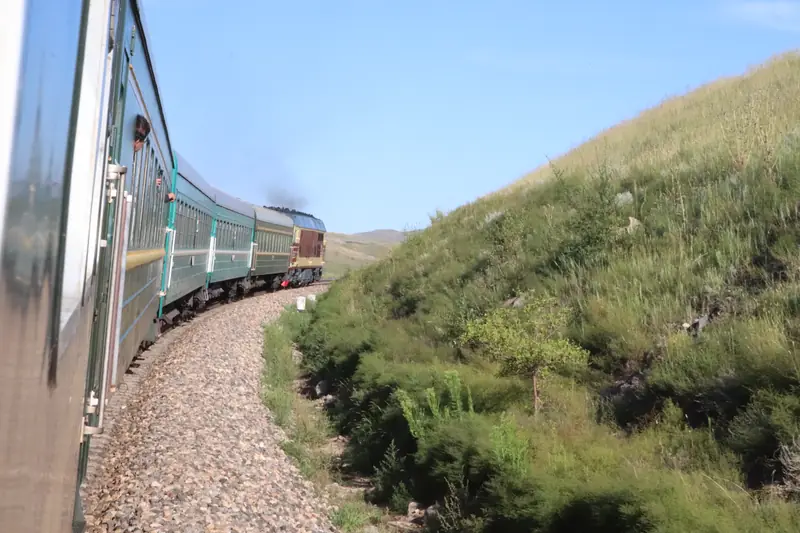
Photo adjustments
EXIF orientation normalized; resized without changing aspect ratio; converted to WebP. No subject edits.
- Administrative area
- Banner · 旗
- Part of
- Xilingol League
- Chinese name
- 苏尼特右旗
- Local areas
- Banner guide
Area & population
- Area in the source
- 22,450.00 km²
- Population · 2020
- 62,402
- Administrative seat
- Saihan Tal
Source: cited geographic source, as of the dates shown.
Setting and landscape
The banner lies in desert and semi-desert steppe with an arid continental climate: 170 to 190 millimetres of rain a year against evaporation of around 2,700 millimetres. The autonomous region rates Sonid sheep and the Sonid Bactrian camel as improved livestock breeds. The banner seat is Saihan Tal (赛汉塔拉镇), 120 kilometres from Erenhot.
History
The Sonid (苏尼特部) took shape as a Mongol group after Genghis Khan united the Mongols, and his seventeenth-generation descendant Kukechitu Mergen Taiji (库克齐图墨尔根台吉) led them to this area. The Qing set up the banner in 1642. In late July 1946 a congress of all social strata, called by the Communist Party at the Sonid Right prince's residence (王府), ended the banner's feudal jasagh (札萨克) system, and in 1957 the first Ulan Muqir troupe was formed here. The banner government moved from Wendur Miao (温都尔庙) to Saihan Tal in 1958; from 1969 the banner belonged to Ulanqab League (乌兰察布盟), returning to Xilingol in May 1980.
Food and local products
The banner government describes local mutton as fine-grained and full of flavour and recommends it for instant-boiled mutton (涮羊肉) and hand-held mutton (手把肉), fresh mutton boiled with simple seasoning and eaten with the fingers. It also lists whole roast lamb (烤全羊), the Mongols' highest honour for guests, and milk tofu (奶豆腐), a dairy food made from fermented fresh milk.
The banner is also known for its gobi stones (戈壁奇石): agate in red, yellow, white and black, with grape agate the most prized; wind-polished stones (风凌石), among the most common; 'coin stones' (钱币石) formed by minerals filling volcanic gas holes; and desert varnish (沙漠漆), stones coated with a black or brown oxide layer.
Getting oriented
The Jining–Erenhot railway (集二铁路) runs through the banner from north to south with a station at Saihan Tal, and the Erenhot–Guangzhou Expressway (二广高速) and National Highway 208 cross it. The banner seat is 90 kilometres from Saiwusu airport (赛乌苏机场).
Highlights
- Ulan Muqir 乌兰牧骑: China's first troupe of this kind was formed in the banner in 1957.
- Gobi stones 戈壁奇石: Agate, wind-polished stones, coin stones and desert varnish from the banner's gobi.
- Sonid Bactrian camel 苏尼特双峰驼: Local breed rated as improved livestock by the autonomous region.
Sources for this guide
西苏概况 · Sonid Right Banner People's Government
历史沿革 · Sonid Right Banner People's Government
尝美食 · Sonid Right Banner People's Government
赏奇石 · Sonid Right Banner People's Government
苏尼特右旗 · Wikipedia (Chinese) · CC BY-SA 4.0
Original English written from the listed sources and checked sentence by sentence against quoted extracts by a separate reviewer. Updated 2026-09-26.
Explore Sonid Right Banner
Core places to explore, with English and Chinese names.
Sonid Right Banner 苏尼特右旗
Plan your visit
Getting there
Sonid Right Banner is about 305 km in a straight line from central Xilingol League. Search for 苏尼特右旗 in a map app to find stations and your accommodation.
Where to stay →More in Xilingol League
Sources & geographic information
Administrative names and parent areas: Official geographic directory · Reference date 2026-09-06.
Some facts checked against 苏尼特右旗 — Wikipedia contributors, CC BY-SA 4.0.
Map data © OpenStreetMap contributors. Pins mark approximate centres, not entrances or boundaries.