


Get to know West Ujimqin Banner
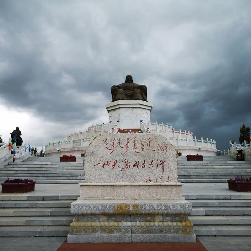
Photo adjustments
EXIF orientation normalized; resized without changing aspect ratio; converted to WebP. No subject edits.
- Administrative area
- Banner · 旗
- Part of
- Xilingol League
- Chinese name
- 西乌珠穆沁旗
- Local areas
- Banner guide
Area & population
- Area in the source
- 22,380.00 km²
- Population · 2020
- 99,255
- Administrative seat
- Balgar Gol
Source: cited geographic source, as of the dates shown.
Setting and landscape
The banner lies where north China meets the northeast, and its seat, Balgar Gol (巴拉嘎尔高勒镇), is a little over 500 kilometres from Beijing in a straight line. Usable pasture covers 88 per cent of the land, ranging from mountain meadow steppe and low-hill meadow to semi-desert steppe and meadows in river flats and lake basins. There are 14 rivers, 326 lakes large and small and 60 springs. The climate is mid-temperate, continental and arid to semi-arid: windy, drought-prone springs, warm summers with uneven rain, early frost in autumn and long cold winters, with an average of about 350 millimetres of rain a year, falling off from southeast to northwest.
History and culture
Ujimqin (乌珠穆沁) is Mongolian for 'grape pickers'. According to the banner government, the Ujimqin tribe lived around a 'grape mountain' in the Altai range in the 13th century and settled here in the mid-17th century. The banner calls itself a cradle of bökh (搏克), Mongolian wrestling, and a home of Mongolian long song (长调); it counts the 19th-century wrestler Durongzhana (都荣扎那) among its heroes and says it has produced more than 40 national-level wrestlers. Ujimqin horse racing includes a traditional 60-li long-distance race and a 30-li race for young horses, and the riders are mostly children of seven or eight. Wrestlers enter the ring in copper-studded vests with an 'eagle step' dance.
Food and local products
The banner government's account of Mongol food divides it into 'white food' (查干伊德), the dairy products, and 'red food' (乌兰伊德), the meat. The traditional staple is hand-held mutton (手把肉): a grown wether goes from slaughter to the table in about three quarters of an hour and is cut in large pieces with a knife. Milk tea made from strong tea and fresh milk, and mare's milk wine (马奶酒), are the most characteristic Mongol drinks; a whole sheep is the most formal dish for honoured guests.
What to see
The banner's 'nomadic tribe' touring route links Haoqinde Temple (浩沁德庙), Genghis Khan Lookout Mountain (成吉思汗瞭望山), the Mongol Khan City (蒙古汗城), a nomadic-culture protection area, the Gulestai (古勒斯台) ecological reserve, the Habuqigai (哈布其盖) sandland resort and Dongke'er Temple (东克儿庙). The steppe road the banner has branded 'Road 99' (99号公路) has a visitor centre at its start, a boardwalk on Lookout Mountain and a cycle path.
Highlights
- Genghis Khan Lookout Mountain 成吉思汗瞭望山: Stop on the banner's nomadic-tribe touring route.
- Road 99 99号公路: Steppe road with a visitor centre, music road and cycle path, developed in 2025.
- Hand-held mutton 手把肉: Traditional Mongol staple: wether mutton on the table about 45 minutes after slaughter.
Sources for this guide
地区概况 · West Ujimqin Banner People's Government
历史人文 · West Ujimqin Banner People's Government
自然地理 · West Ujimqin Banner People's Government
Original English written from the listed sources and checked sentence by sentence against quoted extracts by a separate reviewer. Updated 2026-09-26.
Explore West Ujimqin Banner
Core places to explore, with English and Chinese names.
West Ujimqin Banner 西乌珠穆沁旗
Plan your visit
Getting there
West Ujimqin Banner is about 145 km in a straight line from central Xilingol League. Search for 西乌珠穆沁旗 in a map app to find stations and your accommodation.
Where to stay →More in Xilingol League
Sources & geographic information
Administrative names and parent areas: Official geographic directory · Reference date 2026-09-06.
Map data © OpenStreetMap contributors. Pins mark approximate centres, not entrances or boundaries.