


Get to know Donghai County
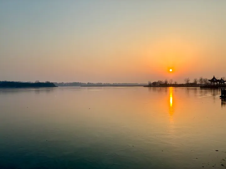
Photo adjustments
Full frame retained; proportionally resized and converted to WebP. No retouching or changes to the photographed subject. Card displays may crop the view.
- Administrative area
- County · 县
- Part of
- Lianyungang
- Chinese name
- 东海县
- Local areas
- County guide
Area & population
- Area in the source
- 2,037.00 km²
- Population · 2020
- 1,047,357
Source: cited geographic source, as of the dates shown.
Setting and landscape
Donghai sits at the southeastern edge of the Huang-Huai-Hai plain, longer from east to west than from north to south. The land is higher in the west, with rolling plain and hills in the centre and west, and flat in the east; the Maling Mountains (马陵山) form the northwestern boundary with Tancheng (郯城) in Shandong, and the Xinshu River (新沭河) the northeastern edge facing Ganyu (赣榆). Its rivers belong to the lower Yi (沂) and Shu (沭) systems, and with 63 reservoirs it is nicknamed the "county of a hundred reservoirs". Chinese Wikipedia lists Shilianghe Reservoir (石梁河水库) as the largest in Jiangsu.
Chinese Wikipedia traces the name to a Ming writer, Gao Denglong (高登龙), who wrote that Haizhou (海州) lay by the sea in the east, hence "Donghai", "eastern sea".
History
The county government puts Donghai's history as a county at more than 2,000 years. Old sites include the Paleolithic site at Daxianzhuang (大贤庄), which Chinese Wikipedia dates to about 50,000 years ago, and the cliff carvings at Fangshan (房山摩崖石刻). The Han tombs at Yinwan (尹湾汉墓群) and the Han-dynasty city ruins at Quyang (曲阳汉代古城遗址) are both national key cultural relic sites. The essayist Zhu Ziqing (朱自清) and the painter Yan Han (彦涵) were born in Donghai.
What to see
The county government says Donghai produces more than 500 tonnes of natural crystal a year, half of China's output, and has more than 300 crystal-processing firms. The Donghai Crystal Museum (中国东海水晶博物馆) and the Donghai International Crystal Jewellery City (东海国际水晶珠宝城) are both national 4A scenic areas, as are the Yuquan scenic area (羽泉景区) and Xishuang Lake (西双湖), a national wetland park planted with more than 200 kinds of lily. The Donghai Hot Spring resort (东海温泉旅游度假区), a provincial tourist resort, lies 15 kilometres northwest of the county town. The county is also recognised by the China Flower Association as a "home of flowers and nursery trees", with nearly 40,000 mu of cut flowers.
Highlights
- Donghai Crystal Museum 中国东海水晶博物馆: National 4A scenic area in the 'world capital of crystal'.
- Xishuang Lake 西双湖: National wetland park and 4A area planted with over 200 kinds of lily.
- Donghai Hot Spring resort 东海温泉旅游度假区: Provincial tourist resort 15 km northwest of the county town.
- Yinwan Han tombs 尹湾汉墓群: National key cultural relic site.
- Shilianghe Reservoir 石梁河水库: Listed by Chinese Wikipedia as Jiangsu's largest reservoir.
Sources for this guide
东海县 - 维基百科,自由的百科全书 · Chinese Wikipedia · CC BY-SA 4.0
东海县人民政府 - 魅力晶都 · Donghai County People's Government
Original English written from the listed sources and checked sentence by sentence against quoted extracts by a separate reviewer. Updated 2026-09-25.
Explore Donghai County
Core places to explore, with English and Chinese names.
Places to explore around Donghai County
 AI illustration · AI
 Plan your visit
Getting there
Donghai County is about 40 km in a straight line from central Lianyungang. Search for 东海县 in a map app to find stations and your accommodation.
Where to stay →Build your route
Start with China Donghai Crystal Museum. The linked place guides have entrance and visit details.
Continue with Lianyungang →More in Lianyungang
Sources & geographic information
Administrative names and parent areas: Official geographic directory · Reference date 2026-09-06.
Some facts checked against 东海县 — Wikipedia contributors, CC BY-SA 4.0.
Map data © OpenStreetMap contributors. Pins mark approximate centres, not entrances or boundaries.