


Get to know Ganyu District
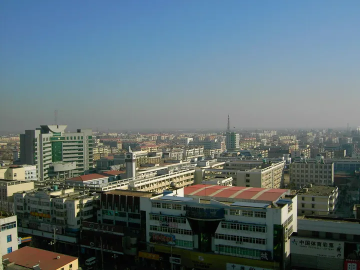
Photo adjustments
Full frame retained; proportionally resized and converted to WebP. No retouching or changes to the photographed subject. Card displays may crop the view.
- Administrative area
- District · 市辖区
- Part of
- Lianyungang
- Chinese name
- 赣榆区
- Local areas
- District guide
Area & population
- Area in the source
- 1,363.00 km²
- Population · 2020
- 1,003,844
- Administrative seat
- Qingkou (青口镇)
Source: cited geographic source, as of the dates shown.
Setting and landscape
Ganyu sits between Haizhou Bay and the Yimeng Mountains (沂蒙山脉). Low hills fill the west and north, rising to 364.4 metres, while the east is a flat coastal plain only 0.5 to 3 metres above the sea. To the north and west lie Rizhao (日照) and Linyi (临沂) in Shandong; to the south the Shiliang River Reservoir (石梁河水库) and the Xinshu River (新沭河) separate it from the rest of Lianyungang. The district government counts 45.71 km of coastline. Qinshan Island (秦山岛) is the one island offshore, about 15 km in a straight line from the urban area.
History
A county was first set up here under the Qin; inscribed tiles naming Ganyu, found in 1979 in a Qin convict cemetery at Lintong (临潼) in Shaanxi, are taken as proof. From the Southern and Northern dynasties to the early Jin (金) dynasty it was called Huairen County (怀仁县). In 1945 it was renamed Zhuting County (竹庭县) after the anti-Japanese commander Fu Zhuting (符竹庭), and the old name returned in 1950. The county became a district of Lianyungang in July 2014.
What to see
The Xu Fu Shrine (徐福祠) in Xufu village, Jinshan town (金山镇), was built by the county government on the site of an old temple, and delegations from Shingu (新宫) and Saga (佐贺) in Japan have visited it. Qinshan Island is linked to the First Emperor's eastern tours; a seal-script inscription by his minister Li Si (李斯) once stood there but is now lost.
At the foot of Jiagu Mountain (夹谷山) is the site of the Spring and Autumn meeting between the states of Qi and Lu, with a stele marking where Confucius attended, erected in 1576. The Kangri Mountain Martyrs' Cemetery (抗日山烈士陵园) is a national martyrs' cemetery and a national 4A-rated scenic area. The Haizhou Bay tourist resort in Haitou town (海头镇) is described as having Jiangsu's longest good-quality sand beach.
Food and local products
Ganyu jianbing (赣榆煎饼) is a thin griddle pancake spread by hand over a slow fire on an ao (鏊子) griddle from wheat batter, flour, soybean, maize or sweet-potato flour. It comes out golden and chewy, and locals roll it around youtiao (油条) fried dough, spring onion with dried shrimp, or dried fish. Sweet pickled melon (甜闷瓜) goes back to a sauce works opened in Qingkou (青口镇) under the Qianlong emperor by a merchant from Shanxi. The Haizhou Bay fishery supplies swimming crab, Chinese white shrimp and purple laver.
Highlights
- Xu Fu Shrine 徐福祠: Shrine to Xu Fu in Xufu village, visited by delegations from Shingu and Saga in Japan.
- Qinshan Island 秦山岛: The district's only offshore island, tied to the First Emperor's eastern tours.
- Jiagu Mountain meeting site 夹谷山: Site of the Qi-Lu meeting, with a 1576 stele naming Confucius.
- Kangri Mountain Martyrs' Cemetery 抗日山烈士陵园: National martyrs' cemetery and 4A scenic area.
- Ganyu jianbing 赣榆煎饼: Hand-spread griddle pancake from mixed grain batters, eaten rolled.
Sources for this guide
赣榆区概况 · Ganyu District People's Government
赣榆区 - 维基百科 · Wikipedia (Chinese) · CC BY-SA 4.0
Original English written from the listed sources and checked sentence by sentence against quoted extracts by a separate reviewer. Updated 2026-09-25.
Explore Ganyu District
Core places to explore, with English and Chinese names.
Ganyu District 赣榆区
Plan your visit
Getting there
Ganyu District is about 40 km in a straight line from central Lianyungang. Search for 赣榆区 in a map app to find stations and your accommodation.
Where to stay →More in Lianyungang
Sources & geographic information
Administrative names and parent areas: Official geographic directory · Reference date 2026-09-06.
Some facts checked against 赣榆区 — Wikipedia contributors, CC BY-SA 4.0.
Map data © OpenStreetMap contributors. Pins mark approximate centres, not entrances or boundaries.