


Get to know Guannan County
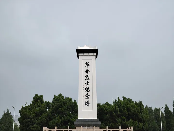
Photo adjustments
Full frame retained; proportionally resized and converted to WebP. No retouching or changes to the photographed subject. Card displays may crop the view.
- Administrative area
- County · 县
- Part of
- Lianyungang
- Chinese name
- 灌南县
- Local areas
- County guide
Area & population
- Area in the source
- 1,030.00 km²
- Population · 2020
- 612,345
Source: cited geographic source, as of the dates shown.
History
The area's old name is Haixi (海西, "west of the sea"); the county government dates the first Haixi County to 90 BC. The modern county was formed in 1958 by joining nine townships of Guanyun County (灌云县) with five of Lianshui County (涟水县), and was named Guannan that March. The county seat is Xin'an town (新安镇).
Setting and getting oriented
North of the county town, at Wulongkou (五龙口), five waterways meet: the Yan River (盐河), the Wuzhang River (武障河), the South and North Liutang rivers (六塘河) and the Gongxing River (公兴河). Inland shipping reaches the Yellow Sea to the east, the Grand Canal to the south and Lianyungang port to the north, and the Changshen and Coastal expressways cross the county.
What to see
Local legend holds that Erlang Shen lived at the mouth of the Guan River. Records place an Erlang Shen temple at Wulongkou from the Ming and Qing into the Republican years; it was later destroyed in war. The Erlang Shen Cultural Heritage Park (二郎神文化遗迹公园), built on the same spot and opened in 2012, was rated a national 4A scenic area in May 2014; the county describes it as the largest Taoist site in northern Jiangsu and southern Shandong. The Guannan People's Revolution Memorial Hall (灌南人民革命纪念馆), in the east of town, grew out of a 1959 martyrs' cemetery; its ground floor covers the revolutionary struggles of 1928 to 1949. Haixi Park (海西公园), built in 2007 in the town centre, has a row of twelve arched bridges over a stream that joins its lake.
Food and local products
Tanggou old town (汤沟古镇) already had more than ten distilleries in the Ming, and the Qing playwright Hong Sheng (洪昇) praised its liquor in the line "南国汤沟酒,开坛十里香" ("Tanggou liquor of the south: open the jar and it scents ten li"). Tanggou daqu won a silver medal at a Leipzig fair in 1915, and its brewing method is on Jiangsu's first provincial intangible heritage list. Local dishes include smoked pork from Bailu town (百禄镇), slow-simmered mutton soup from Baizaogou (白皂沟) and Guannan tuozi (灌南坨子), deep-fried balls that are crisp outside and juicy within. The county is also a large grower of king oyster, button and enoki mushrooms, and Guannan enoki carries a national geographical indication. Magic has been performed at local temple fairs since the Ming and Qing, and a local magic troupe founded a county magic school.
Highlights
- Erlang Shen Cultural Heritage Park 二郎神文化遗迹公园: Rebuilt Erlang Shen temple site at the five-river junction of Wulongkou; national 4A scenic area since 2014.
- Guannan People's Revolution Memorial Hall 灌南人民革命纪念馆: Memorial built out of a 1959 martyrs' cemetery; its ground floor covers 1928-1949.
- Tanggou liquor 汤沟酒: Liquor from Tanggou old town; brewing method on Jiangsu's first intangible heritage list.
- Guannan tuozi 灌南坨子: Deep-fried balls, crisp outside and juicy inside.
- Guannan enoki mushrooms 灌南金针菇: National geographical indication product.
Sources for this guide
灌南名片 - 走进灌南 · Guannan County People's Government
旅游灌南 · Guannan County People's Government
[连云港]灌南县:用心用情,凝心聚力扎实推进惠侨工作 · Jiangsu United Front (CPC Jiangsu United Front Work Department)
灌南县 - 维基百科 · Wikipedia (Chinese) · CC BY-SA 4.0
Original English written from the listed sources and checked sentence by sentence against quoted extracts by a separate reviewer. Updated 2026-09-25.
Explore Guannan County
Core places to explore, with English and Chinese names.
Guannan County 灌南县
Plan your visit
Getting there
Guannan County is about 55 km in a straight line from central Lianyungang. Search for 灌南县 in a map app to find stations and your accommodation.
Where to stay →More in Lianyungang
Sources & geographic information
Administrative names and parent areas: Official geographic directory · Reference date 2026-09-06.
Some facts checked against 灌南县 — Wikipedia contributors, CC BY-SA 4.0.
Map data © OpenStreetMap contributors. Pins mark approximate centres, not entrances or boundaries.