


Get to know Zhangjiagang
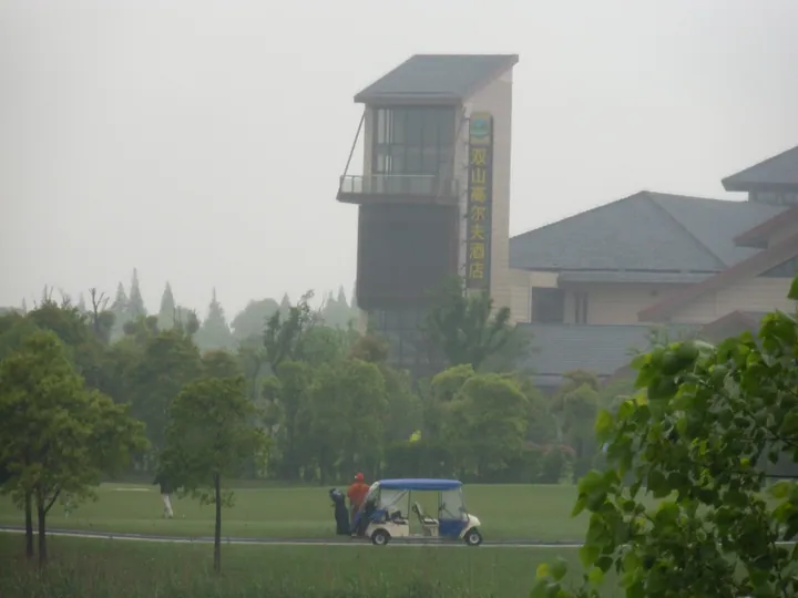
Photo adjustments
Full frame retained; proportionally resized and converted to WebP. No retouching or changes to the photographed subject. Card displays may crop the view.
- Administrative area
- County-level city · 县级市
- Part of
- Suzhou
- Chinese name
- 张家港市
- Local areas
- County-level city guide
Area & population
- Area in the source
- 772.40 km²
- Population · 2010 census
- 1,246,762
Source: cited geographic source, as of the dates shown.
Setting and landscape
The city sits on the Yangtze's alluvial plain between Changshu (常熟) to the south-east and Jiangyin (江阴) to the west. Much of the north was river until comparatively late: in the Qing dynasty the area was sandbanks off the south shore, farmed by settlers who crossed from counties on the north bank. A channel dug in 1874, the Changtong (常通港), divided the Changyin Sand (常阴沙), given to Changshu, from the Liuhai Sand (刘海沙) to its north, which was governed from Tongzhou (通州). People in the reclaimed north, largely descended from migrants from Haimen (海门) and Qidong (启东), speak Shadi dialect (沙地话); the older south speaks Changshu dialect.
History
The city government dates human activity in the south to 8,000 years ago. In 202 BC the Han founded Jiyang township (暨阳乡) under Piling County (毗陵县), the first recorded local administration; the Jin dynasty set up Jiyang County (暨阳县), and under the Liang dynasty of the Southern Dynasties, Liangfeng County (梁丰县) was built on its ruins. From the Tang onward the land was divided between Changshu and Jiangyin. In 1962 fourteen communes from Changshu and nine from Jiangyin were joined as Shazhou County under Suzhou prefecture. In September 1986 the State Council approved its replacement by a city named after the natural harbour of Zhangjiagang. Chinese Wikipedia adds that the 'gang' (港) of the name refers to a river, not a port.
What to see
Xiangshan (香山) scenic area, a national AAAA site of 6.69 square kilometres, rises to 136.6 metres, the highest point in the city. Its sights include the Caixiang Path (采香径), linked to the legend of Xi Shi (西施) gathering fragrant herbs, the Plum Blossom Hall (梅花堂) with a name board written by Su Dongpo (苏东坡), and the Peach Blossom Gully (桃花涧) praised by the travel writer Xu Xiake (徐霞客). There is also a plum garden of ten thousand trees and a 200-mu cherry garden.
Jiyang Lake (暨阳湖) ecological tourism area, in the south of the urban area, is a man-made lake and urban wetland park of 2 square kilometres, with a lake surface of 1,000 mu. It is rated national AAAA.
Getting oriented
The government seat is in Yangshe (杨舍镇). Chinese Wikipedia puts the city 30 kilometres from Nantong, 40 from Wuxi (无锡), 58 from Suzhou and 98 from Shanghai. Zhangjiagang station lies on the Shanghai–Nantong Railway (沪通铁路), and the Shanghai–Suzhou–Nantong Yangtze River Bridge (沪苏通长江公铁大桥), opened in 2020, carries road and rail across the river.
Highlights
- Xiangshan scenic area 香山: National AAAA area around the city's highest hill, 136.6 metres, with a plum garden and paths tied to Xi Shi, Su Dongpo and Xu Xiake.
- Jiyang Lake ecological tourism area 暨阳湖生态旅游区: Man-made lake and urban wetland park of 2 square kilometres in the south of the city; national AAAA.
- Shanghai–Suzhou–Nantong Yangtze River Bridge 沪苏通长江公铁大桥: Road and rail crossing of the Yangtze opened in 2020.
Sources for this guide
张家港市 · Wikipedia (Chinese) · CC BY-SA 4.0
历史沿革 · Zhangjiagang Municipal People's Government
香山景区(国家AAAA级旅游景区) · Zhangjiagang Municipal Bureau of Culture, Sports, Radio, Television and Tourism (Zhangjiagang government portal)
暨阳湖生态旅游区(国家AAAA级旅游景区) · Zhangjiagang Municipal Bureau of Culture, Sports, Radio, Television and Tourism (Zhangjiagang government portal)
Original English written from the listed sources and checked sentence by sentence against quoted extracts by a separate reviewer. Updated 2026-09-25.
Explore Zhangjiagang
Core places to explore, with English and Chinese names.
Places to explore around Zhangjiagang
 AI illustration · AI
 Plan your visit
Getting there
Zhangjiagang is about 65 km in a straight line from central Suzhou. Search for 张家港市 in a map app to find stations and your accommodation.
Where to stay →Build your route
Start with Mount Xiangshan. The linked place guides have entrance and visit details.
Continue with Suzhou →More in Suzhou
Sources & geographic information
Administrative names and parent areas: Official geographic directory · Reference date 2026-09-06.
Some facts checked against 张家港市 — Wikipedia contributors, CC BY-SA 4.0.
Map data © OpenStreetMap contributors. Pins mark approximate centres, not entrances or boundaries.