


Get to know Dongtai
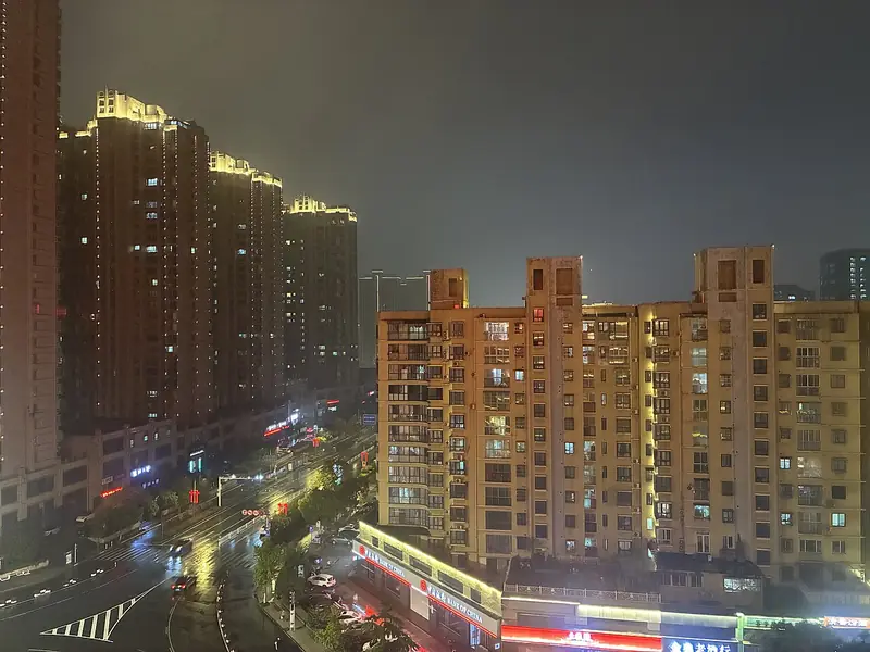
Photo adjustments
Full frame retained; EXIF orientation normalized, proportionally resized to at most 800 pixels and converted to WebP. No generated pixels or subject changes. Cards may crop the display.
- Administrative area
- County-level city · 县级市
- Part of
- Yancheng
- Chinese name
- 东台市
- Local areas
- County-level city guide
Area & population
- Area in the source
- 3,175.67 km²
- Population · 2020
- 888,410
Source: cited geographic source, as of the dates shown.
Setting and landscape
The land is flat. National Highway 204, which follows the old Fangong Embankment (范公堤), runs north to south and splits the city in two. West of the embankment lies the eastern rim of the saucer-shaped Lixiahe (里下河) lowland, while to the east is a coastal plain of tidal flats built from Yangtze sediment carried back by the sea and from silt laid down after the Yellow River took over the course of the Huai. Tiaozini lies east of Qianggang (弶港镇).
History
The name Dongtai first appears in 937, when the Southern Tang moved the Hailing salt directorate (海陵监) to Dongtai saltworks. Dongtai County was split from Taizhou in 1767 and named after that saltworks, and it became a county-level city in December 1987. Dongtai is one of the places whose claim to the Dong Yong legend (董永传说), the tale of the filial son Dong Yong and the Seventh Fairy, entered the first national intangible-heritage list in 2006; the China Intangible Cultural Heritage Network notes that a Southern Song geography already recorded a hamlet here as Dong Yong's home.
What to see
The Xixi Tianxianyuan scenic area (西溪天仙缘景区) is a 4A site on the old salt-transport canal west of the city centre. It holds the Haichunxuan Pagoda (海春轩塔), dated by the Yancheng tourism bureau to the Zhenguan reign of the Tang and a national protected monument, and the Taishan Huguo Temple (泰山护国禅寺), built in the Jiading reign of the Southern Song.
Tiaozini, named for its strip-shaped tidal creeks, became part of the World Heritage site Migratory Bird Sanctuaries along the Coast of Yellow Sea-Bohai Gulf of China (Phase I) in July 2019; the spoon-billed sandpiper is its best-known bird. The Yellow Sea Forest Park (黄海森林公园), a national forest park of 68,000 mu, has avenues of dawn redwood, ginkgo, poplar and bamboo. Anfeng Old Town (安丰古镇) is another 4A site.
Food and local products
Dongtai fish-soup noodles (东台鱼汤面) are served in a milky, rich broth, and locals say a bowl beats the God of Longevity. Dongtai hair embroidery (东台发绣), national intangible heritage since 2021, stitches pictures with girls' hair at least 30 centimetres long using Suzhou embroidery techniques.
Highlights
- Tiaozini 条子泥: Wetland inscribed as part of a World Heritage site in 2019; known for the spoon-billed sandpiper.
- Haichunxuan Pagoda 海春轩塔: Tang-period pagoda in the Xixi Tianxianyuan area; national protected monument.
- Yellow Sea Forest Park 黄海森林公园: National forest park of 68,000 mu with dawn redwood, ginkgo, poplar and bamboo avenues.
- Dongtai fish-soup noodles 东台鱼汤面: Noodles in a milky, rich fish broth.
- Dongtai hair embroidery 东台发绣: Embroidery in human hair; national intangible heritage (2021).
Sources for this guide
东台市 - 维基百科,自由的百科全书 · Chinese Wikipedia · CC BY-SA 4.0
西溪天仙缘景区 · Yancheng Municipal People's Government (Culture, Radio, TV and Tourism Bureau)
条子泥景区 · Yancheng Municipal People's Government (Culture, Radio, TV and Tourism Bureau)
黄海森林公园 · Yancheng Municipal People's Government (Culture, Radio, TV and Tourism Bureau)
东台鱼汤面 · Yancheng Municipal People's Government (Culture, Radio, TV and Tourism Bureau)
董永传说 - 中国非物质文化遗产网 · China Intangible Cultural Heritage Network (ihchina.cn)
发绣(东台发绣) - 中国非物质文化遗产网 · China Intangible Cultural Heritage Network (ihchina.cn)
国家4A级旅游景区 - 维基百科 · Chinese Wikipedia · CC BY-SA 4.0
Original English written from the listed sources and checked sentence by sentence against quoted extracts by a separate reviewer. Updated 2026-09-25.
Explore Dongtai
Core places to explore, with English and Chinese names.
Places to explore around Dongtai
 Tiaozini Birdwatching Area · 条子泥开放观鸟区
Tiaozini Birdwatching Area条子泥开放观鸟区
Tiaozini's public birdwatching points overlook a Dongtai tidal wetland used by migrating shorebirds on the East Asian–Australasian Flyway.
Read the place guide →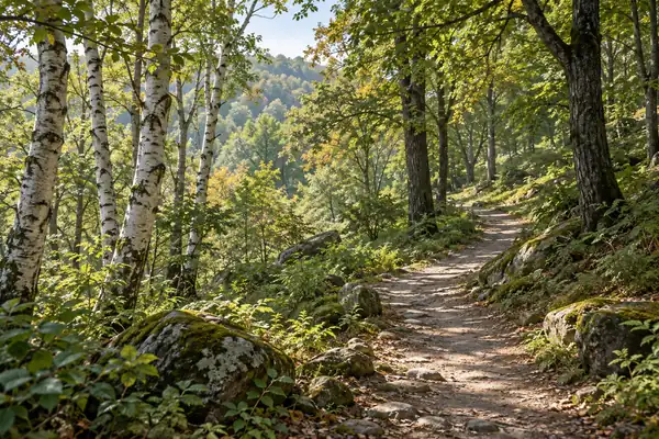 AI illustration · AI 示意图(仅供参考,非该地点实拍)
Huanghai Forest Park黄海森林公园
Huanghai Forest Park in Dongtai grew from a shelterbelt planted on saline coastal land into a large managed woodland of metasequoia, poplar and ginkgo.
Read the place guide →Plan your visit
Getting there
Dongtai is about 70 km in a straight line from central Yancheng. Search for 东台市 in a map app to find stations and your accommodation.
Where to stay →Build your route
Tiaozini Birdwatching Area and Huanghai Forest Park are both listed here. The linked place guides have entrance and visit details.
Continue with Yancheng →More in Yancheng
Sources & geographic information
Administrative names and parent areas: Official geographic directory · Reference date 2026-09-06.
Some facts checked against 东台市 — Wikipedia contributors, CC BY-SA 4.0.
Some facts checked against 国家4A级旅游景区 — Wikipedia contributors, CC BY-SA 4.0.
Photo: Tiaozini Birdwatching Area · Source photographer · License not provided. EXIF orientation normalized; resized without changing aspect ratio; converted to WebP. No subject edits.
Map data © OpenStreetMap contributors. Pins mark approximate centres, not entrances or boundaries.