


Get to know Jianhu County
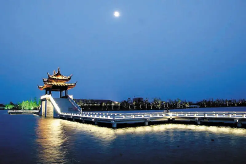
Photo adjustments
EXIF orientation normalized; resized without changing aspect ratio; converted to WebP. No subject edits.
- Administrative area
- County · 县
- Part of
- Yancheng
- Chinese name
- 建湖县
- Local areas
- County guide
Area & population
- Area in the source
- 1,154.00 km²
- Population · 2016
- 800,600
Source: cited geographic source, as of the dates shown.
Setting and landscape
Old Sheyang Lake lay roughly between what are now Baoying (宝应), Jianhu, Yancheng and Xinghua (兴化). Formed from river silt after the Warring States period, it remained until the Northern Song the largest lake on the northern Jiangsu plain, and it ran east past Jiulongkou towards the sea at Funing (阜宁). Low-lying, with lakes and marshes linked one to another, it silted up faster after the Yellow River captured the Huai in 1128, and after the late Qing most of it became marsh or farmland. Jiulongkou is today a town of Jianhu County.
History
In 119 BC most of the present county came under Yandu County (盐渎县). Jianhu itself was created on 18 September 1941 as Jianyang County (建阳县), named after the town of Jianyang. Because Fujian already had a Jianyang County, it was renamed in 1951, combining the first characters of Jianyang and Huduo (湖垛), the county seat.
What to see
Sights in the county include Jiulongkou, the Wugu Tree (五谷树), Menglong Pagoda (朦胧塔), the former residence of Qiao Guanhua (乔冠华故居) and Shuanghu Park (双湖公园).
Jianhu acrobatics, known as the Eighteen Troupes (十八团), entered the national intangible-heritage list in 2008. The tradition centres on Qingfeng (庆丰镇) in the middle of the county, where 18 villages each formed a circus troupe; in the late Ming and early Qing these troupes toured China and Southeast Asia. The China Intangible Cultural Heritage Network describes it as a distinct southern school of acrobatics, with pieces such as bowl-balancing between partners and the double high wire.
Food and local products
Jianhu lotus-starch dumplings (建湖藕粉圆) are the county's signature snack. The Yancheng culture and tourism bureau dates them back more than 200 years and describes their taste as clean and sweet, without greasiness.
Highlights
- Jiulongkou 九龙口: Town of Jianhu on the course of the old Sheyang Lake.
- Jianhu acrobatics 建湖杂技: Eighteen Troupes of Qingfeng; national intangible heritage since 2008.
- Jianhu lotus-starch dumplings 建湖藕粉圆: Local snack with more than 200 years of history.
Sources for this guide
建湖县 - 维基百科,自由的百科全书 · Chinese Wikipedia · CC BY-SA 4.0
建湖杂技 - 中国非物质文化遗产网 · China Intangible Cultural Heritage Network (ihchina.cn)
建湖藕粉圆 · Yancheng Municipal People's Government (Culture, Radio, TV and Tourism Bureau)
九龙口镇 - 维基百科,自由的百科全书 · Chinese Wikipedia · CC BY-SA 4.0
射阳湖 - 维基百科,自由的百科全书 · Chinese Wikipedia · CC BY-SA 4.0
Original English written from the listed sources and checked sentence by sentence against quoted extracts by a separate reviewer. Updated 2026-09-25.
Explore Jianhu County
Core places to explore, with English and Chinese names.
Places to explore around Jianhu County
 AI illustration · AI
 Plan your visit
Getting there
Jianhu County is about 35 km in a straight line from central Yancheng. Search for 建湖县 in a map app to find stations and your accommodation.
Where to stay →Build your route
Start with Jiulongkou Scenic Area. The linked place guides have entrance and visit details.
Continue with Yancheng →More in Yancheng
Sources & geographic information
Administrative names and parent areas: Official geographic directory · Reference date 2026-09-06.
Some facts checked against 建湖县 — Wikipedia contributors, CC BY-SA 4.0.
Some facts checked against 九龙口镇 — Wikipedia contributors, CC BY-SA 4.0.
Some facts checked against 射阳湖 — Wikipedia contributors, CC BY-SA 4.0.
Map data © OpenStreetMap contributors. Pins mark approximate centres, not entrances or boundaries.