


Get to know Funing County
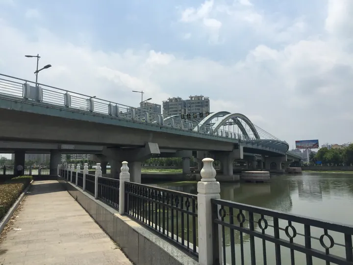
Photo adjustments
Full frame retained; proportionally resized and converted to WebP. No retouching or changes to the photographed subject. Card displays may crop the view.
- Administrative area
- County · 县
- Part of
- Yancheng
- Chinese name
- 阜宁县
- Local areas
- County guide
Area & population
- Area in the source
- 1,439.00 km²
- Population · 2020
- 794,036
Source: cited geographic source, as of the dates shown.
Setting and landscape
Funing sits where three farming regions meet: the Lixiahe, the coast and the Xuhuai (徐淮) area. The land is flat and crossed by waterways, with about 300,000 mu of lake and marsh water surface, including the Majiadang (马家荡) and Baishuitang (白水塘) marshes and the abandoned Yellow River course (黄河故道). The Tongyu Canal (通榆运河), the Northern Jiangsu Main Irrigation Canal (苏北灌溉总渠) and the Huai River Seaward Channel (淮河入海水道) also run through the county. Along the old Yellow River corridor the county has laid out woodland and orchards in the north and lake-and-marsh aquaculture in the south.
History
The county has late Neolithic and Liangzhu culture sites, including the Dongyuan (东园) Neolithic site. A walled town was built at Miaowan (庙湾) in 1595, and Funing County was created in 1731 under Huai'an Prefecture (淮安府), its name taken from a phrase wishing for flourishing trade and a peaceful locality. From July 1941 to December 1942 the headquarters of the New Fourth Army (新四军) was stationed in Funing. Funing is known as a home of Huai opera (淮剧).
What to see
Jinsha Lake (金沙湖), a resort in Fucheng (阜城), the subdistrict that holds the county government, is a 4A scenic area and provincial tourist resort, and the lake was the focus of a ten-year ecological restoration project. It hosted a national kite invitational in 2025, and the 2026 Jinsha Lake Cup contest was set to open on its sand beach on 4 April, with a night-time display of illuminated kites. The Yancheng government names Jinsha Lake and Majiadang as the county's core scenic areas, and Mugou Old Village (穆沟古村) and Tingchigang (停翅港) as villages developing rural tourism.
Food and local products
Funing cake (阜宁大糕) is made from glutinous rice, white sugar, refined fat and candied fruit into thin, soft white slices that can be rolled up and laid flat again. Legend says the Qianlong Emperor tasted it and named it jade-belt cake (玉带糕), and families keep it to offer guests at Spring Festival. Other local products include Majiadang crabs, Qiqiao dried tofu (戚桥茶干) and Yilin soy sauce (益林酱油).
Highlights
- Jinsha Lake 金沙湖: 4A scenic area and provincial tourist resort; venue of the 2025 national kite invitational and the 2026 Jinsha Lake Cup.
- Majiadang 马家荡: Marsh named as one of the county's core scenic areas and a source of crabs.
- Funing cake 阜宁大糕: Thin rolled slices of glutinous-rice cake served at Spring Festival.
Sources for this guide
阜宁县 - 维基百科,自由的百科全书 · Chinese Wikipedia · CC BY-SA 4.0
阜宁大糕 · Yancheng Municipal People's Government (Culture, Radio, TV and Tourism Bureau)
阜宁擘画淮河经济带绿色新画卷 · Yancheng Municipal People's Government
2026“金沙湖杯”全国风筝邀请赛,即将在盐城阜宁启幕 · Yangtse Evening Post
Original English written from the listed sources and checked sentence by sentence against quoted extracts by a separate reviewer. Updated 2026-09-25.
Explore Funing County
Core places to explore, with English and Chinese names.
Funing County 阜宁县
Plan your visit
Getting there
Funing County is about 55 km in a straight line from central Yancheng. Search for 阜宁县 in a map app to find stations and your accommodation.
Where to stay →More in Yancheng
Sources & geographic information
Administrative names and parent areas: Official geographic directory · Reference date 2026-09-06.
Some facts checked against 阜宁县 — Wikipedia contributors, CC BY-SA 4.0.
Map data © OpenStreetMap contributors. Pins mark approximate centres, not entrances or boundaries.