


Get to know Suichuan County
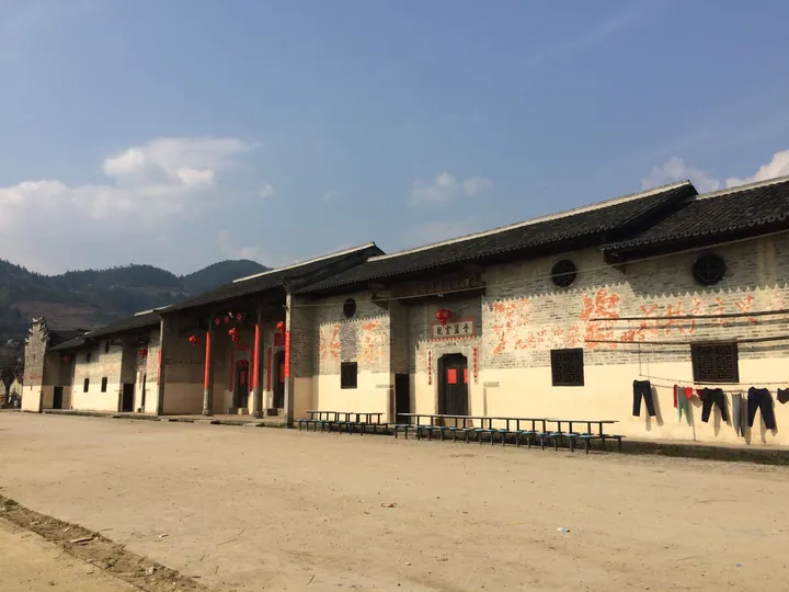
Photo adjustments
Full frame retained; proportionally resized and converted to WebP. No retouching or changes to the photographed subject. Card displays may crop the view.
- Administrative area
- County · 县
- Part of
- Ji'an
- Chinese name
- 遂川县
- Local areas
- County guide
Area & population
- Area in the source
- 3,144.17 km²
- Population · 2019
- 622,200
Source: cited geographic source, as of the dates shown.
Setting and landscape
Wikipedia describes the county as having many mountains and little farmland, its ground shaped like a winnowing basket open to the northeast: middle mountains in the southwest give way to low mountains, hills and river-valley plains towards the northeast. The Wanyang (万洋山脉) and Zhuguang (诸广山山脉) ranges run northeast from the western edge, with five peaks above 2,000 metres. Nanfengmian, at 2,120.4 metres, is the county's highest point; the county government calls it the highest peak on the Hunan-Jiangxi border. The two largest rivers, the Suichuan River (遂川江) and the Shu River (蜀水), flow northeast into the Gan River (赣江).
The county government lists three national protected areas: Nanfengmian National Nature Reserve, Luoxiao Mountain Grand Canyon National Forest Park (罗霄山大峡谷国家森林公园) and Wudoujiang National Wetland Park (五斗江国家湿地公园). It also describes a bird migration corridor through the county, the "thousand-year bird path" (千年鸟道), as the second largest in China.
History
The county government dates the first county here to 199, in the Jian'an era of the Eastern Han; earlier names include Suixing, Xinxing, Longquan and Quanjiang. In 960 the Southern Tang raised the Longquan outpost to Longquan County (龙泉县), and the name Suichuan dates from 1914. Suichuan formed part of the Jinggangshan (井冈山) revolutionary base, and Mao Zedong set up the Suichuan County Workers', Peasants' and Soldiers' Government (遂川县工农兵政府) here; according to Wikipedia its former site is a Jiangxi provincial protected site.
What to see and eat
The Taoyuan terraces (桃源梯田) are high mountain terraces at Taoyuan village (桃源村) in Zuo'an town (左安镇). People's Daily Online reported in 2022 that the county repaired 72 old houses in the village left after relocation, decorating them with old steamers, stone rollers, roof tiles and straw rain capes, and planted cherry, red maple and peach trees along channels and paths.
The county calls itself a home of famous Chinese tea, and Gougunao tea is a Chinese geographical indication product.
Highlights
- Nanfengmian 南风面: 2,120.4-metre peak, the county's highest point and a national nature reserve.
- Taoyuan terraces 桃源梯田: High mountain terraces at Taoyuan village in Zuo'an town.
- Gougunao tea 狗牯脑茶: The county's tea, a Chinese geographical indication product.
- Suichuan County Workers', Peasants' and Soldiers' Government site 遂川县工农兵政府旧址: Site of the revolutionary county government set up by Mao Zedong; provincial protected site.
Sources for this guide
遂川县人民政府-遂川概貌 · Suichuan County People's Government (Suichuan County Party History and Local Chronicles Research Centre)
遂川县 - 维基百科,自由的百科全书 · Chinese Wikipedia · CC BY-SA 4.0
江西遂川:古老梯田焕发新生机--江西--人民网 · People's Daily Online, Jiangxi channel
Original English written from the listed sources and checked sentence by sentence against quoted extracts by a separate reviewer. Updated 2026-09-25.
Explore Suichuan County
Core places to explore, with English and Chinese names.
Places to explore around Suichuan County
 Taoyuan Rice Terraces ·
 Local life & food
Suichuan County local specialties
遂川县特色美食 · 1 specialties to discover
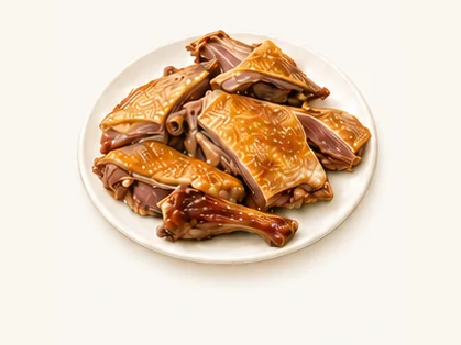 Suichuan cured duck 遂川板鸭AI dish illustration / AI 菜品示意图
The meat has a concentrated savoury flavour and a firmer texture than freshly poached duck. The skin and lean portions differ noticeably.
Source ↗Read the dish guide →All dish names · 全部菜名 (1)
More dishes from across Jiangxi are in the Jiangxi food guide.
Plan your visit
Getting there
Suichuan County is about 95 km in a straight line from central Ji'an. Search for 遂川县 in a map app to find stations and your accommodation.
Where to stay →Build your route
Start with Taoyuan Rice Terraces. The linked place guides have entrance and visit details.
Continue with Ji'an →More in Ji'an
Sources & geographic information
Administrative names and parent areas: Official geographic directory · Reference date 2026-09-06.
Some facts checked against 遂川县 — Wikipedia contributors, CC BY-SA 4.0.
Photo: Taoyuan Rice Terraces · Source photographer · License not provided. EXIF orientation normalized; resized without changing aspect ratio; converted to WebP. No subject edits.
Map data © OpenStreetMap contributors. Pins mark approximate centres, not entrances or boundaries.