


Get to know Xin'gan County
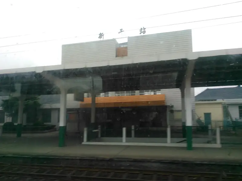
Photo adjustments
Full frame retained; EXIF orientation normalized, proportionally resized to at most 800 pixels and converted to WebP. No generated pixels or subject changes. Cards may crop the display.
- Administrative area
- County · 县
- Part of
- Ji'an
- Chinese name
- 新干县
- Local areas
- County guide
Area & population
- Area in the source
- 1,245.00 km²
- Population · 2010
- 329,830
- Administrative seat
- Jinchuan Town
Source: cited geographic source, as of the dates shown.
History
Neolithic sites at Tangtou (塘头镇) show early settlement. The county was founded in 221 BC under the Qin as Xin'gan (新淦) and is one of Jiangxi's eighteen ancient counties; its seat moved in 589 from Ganyang, in today's Zhangshu (樟树), to Nanshi village, now Jinchuan. After character simplification, the second character was replaced in 1957 by the homophone gan (干). Local figures include the Ming grand secretary Jin Youzi (金幼孜). In the Red Army years Mao Zedong's troops passed through several times; his former residence at Gongjia (龚家) in Maixie (麦斜) and the county soviet site are preserved.
What to see
The Dayangzhou Shang tomb yielded 486 bronzes, 754 jades and 139 pottery pieces, including 23 first-grade national relics, and the find was named one of China's hundred major archaeological discoveries of the 20th century. The Dayangzhou Shang site park has a planned area of 500 mu (about 33 hectares). Niucheng (牛城), 5 li (about 2.5 kilometres) from the tomb, has earthen walls and has produced pottery and a set of five bronze ding cauldrons. The Shang–Zhou Niutoucheng site (牛头城遗址) and the Warring States granary site at Jiebu (界埠) are provincial key protected sites.
The county government also lists the Jin-dynasty Dongshan Temple (东山寺), the review platform at Hepu (荷浦), where the Southern Song general Yue Fei stationed troops, and the Ming Wenchang Pagoda (文昌塔). Zaoshi (燥石), a Chinese traditional village in Qiqin town (七琴镇), lies at more than 600 metres, and its Caidiyan Mountain (才地岩山) rises to 1,082 metres; its main sights are odd rocks, waterfalls, stone-built houses, terraced fields and azaleas that flower in May.
Food and local products
Xin'gan red tangerines (新干红桔) appear in the Western Jin writer Zhang Hua's 'Records of Diverse Matters' (博物志) and were sent as tribute from the Song onward; the Qianlong Emperor called them 'big red robe' (大红袍). Zhang Henshui (张恨水) set his novel 'Swallows Flying North' (北雁南飞) in the Sanhu (三湖) orchards, and the fruit was first exported to the Soviet Union in 1957.
Highlights
- Dayangzhou Shang tomb 大洋洲商代大墓: Found in 1989 with 486 bronzes and 754 jades; one of China's hundred major 20th-century archaeological finds.
- Niucheng 牛城: Walled site 5 li from the Dayangzhou tomb that produced five bronze ding.
- Zaoshi village 燥石: Chinese traditional village above 600 metres in Qiqin town, with stone houses, terraces and May azaleas.
- Xin'gan red tangerine 新干红桔: Recorded in the Western Jin; tribute fruit from the Song; called 'big red robe' by the Qianlong Emperor.
Sources for this guide
新干县人民政府-历史渊源 · Xin'gan County People's Government
新干县人民政府-大洋洲商代青铜文化遗址公园 · Xin'gan County People's Government
新干县人民政府-特色人文古迹及自然景观 · Xin'gan County People's Government
新干县人民政府-中国传统村落--燥石 · Xin'gan County People's Government
新干县人民政府-新干红桔 · Xin'gan County People's Government
新干县 - 维基百科,自由的百科全书 · Wikipedia (Chinese) · CC BY-SA 4.0
Original English written from the listed sources and checked sentence by sentence against quoted extracts by a separate reviewer. Updated 2026-09-25.
Explore Xin'gan County
Core places to explore, with English and Chinese names.
Xin'gan County 新干县
Plan your visit
Getting there
Xin'gan County is about 85 km in a straight line from central Ji'an. Search for 新干县 in a map app to find stations and your accommodation.
Where to stay →More in Ji'an
Sources & geographic information
Administrative names and parent areas: Official geographic directory · Reference date 2026-09-06.
Some facts checked against 新干县 — Wikipedia contributors, CC BY-SA 4.0.
Map data © OpenStreetMap contributors. Pins mark approximate centres, not entrances or boundaries.