


Get to know Hunjiang District
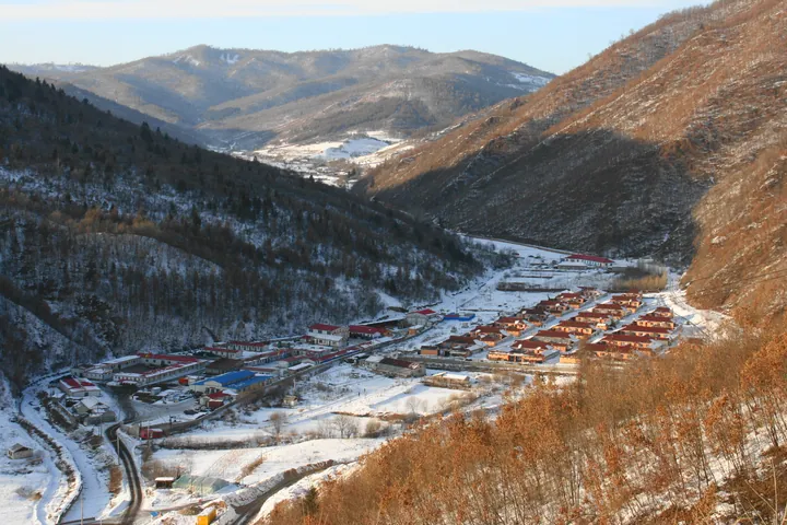
Photo adjustments
Full frame retained; proportionally resized and converted to WebP. No retouching or changes to the photographed subject. Card displays may crop the view.
- Administrative area
- District · 市辖区
- Part of
- Baishan
- Chinese name
- 浑江区
- Local areas
- District guide
Area & population
- Area in the source
- 1,381.88 km²
- Population · 2020 census
- 307,982
- Administrative seat
- Xinjian Subdistrict
Source: cited geographic source, as of the dates shown.
Setting and landscape
North of the Hun River the hills belong to the Longgang range and south of it to the Laoling range, both mid-height and low mountains. The highest point is Laoliangzi (老梁子) in the Longgang range, 1,492 metres, on the Linjiang border southwest of Hongtuya town (红土崖镇). The Yalu flows through the district for 45 kilometres, and the Hun River, its largest tributary, for 37 kilometres. Winters are long and cold, averaging -18°C, while the district government promotes it as a summer retreat with a comfortable 22°C.
What to see
Longshan Lake (龙山湖), a 3A scenic area 57 kilometres from the city on the middle Yalu, is the winding valley reservoir behind the Yunfeng hydropower dam (云峰水电站). It has an island in the river, three caves and sixteen named peaks, and the district's suggested one-day route runs from the reservoir past Ermaju Peak (二马驹) and the island to the Yunfeng dam. Closer to town, Qingshan Lake (青山湖), a 2A scenic area 2 kilometres from the city in the northern hills, is the reservoir of Qinggouzi (青沟子) dam, about 1 kilometre long and 200 metres wide, developed for visitors since 1992.
The district's own list of sights, from south to north, also includes Xiaochang (小长村) fishing village on the Yalu, the Changbai Mountain Maze karst cave (长白山迷宫溶洞, a 3A site), the site of the Qidaojiang Conference (七道江会议旧址), Tai'an Lake Manchu folk park (泰安湖满族风情园), Beishan Park (北山公园) and the red-leaf valley at Sifangshan (四方山红叶谷).
History and culture
Before the Qing conquest the area was home mainly to the ancestors of today's Manchu, Mongol and Korean peoples, and by the early twentieth century it had become an important political, economic and military town for the area. The district government names three strands of local culture: fishing and hunting, timber rafting on the rivers, and Korean folk customs. The district carried the name Badaojiang (八道江区) until the State Council renamed it Hunjiang on 22 February 2010.
Highlights
- Longshan Lake 龙山湖: 3A scenic area on the middle Yalu, the valley reservoir of the Yunfeng hydropower dam.
- Qingshan Lake 青山湖: 2A scenic area 2 km from the city, the reservoir of Qinggouzi dam, developed since 1992.
- Changbai Mountain Maze Cave 长白山迷宫溶洞: Karst cave listed by the district as a 3A scenic area.
Sources for this guide
浑江区人民政府 — 浑江区简介 · Hunjiang District People's Government, Baishan
浑江区人民政府 — 青山湖景区 · Hunjiang District People's Government, Baishan
浑江区人民政府 — 龙山湖风景区 · Hunjiang District People's Government, Baishan
Hunjiang, Baishan - Wikipedia · Wikipedia (English) · CC BY-SA 4.0
Original English written from the listed sources and checked sentence by sentence against quoted extracts by a separate reviewer. Updated 2026-09-25.
Explore Hunjiang District
Core places to explore, with English and Chinese names.
Hunjiang District 浑江区
Plan your visit
Getting there
Hunjiang District covers the centre of Baishan. Search for 浑江区 in a map app to find stations and your accommodation.
Where to stay →More in Baishan
Sources & geographic information
Administrative names and parent areas: Official geographic directory · Reference date 2026-09-06.
Some facts checked against Hunjiang, Baishan — Wikipedia contributors, CC BY-SA 4.0.
Map data © OpenStreetMap contributors. Pins mark approximate centres, not entrances or boundaries.