


Get to know Changbai Korean Autonomous County
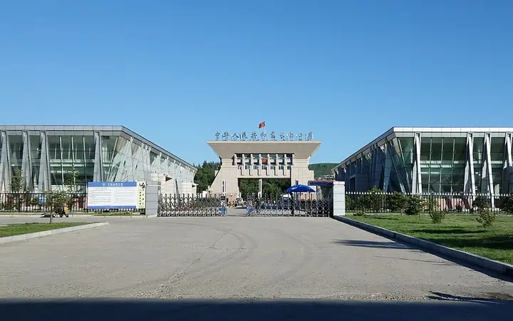
Photo adjustments
Full frame retained; resized proportionally to a maximum dimension of 960 pixels and converted to WebP quality 88. No crop, retouch, generated elements, or subject alteration. Final website rendition: full frame retained, proportionally resized to at most 720 pixels and converted to WebP. No additional retouching or subject alteration. Card displays may crop the view.
- Administrative area
- Autonomous county · 自治县
- Part of
- Baishan
- Chinese name
- 长白朝鲜族自治县
- Local areas
- Autonomous county guide
Area & population
- Area in the source
- 2,497.60 km²
- Population · 2020 census
- 58,266
- Administrative seat
- Changbai
Source: cited geographic source, as of the dates shown.
Setting and landscape
The county covers 2,497.6 square kilometres and stretches about 83 kilometres from east to west but only 30 kilometres from north to south. Linjiang (临江市) lies to the west and Fusong County (抚松县) to the north. Across the Yalu it faces Ryanggang Province (两江道) of North Korea, and its border runs for 260.5 kilometres, of which 257 kilometres follow the river.
The county seat, Changbai Town (长白镇), sits on the upper Yalu at about 700 metres and looks across the water at Hyesan (惠山市). The county government records a frost-free season of around 115 days there. The highest point of neighbouring Malugou Town (马鹿沟镇) is Hongtou Mountain (红头山), at 2,012 metres.
History
The Qing court closed the area to settlers in 1677 and lifted the ban in 1875. In 1908 it set up Changbai Prefecture (长白府), with its offices at a place then called Tadian (塔甸), now Changbai Town. The prefecture became Changbai County in 1913. The State Council decided on 29 May 1958 to replace the county with a Korean autonomous county, which was formally founded on 15 September 1958. In April 1985 it was placed under Hunjiang (浑江市), the city now called Baishan.
What to see
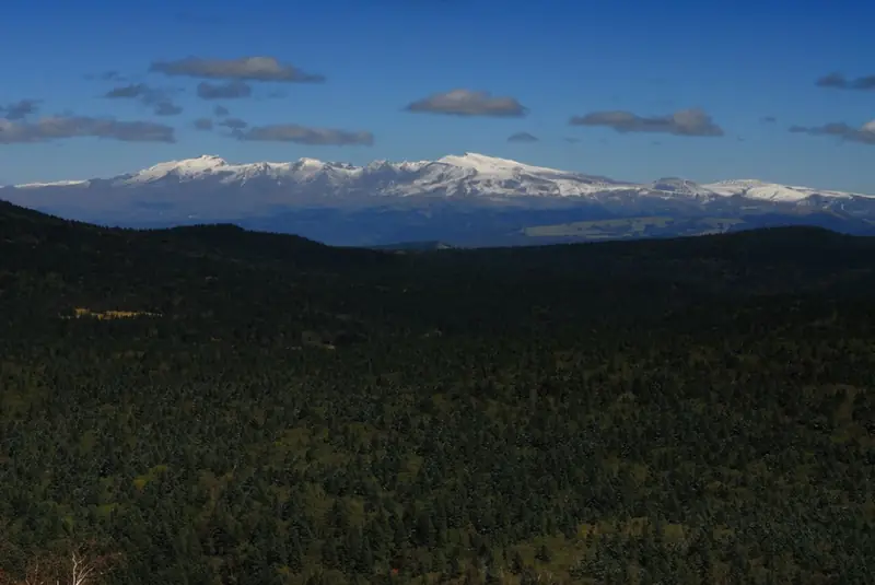
Wangtian'e (望天鹅) scenic area, in Shisidaogou Town (十四道沟镇) about 45 kilometres from the county town, is a national 3A scenic area, a national forest park and a provincial geopark. Lava from the Wangtian'e volcano built a plateau that weathering has cut into a basalt canyon; the gorge system is 38 kilometres long, and the volcano's 2,051.4-metre main peak is 35 kilometres from Heaven Lake (天池) on Changbai Mountain. The cooling lava formed columnar joints: at Qianzhu Peak (千柱峰), 108 exposed columns up to 26 metres tall hold up the peak. The gorge also has a string of waterfalls that freeze in winter.
Lingguang Pagoda (灵光塔), northwest of the county town, is a five-storey hollow brick pagoda 13 metres high left from the Bohai kingdom (渤海国). It was placed on the third national list of protected monuments in 1988. The Gangouzi tombs (干沟子古墓群) date from the Spring and Autumn and Warring States periods. The Yalu riverside at Changbai Town looks straight across at Hyesan on the North Korean bank.
Highlights
- Wangtian'e scenic area 望天鹅: Basalt gorge with columnar joints and waterfalls below the Wangtian'e volcano; national 3A scenic area and provincial geopark.
- Lingguang Pagoda 灵光塔: Five-storey brick pagoda of the Bohai kingdom, 13 metres high; national protected monument since 1988.
- Changbai riverside 长白口岸江畔: The Yalu bank at Changbai Town, facing Hyesan in North Korea across the river.
Sources for this guide
长白朝鲜族自治县人民政府 · Changbai Korean Autonomous County People's Government
长白朝鲜族自治县人民政府 · Changbai Korean Autonomous County People's Government
长白朝鲜族自治县人民政府 · Changbai Korean Autonomous County People's Government
望天鹅国家公园 - 长白民俗旅游网 · Changbai Korean Autonomous County People's Government (Changbai folk-custom tourism site)
灵光塔 - 维基百科,自由的百科全书 · Wikipedia (Chinese) · CC BY-SA 4.0
长白朝鲜族自治县 - 维基百科,自由的百科全书 · Wikipedia (Chinese) · CC BY-SA 4.0
Original English written from the listed sources and checked sentence by sentence against quoted extracts by a separate reviewer. Updated 2026-09-25.
Explore Changbai Korean Autonomous County
Core places to explore, with English and Chinese names.
Places to explore around Changbai Korean Autonomous County
 Wangtian’e Scenic Area · 望天鹅
Wangtian’e Scenic Area望天鹅
Wangtian’e is a volcanic landscape in Changbai Korean Autonomous County, known for rock formations and waterfalls along the Shisidaogou valley.
Read the place guide →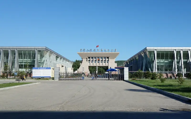 Changbai Port Riverfront · 长白口岸江畔
Changbai Port Riverfront长白口岸江畔
The waterfront by Changbai Port overlooks the Yalu River toward Hyesan, linking the border town's river views with its Korean cultural setting.
Read the place guide →Plan your visit
Getting there
Changbai Korean Autonomous County is about 160 km in a straight line from central Baishan. Search for 长白朝鲜族自治县 in a map app to find stations and your accommodation.
Where to stay →Build your route
Wangtian’e Scenic Area and Changbai Port Riverfront are both listed here. The linked place guides have entrance and visit details.
Continue with Baishan →More in Baishan
Sources & geographic information
Administrative names and parent areas: Official geographic directory · Reference date 2026-09-06.
Some facts checked against 灵光塔 — Wikipedia contributors, CC BY-SA 4.0.
Some facts checked against 长白朝鲜族自治县 — Wikipedia contributors, CC BY-SA 4.0.
Photo: Wangtian’e Scenic Area · 大漠1208 · CC BY 3.0. EXIF orientation normalized; resized without changing aspect ratio; converted to WebP. No subject edits.

Photo: Changbai Port Riverfront · Source photographer · License not provided. EXIF orientation normalized; resized without changing aspect ratio; converted to WebP. No subject edits.
Map data © OpenStreetMap contributors. Pins mark approximate centres, not entrances or boundaries.