


Get to know Dehui
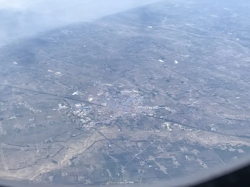
Photo adjustments
EXIF orientation normalized; resized without changing aspect ratio; converted to WebP. No subject edits.
- Administrative area
- County-level city · 县级市
- Part of
- Changchun
- Chinese name
- 德惠市
- Local areas
- County-level city guide
Area & population
- Area in the source
- 3,439.20 km²
- Population · 2010
- 748,369
- Administrative seat
- Shengli Subdistrict (胜利街道)
Source: cited geographic source, as of the dates shown.
Setting and landscape
The land is higher in the south and lower in the north, rolling gently at mostly 149 to 241 metres above sea level. The Songhua River (松花江) runs along the northeast, across from Fuyu (扶余) and Yushu (榆树). The Yitong River (伊通河) marks the western boundary with Nong'an County (农安县), and the Yinma River (饮马河) crosses the city. The two meet in the north of Biangang Township (边岗乡), and the Dehui local chronicles office calls the land between them the Yin-Yi delta (饮伊三角洲).
History
Farmers from Shandong and Hebei began settling and clearing the land after 1791. The Qing government created the county on 24 May 1910 and named it by joining the last characters of two townships, Mude (沐德) and Huaihui (怀惠); the first county seat was at Dafangshen (大房身). On 1 April 1936, under Manchukuo, the county office moved to Zhangjiawan (张家湾), which was renamed Dehui. The county became a county-level city in July 1994.
Dehui Station (德惠站) on the Beijing–Harbin line was built at Zhangjiawan in 1903 by Chinese Eastern Railway (东清铁路) crews. It was first called Yaomen (窑门站) because seven brick kilns stood a short way south, and took the name Dehui in 1936.
What to see
Sights listed for the city include the Chinese Eastern Railway buildings in Dehui (中东铁路建筑群), Dehui Museum (德惠市博物馆), a national AAA-rated scenic area, the Dehui Orthodox church (德惠东正教堂), the Songhua River railway bridge (德惠松花江铁路大桥), the Gongjiang stele (贡江碑) and Dabaishui Wetland Park (大白水湿地公园).
Food and local products
Maize, rice, sorghum and soybeans are the main crops, and Dehui carries the titles 'home of Songhua River rice' (中国松花江大米之乡) and 'home of broiler chickens' (中国肉鸡之乡). Named local products are Dehui Daqu liquor (德惠大曲酒), broiler chickens and straw weaving. Chaluokou (岔路口镇), a town on the Songhua in the southeast, is a rice-growing centre described as 'China's first rice town' (中国水稻第一镇).
Getting oriented
The Beijing–Harbin railway and the Beijing–Harbin high-speed railway have six stations in the city, including Dehui and Dehui West (德惠西站). The Beijing–Harbin Expressway, the Changchun metropolitan ring expressway and National Highway 102 also pass through.
Highlights
- Dehui Station 德惠站: Built in 1903 on the Chinese Eastern Railway as Yaomen Station, named after nearby brick kilns; renamed Dehui in 1936.
- Dehui Museum 德惠市博物馆: Listed as a national AAA-rated scenic area.
- Yin-Yi delta 饮伊三角洲: Land at the meeting of the Yinma and Yitong rivers in Biangang Township.
- Dehui Daqu liquor 德惠大曲酒: Named among Dehui's local products with broiler chickens and straw weaving.
Sources for this guide
德惠市 - 维基百科,自由的百科全书 · Wikipedia (Chinese) · CC BY-SA 4.0
历史沿革 · Dehui Municipal People's Government (Dehui local chronicles office)
市情简介 · Dehui Municipal People's Government (Dehui local chronicles office)
德惠站 - 维基百科,自由的百科全书 · Wikipedia (Chinese) · CC BY-SA 4.0
Original English written from the listed sources and checked sentence by sentence against quoted extracts by a separate reviewer. Updated 2026-09-25.
Explore Dehui
Core places to explore, with English and Chinese names.
Plan your visit
Getting there
Dehui is about 75 km in a straight line from central Changchun. Search for 德惠市 in a map app to find stations and your accommodation.
Where to stay →More in Changchun
Sources & geographic information
Administrative names and parent areas: Official geographic directory · Reference date 2026-09-06.
Some facts checked against 德惠市 — Wikipedia contributors, CC BY-SA 4.0.
Some facts checked against 德惠站 — Wikipedia contributors, CC BY-SA 4.0.
Map data © OpenStreetMap contributors. Pins mark approximate centres, not entrances or boundaries.